604 Little Akaloa Road
2 council reports since June 2022, 1 carrying a photograph. The most-reported address on Little Akaloa Road.
The green nearby
- Little Akaloa Domain, 162 m to the edge · playground, 1 pieces
- Lukes Reserve, 296 m to the edge
Parks within half a kilometre, measured to the boundary, the council’s open data. The whole roll is at /parks.
The civic shelf nearby
- Little Akaloa Cemetery, 464 m away · Cemetery
Libraries, halls and the rest within half a kilometre, the council’s open data.
On the doorstep
- Little akaloa campsite, 213 m away · Campgrounds
- Little Akaloa Domain, 226 m away · Campgrounds
Businesses within four hundred metres, measured at the pin, OpenStreetMap and the council directories.
The named ground
the council’s own structure register, bridges, boardwalks and steps standing nearby, the open map’s record.
What gets reported here
- Flooding, 1
- Damaged Road, 1
Photographed here 1 on record
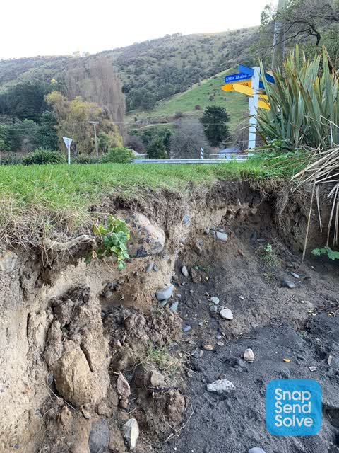
What’s on record
- Damaged Road, 26 Jan 2024
Little Akaloa to Decanter bay road, small hole in seal on downhill side of road, near culvert 13 with large sinkhole below- at least a metre
 Flooding, 26 Jun 2022
 Hi. Just noticed the erosion along the beach front at Little Akaloa, its starting to erode into the grass and soon the road will be at risk.
Elsewhere on Little Akaloa Road
- 594 Little Akaloa Road, 2 reports
- 584 Little Akaloa Road, 2 reports
- 581 Little Akaloa Road, 1 report
- 577 Little Akaloa Road, 1 report
- 525 Little Akaloa Road, 1 report
- 489 Little Akaloa Road, 1 report
- 227 Little Akaloa Road, 1 report
- 166 Little Akaloa Road, 1 report
The street’s crash record
NZTA’s record names Little Akaloa Road in 3 crashes that hurt somebody since 2006, 1 seriously hurt, nobody killed.
The civic layer
This ground votes in Banks Peninsula ward, the Banks Peninsula community board is its local layer. Ward lines don’t always follow suburb lines; this one is measured at the pin, not the suburb’s centre. The whole roll is at /wards.
Little Akaloa Road, the whole record → · Everything about Okains Bay → · What stood on this ground → · On the map → · From the air, RetroLens holds the Crown’s aerials back to 1936; search the address there →
Questions, answered briefly
2 council reports on record since June 2022, most often flooding (1), damaged road (1).
Okains Bay, Christchurch, on Little Akaloa Road.
Nothing on the heritage register at this exact spot, the record around this ground →
Little Akaloa Domain, 162 m to its edge.