Witbrock Reserve
From the air
Where it sits
Its centre falls inside Burnside, suburb membership is a centroid call, not a claim the whole park lies inside the outline.
More green in Burnside
- Burnside Park, Sports ground · 29 ha
- Jellie Park, Sports ground · 13 ha
- Nepal Reserve · 4 ha
- Flay Park, Botanic · 1 ha
- Westburn Reserve, Sports ground · 1 ha
- Wairakei Reserve · 1 ha
- Avice Hill Reserve, Botanic
- Roydvale Reserve
The tracks through it
Track lines whose drawn course enters the park’s outline, measured against the line itself, not a buffer around it.
- Walk and bike track through Burnside, 618 m · walk · bike
The reports on this ground
6 reports pinned inside the park's drawn outline, most often Trees & parks and Roads & footpaths, 5 with a photograph. A pin is where a reporter stood, not a claim about the whole park.
 Dumped Rubbish, 31 Witbrock Crescent, Burnside, Christchurch 8053, New Zealand · 24 April 2026
- Trees - General, 15 Grangewood Lane, Burnside, Christchurch 8053, New Zealand · 7 November 2022
 Pavement - Damaged, 31 Witbrock Crescent, Burnside, Christchurch 8053, New Zealand · 1 September 2022
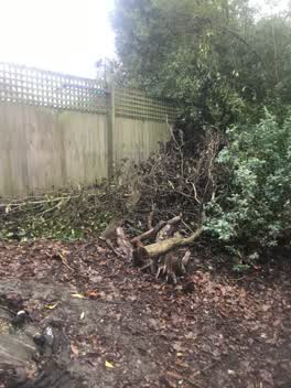 Parks, 31, Witbrock Crescent, Burnside, Canterbury, 8053, New Zealand · 18 June 2021
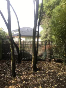 Parks, 29, Witbrock Crescent, Burnside, Canterbury, 8053, New Zealand · 18 June 2021
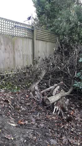 Parks, 31 Witbrock Crescent, Burnside, Christchurch 8053, New Zealand · 17 June 2021
Environment Canterbury / Canterbury Maps, Parks layer · refreshed 10 October 2026.
What stood on this ground before → · On the map →
Questions, answered briefly
1,581 m² by the layer’s own polygon.
Its centre falls inside Burnside, a centroid call, not a claim the whole park lies inside the outline.
A park or reserve.
One line enter the drawn outline, listed above, measured against the line itself, not a buffer.