Nga Puna Wai
Sports ground · 83 ha
From the air
Where it sits
Its centre falls inside Hillmorton, suburb membership is a centroid call, not a claim the whole park lies inside the outline.
More green in Hillmorton
- Canterbury Agricultural Park, Sports ground · 42 ha
- Seager Park · 3 ha
- West Watson Park · 3 ha
- Spreydon Riverbank Reserves · 1 ha
- Sunnyside Heritage Garden, Botanic · 1 ha
- Pavilion Park
- Wolsey Playground
- Linden Grove
What’s built on this ground
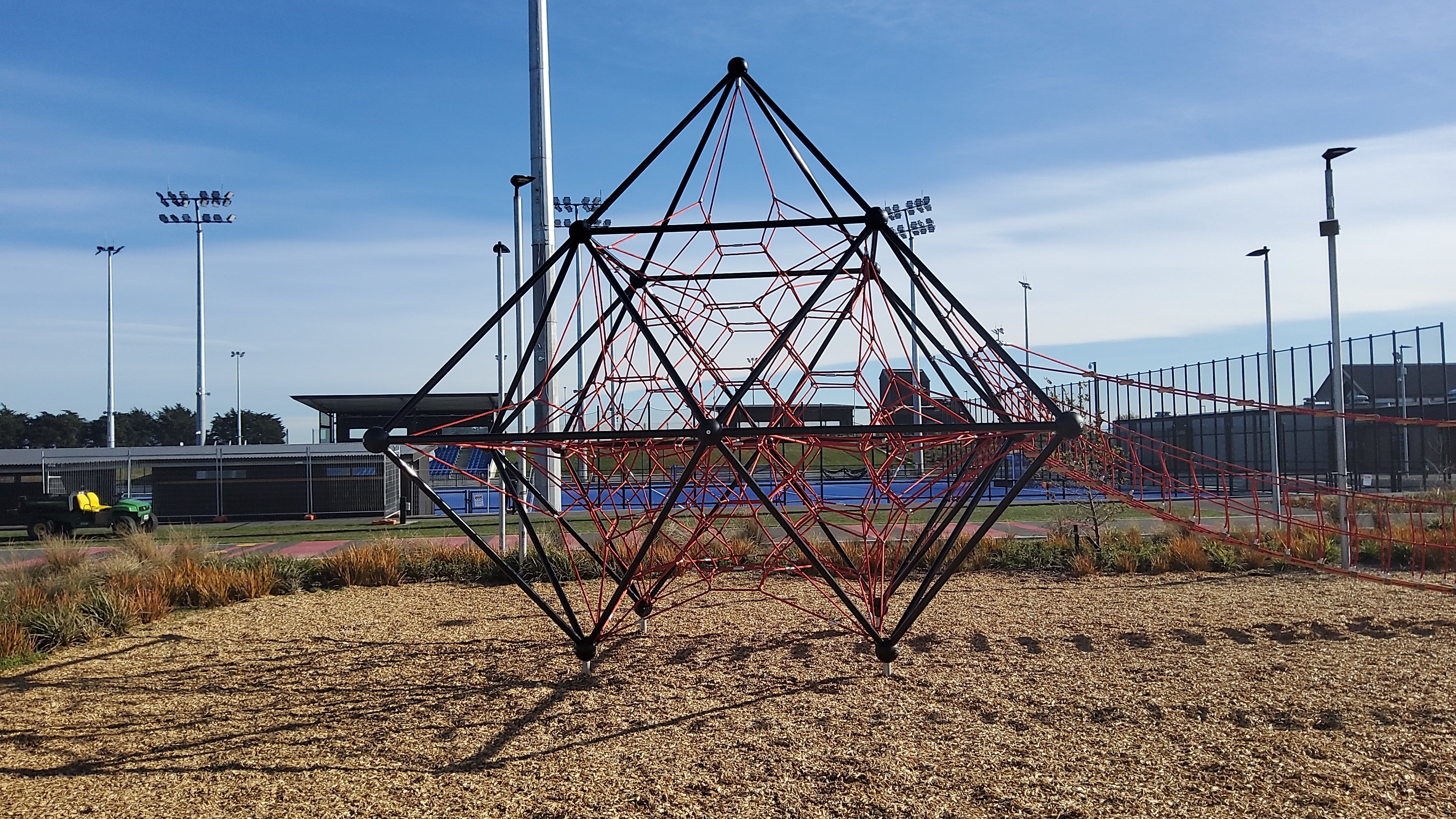
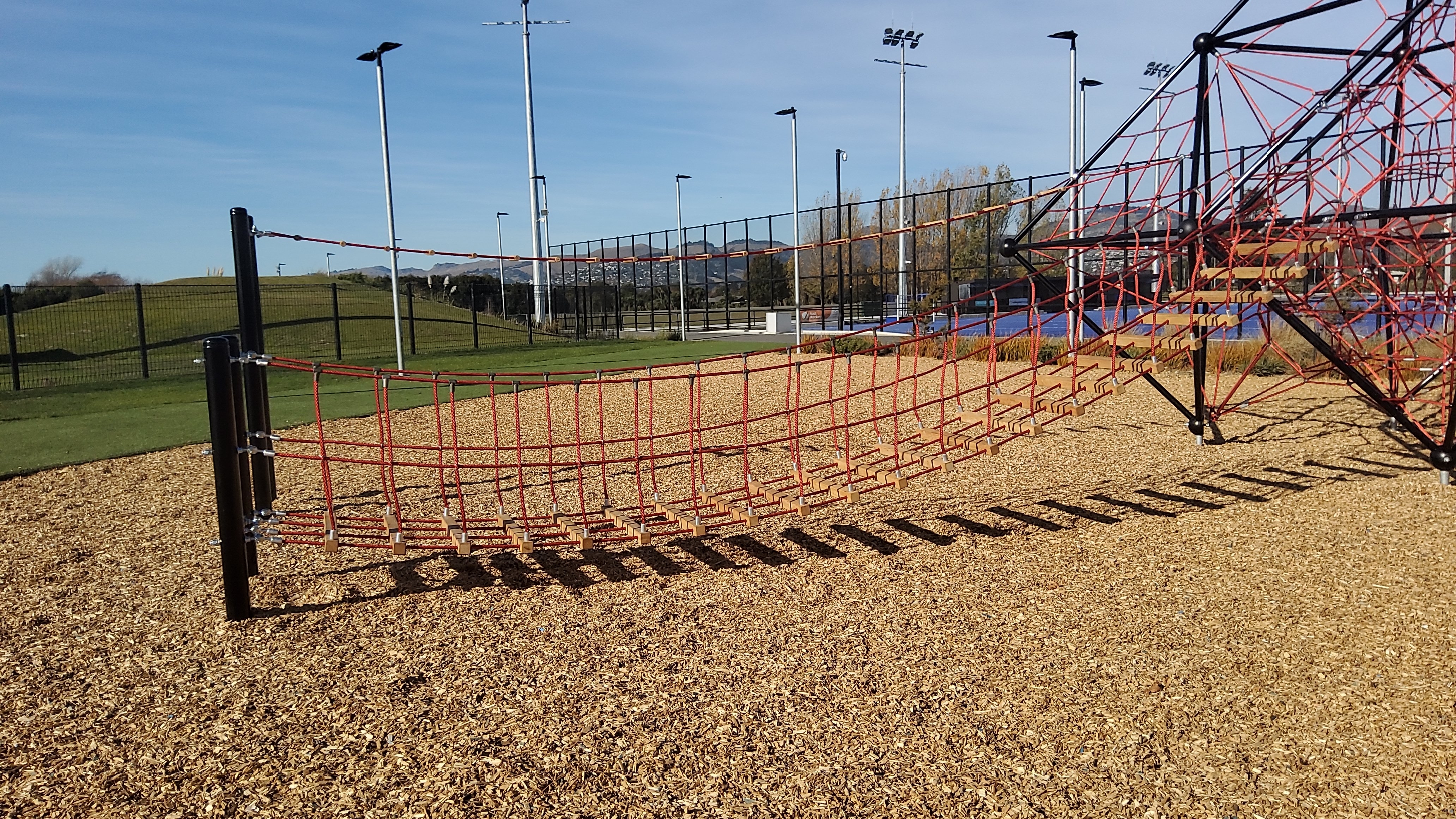
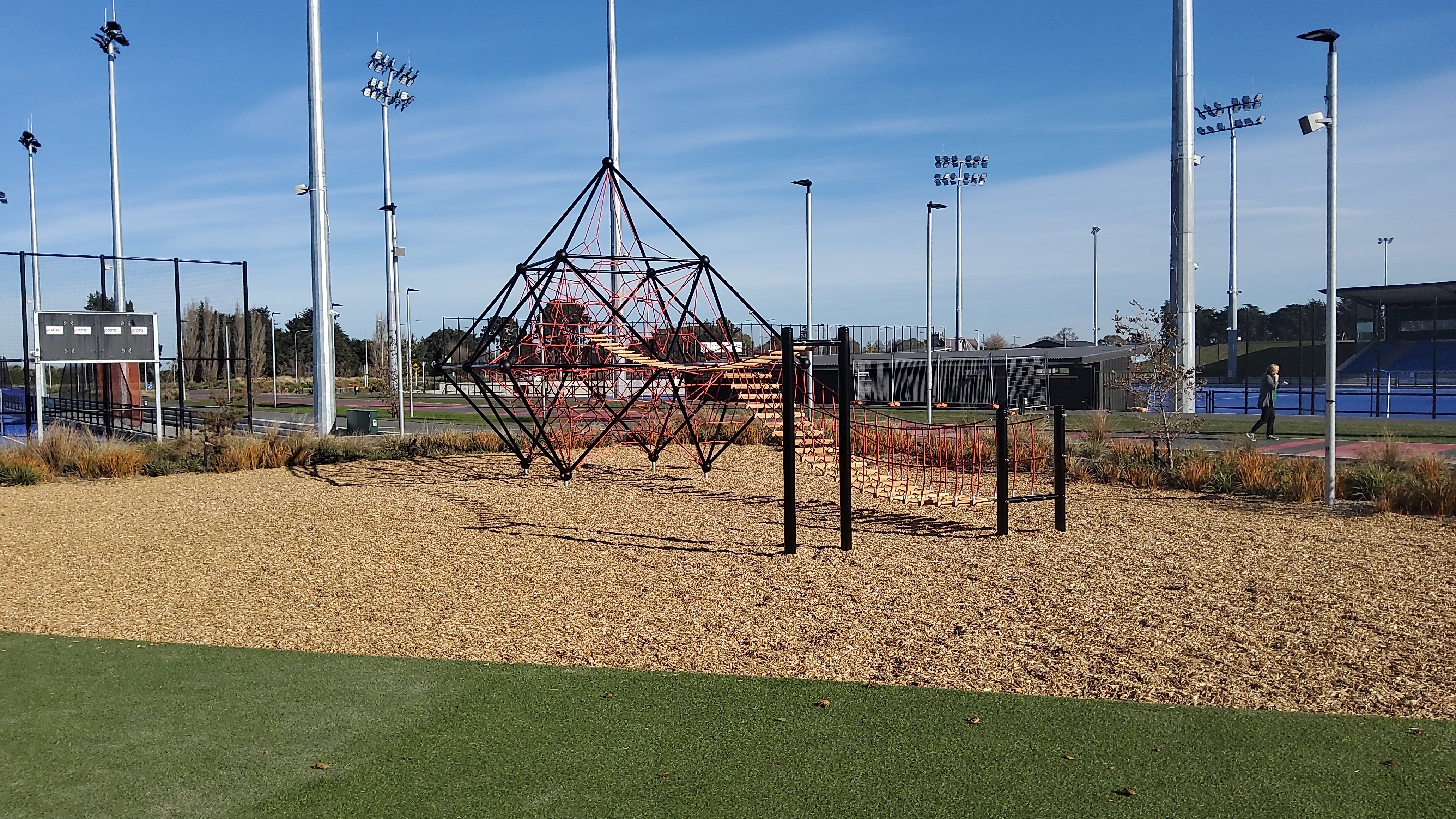
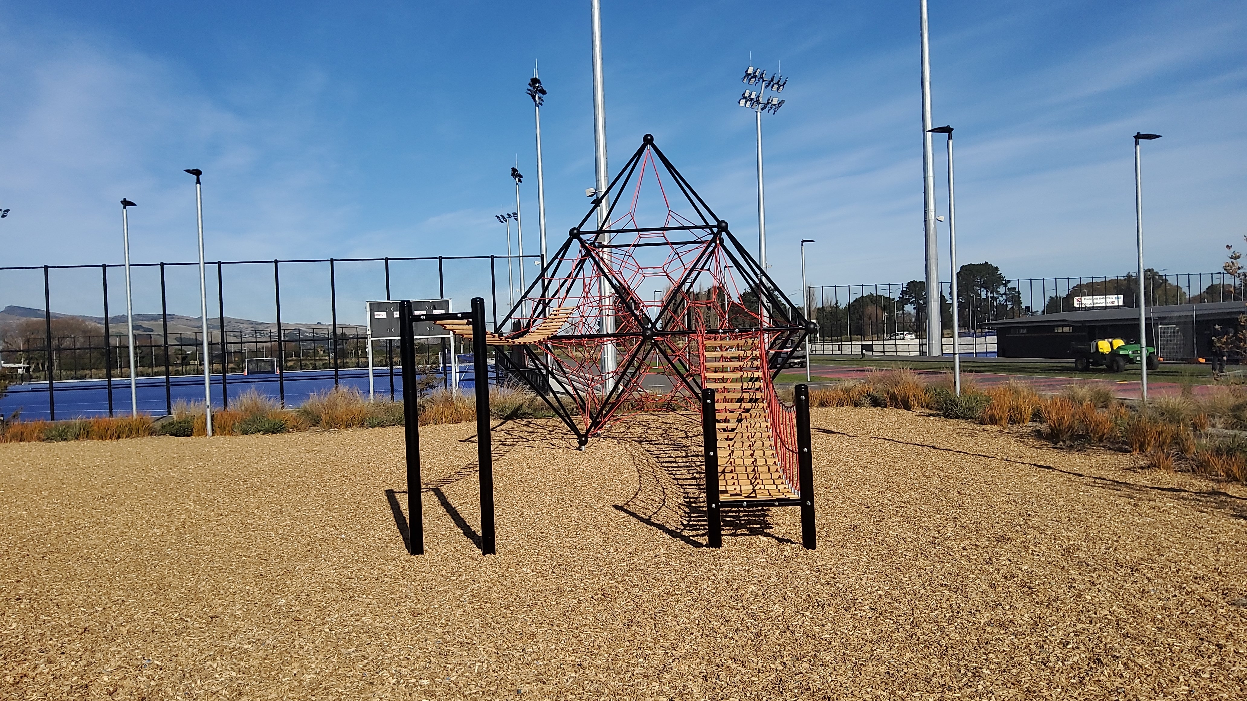
A playground stands here, the register counts 3 pieces of play equipment (1 climbing-net, 1 swing bridge and 1 climbing-monkey bars) plus 1 modular unit on a marked playground ground, the highest rated fall 6 m.
Also on the register: 36 seats (31 benches and 5 seats), 1 picnic table and 11 drinking fountains (bottle filler and dog bowl).
The register’s commission dates run 2014 to 2023.
11 springs are mapped rising inside this ground.
The register’s site tag names this park, and its pins stand inside the drawn outline, two views of the same ground.
Sport and dogs on this ground
The recreation register marks 47 playing surfaces on this ground, 18 Tennis, 9 Athletics, 9 Long Jump, 5 Shotput, 2 Hockey, 2 Rugby League and 1 other code, graded senior on concrete, rubber, sand-based astroturf and sand, 4 run a winter or summer booking season.
The register books them by name, Senior Athletics - High Jump, Senior Athletics, Senior Shotput, Senior Long Jump, Senior Hockey and Senior Tennis, and 4 more named grounds.
The winter window runs April to August; match days land on Saturday and Sunday; training runs Monday to Friday.
No register name matches this park, these are the records whose surveyed centroids sit inside its drawn outline.
The tracks through it
Track lines whose drawn course enters the park’s outline, measured against the line itself, not a buffer around it.
- Walk and bike track through Hillmorton, 1.2 km · walk · bike
- Walk and bike track through Wigram, 4.5 km · walk · bike
The reports on this ground
295 reports pinned inside the park's drawn outline, most often Trees & parks and Water & drains, 229 with a photograph. A pin is where a reporter stood, not a claim about the whole park.
 General Request, 15–17 Augustine Dr, Canterbury, Christchurch 8025, New Zealand · 14 October 2026
- Facility - General Request, 100 McMahon Drive, Aidanfield, Christchurch 8025, New Zealand · 10 October 2026
 Water General, Augustine Drive, Wigram, Christchurch 8025, New Zealand · 7 October 2026
 Facility - General Request, 15–17 Augustine Dr, Canterbury, Christchurch 8025, New Zealand · 28 September 2026
 Pavement - Damaged, 15–17 Augustine Dr, Canterbury, Christchurch 8025, New Zealand · 22 September 2026
 Water Leak, 21 Augustine Drive, Hillmorton, Christchurch 8025, New Zealand · 7 September 2026
- Hazard, vehicle, 17 Augustine Dr, Canterbury, Christchurch 8025, New Zealand · 6 September 2026
 Street Light Outage, 31 Templetons Road, Hillmorton, Christchurch 8025, New Zealand · 3 September 2026
 Park - General Request, 100 McMahon Drive, Aidanfield, Christchurch 8025, New Zealand · 25 August 2026
 Hazard, vehicle, Augustine Drive, Wigram, Christchurch 8025, New Zealand · 14 August 2026
 Pavement - Damaged, Nga Puna Wai North 189 Wigram Road, Wigram, Christchurch 8025, New Zealand · 3 August 2026
 Street Light Outage, 15 Augustine Dr, Canterbury, Christchurch 8025, New Zealand · 30 July 2026
Environment Canterbury / Canterbury Maps, Parks layer · refreshed 10 October 2026.
What stood on this ground before → · On the map →
Questions, answered briefly
83 hectares by the layer’s own polygon.
Its centre falls inside Hillmorton, a centroid call, not a claim the whole park lies inside the outline.
Sports ground.
2 lines enter the drawn outline, listed above, measured against the line itself, not a buffer.