20 Chadbury Street
9 council reports since December 2019, 8 carrying a photograph. The most-reported address on Chadbury Street.
From the air, then
Sourced from Canterbury Maps and partners. LINZ, CC BY 3.0 NZ. Each frame is cut from Environment Canterbury’s historic imagery MapServer for that decade, only where the Footprints layer names a CC BY survey (NZAM-covered spots stay out). RetroLens holds more Crown aerials →
The green nearby
- Arthur Adcock Memorial Reserve, 25 m to the edge · Sports ground · 4 ha
- Bancroft Reserve, 189 m to the edge
- Parklands Reserve, 192 m to the edge · Sports ground · 6 ha · playground, 50 pieces
- Lamorna Reserve, 269 m to the edge
- Evergreen Reserve, 283 m to the edge · playground, 6 pieces
Parks within half a kilometre, measured to the boundary, the council’s open data. The whole roll is at /parks.
The civic shelf nearby
- Parklands Library, 271 m away · Library
Libraries, halls and the rest within half a kilometre, the council’s open data.
On the doorstep
- Pūkeko Centre, 81 m away · Sports centres
- Jete Sudio, 108 m away · Dance studios
- Lavish Beauty, 110 m away · Beauty
- Box Sushi, 112 m away · Restaurants
Businesses within four hundred metres, measured at the pin, OpenStreetMap and the council directories.
The bus nearby
- Queenspark Dr near Chadbury St, 194 m away · route 80
- Queenspark Dr near Chadbury St, 202 m away · route 80
The closest Metro stops, within four hundred and fifty metres.
The named ground
Named places within 1.5 km of this address; the council’s own structure register, bridges, boardwalks and steps standing nearby, the open map’s record.
The remembered names nearby
- This Playground Was Donated to Christchurch City Council, 209 m away ·
THIS PLAYGROUND WAS DONATED TO CHRISTCHURCH CITY COUNCIL FOR CHILDREN OF THE PARKLANDS COM
· 2003 - The Jolly Tractor This Colourful – Jolly Tractor, 221 m away ·
THE JOLLY TRACTOR THIS COLOURFUL – JOLLY TRACTOR WAS PRESENTED TO THE CHILDREN OF THE PARK
· 2009
Inscribed plaques within two hundred and fifty metres, the register’s pins, not surveyed spots. The whole roll is at /plaques.
Renting nearby
new bonds in Parklands ran about $579 a week, $29 above the city median of $550, the suburb page keeps the rent record →.
What gets reported here
Photographed here 8 on record


What’s on record
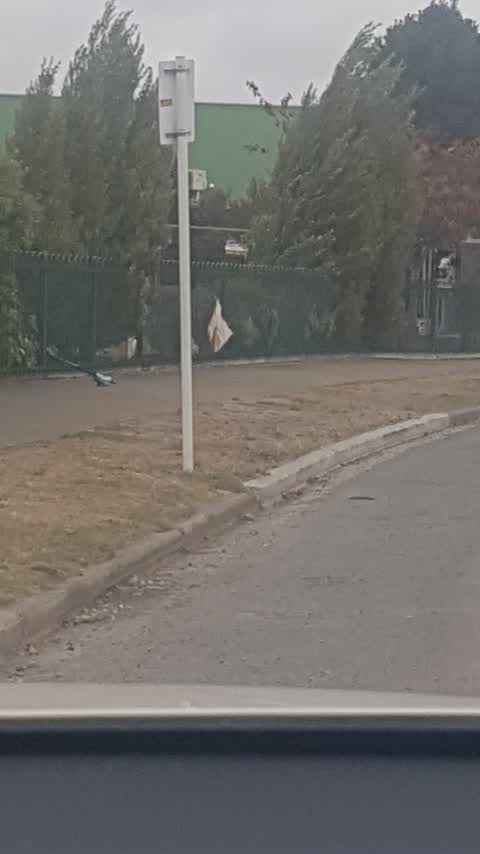
 Damaged Street Sign, 22 Sept 2026
P3 sign has fallen over outside Parkview Parua. We will move sign into our school to protect it. Thanks, Ashleigh
 Pavement - Damaged, 29 Apr 2025
This driveway has been waiting to be finished for months. The footpath was usable, now it's not. Ideally the path needs to be fixed. Or the
 Pavement - Damaged, 11 Mar 2025
The driveway and footpath by the parklands bowling club was ripped up a few weeks ago. It is now rubble, waiting to be sealed. It is annoyin
- Road Signage, 9 May 2023
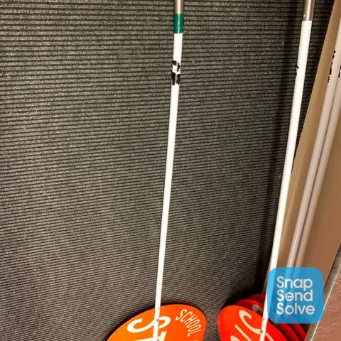
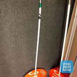 Roading/Streets, 16 Jun 2022
Parua / Parkview School Road Patrol sign damaged and in need of repair (with rivets) / replacement. Contact at School is Co-ordinator Wendy
Roading/Streets, 1 Mar 2020
signs needs realigning (outside Parkview school)
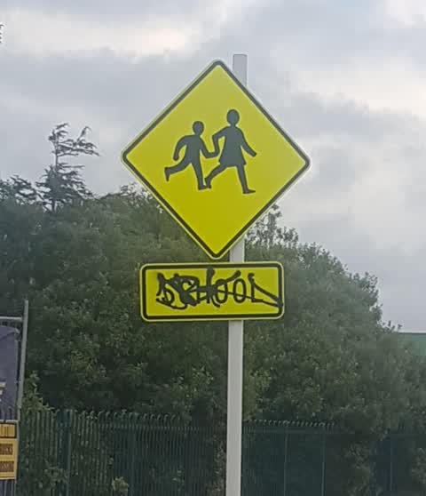
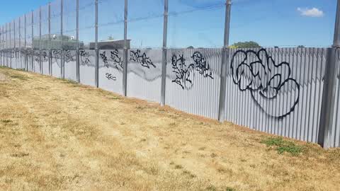
Graffiti, 1 Mar 2020
graffiti on road sign outside Parkview School
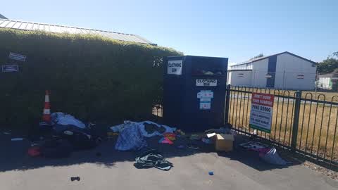
Rubbish/Recycling, 29 Dec 2019
Illegal dumping in front of clothing bin outside Parklands kindy.
Graffiti, 28 Dec 2019
park facing wall on bowling club
Elsewhere on Chadbury Street
- 30 Chadbury Street, 7 reports
- 29 Chadbury Street, 5 reports
- 2 Chadbury Street, 5 reports
- 5 Chadbury Street, 2 reports
- 3 Chadbury Street, 2 reports
- 21 Chadbury Street, 2 reports
- 17B Chadbury Street, 2 reports
- 10 Chadbury Street, 2 reports
The street’s crash record
NZTA’s record names Chadbury Street in 4 crashes that hurt somebody since 2006, 0 seriously hurt, nobody killed.
The civic layer
This ground votes in Coastal ward, the Coastal-Burwood-Linwood community board is its local layer. Ward lines don’t always follow suburb lines; this one is measured at the pin, not the suburb’s centre. The whole roll is at /wards.
Chadbury Street, the whole record → · Everything about Parklands → · What stood on this ground → · On the map → · From the air, RetroLens holds the Crown’s aerials back to 1936; search the address there →
Questions, answered briefly
9 council reports on record since December 2019, most often roading/streets (2), pavement - damaged (2), graffiti (2).
Parklands, Christchurch, on Chadbury Street.
Nothing on the heritage register at this exact spot, the record around this ground →
Arthur Adcock Memorial Reserve, 25 m to its edge, 4 ha.