Roading/Streets
Reported Saturday, 12 December 2020 at 7:43 pm, 32 Warrington Street, Canterbury 8014, New Zealand.
The reporter’s words
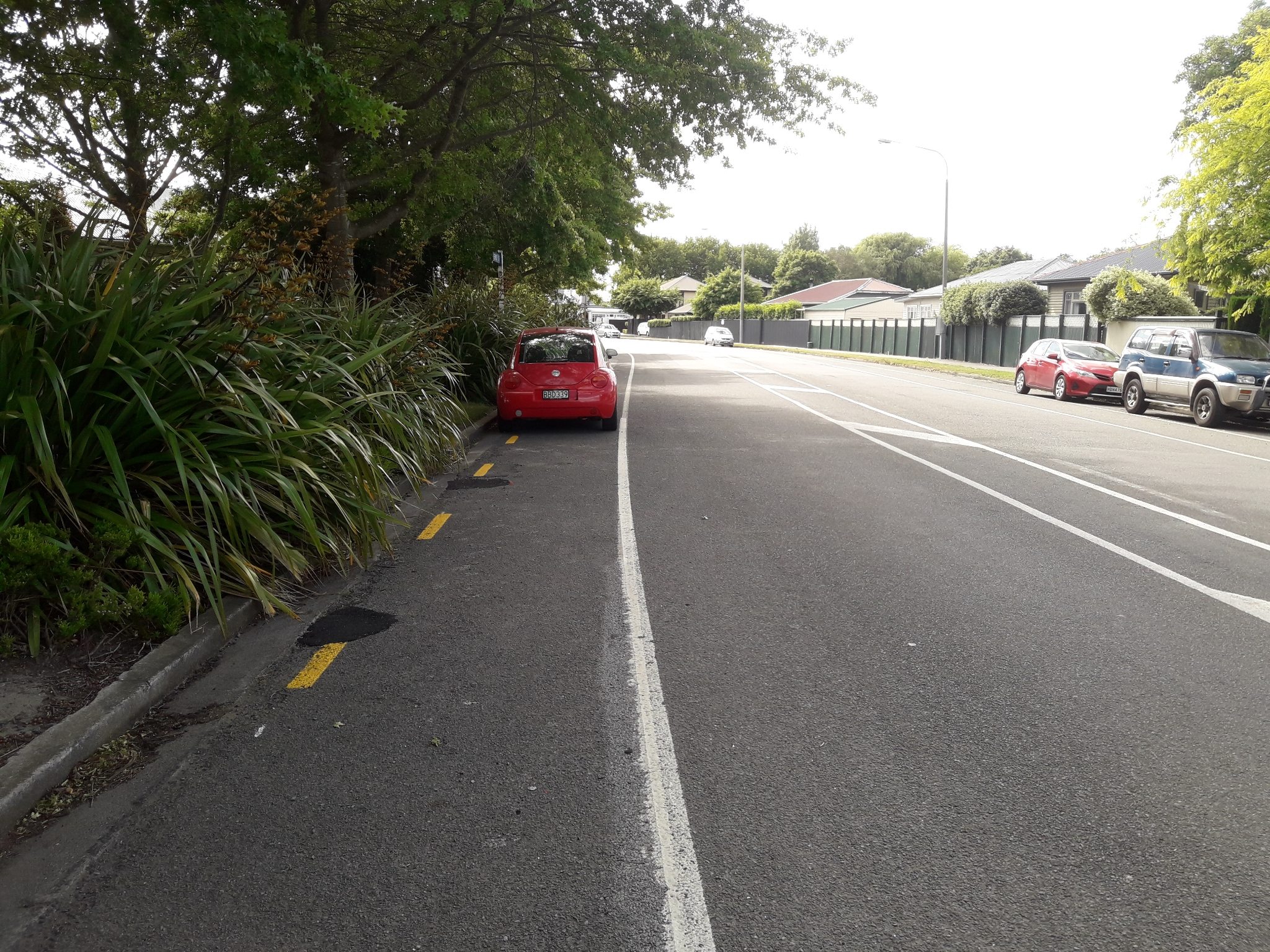
It is good to see the upgrade here to the intersections on either side of this photo and the bike lanes in either side of the new bits. BUT the bike lane with the yellow dash line suddenly stops and becomes a parking lane for cars for about 100 m before becoming a bike lane again. Why is this? Not only is this dangerous but show an incredible lack of planning for a new development. Can the road designers please get this fixed.
The filing
- Filed
- Saturday, 12 December 2020 at 7:43 pm
- Report number
- #1,344,063
- Filed under
- roads
- Coordinates
- the pin on the map →
Also at this address one of 2
 Roading/Streets26 May 2021
The council’s work orders, near this pin
- Road Layout1 m away · resolved 16 Dec 2020, took 4 days · probably the same job, filed through both doors
- Litter (Road)6 m away · resolved 11 Sept 2019, took 2 days
- Safety Improvements6 m away · resolved 19 Sept 2022, took 6 months
- Road Asset (e.g.footpathroadfurniture)7 m away · resolved 19 Mar 2019, took 3 months
- Road/Hard Surface8 m away · resolved 17 May 2024, took 18 months
- Litter9 m away · resolved 23 Jan 2026, took 35 hours
- Road Works9 m away · resolved 20 Mar 2023, took 42 hours
- Signs (Road)10 m away · resolved 28 May 2021, took 36 hours
MyCouncilTicket is the council’s own work-order stream, a different door from the public report above, and the same job can stand in both. The whole ticket roll →
Where this sits
The address32 Warrington Streetone of 2 reports at this address, the address’s whole recordThe streetWarrington Streetthe street’s record, every report on itThe suburbthe suburb, in depthThe problemRoading/Streetsevery filing of its kind on the city’s booksThe date12 Decemberthis date in the archive, across the yearsThe year2020the year’s shelf and ledgerThe mapOn the mapthe pin, among its neighboursBeforeWhat stood herewhat the archive knows of this ground
The feed listed this report when a sweep caught it 5 Sept 2026, it has not been listed since. The record here does not move.