Roading/Streets
Reported Thursday, 18 November 2021 at 7:37 am, 61, Bridle Path Road, Heathcote Valley, Canterbury, 8022, New Zealand.
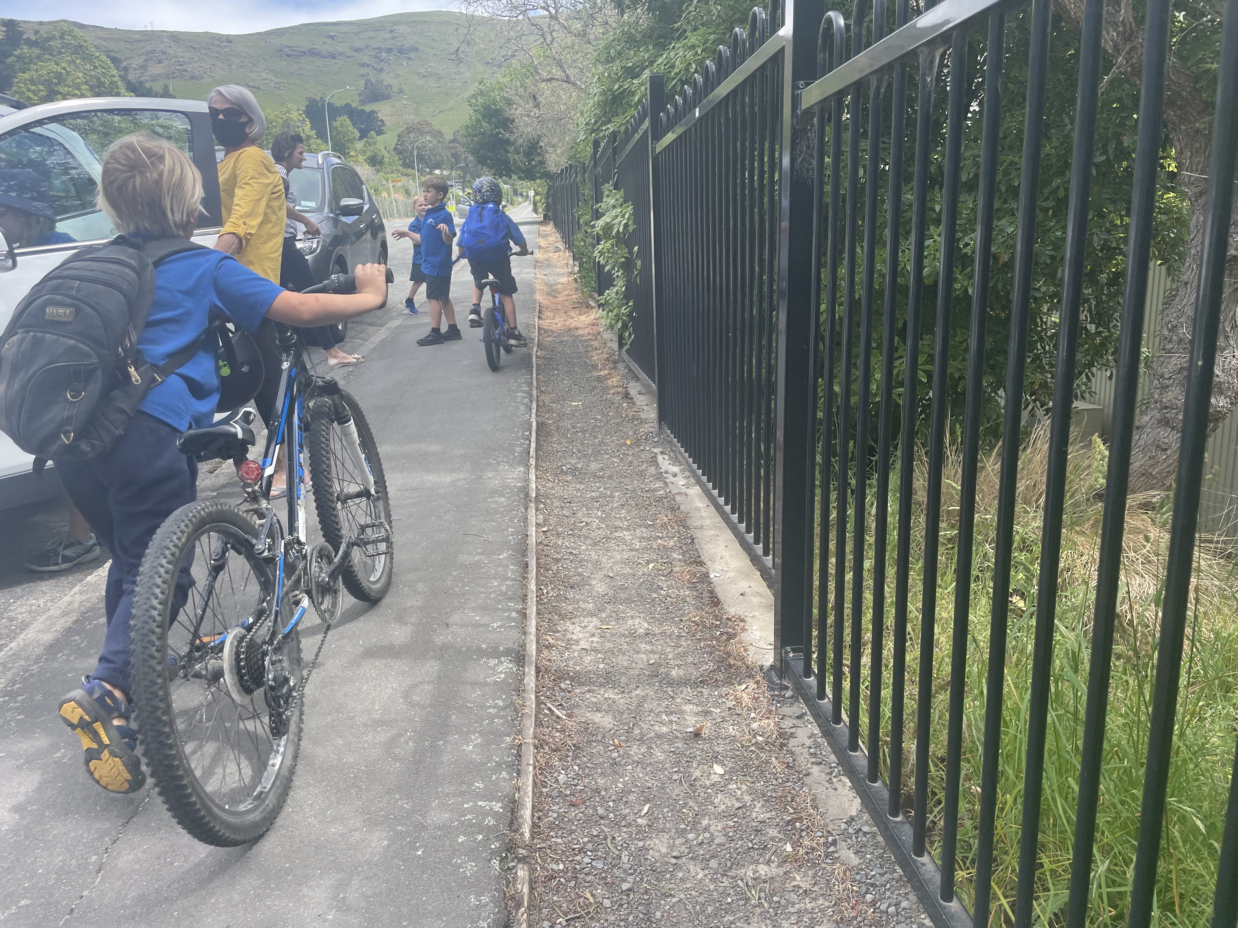
The reporter’s words
The foot path outside Heathcote valley school school is quite unsafe as it’s often very crowded. Because of school drop offs etc… member of the public, Parents, care givers and children are forced to use the extra piece of space on the right in the picture, but it is a full trip hazard. Car door near misses, trips, falls, bike/scooter crashes and some small accidents. Students don,t use the road bikes and scooters as the road is unsafe with cars flying down not often obeying the 40km limit….. The pathway needs to be widened to the school fence, making it more usable and safe for all…
The filing
- Filed
- Thursday, 18 November 2021 at 7:37 am
- Report number
- #1,949,915
- Filed under
- roads
- Coordinates
- the pin on the map →
The council’s work orders, near this pin
- Road Layout23 m away · resolved 30 Mar 2022, took 4 months · probably the same job, filed through both doors
- Trees9 m away · resolved 11 May 2023, took 7 weeks
- Remove Dead Animal14 m away · resolved 24 Jan 2023, took 26 hours
- Road/Hard Surface14 m away · resolved 6 Dec 2023, took 8 days
- Grass (Park)19 m away · resolved 7 Sept 2020, took 6 months
- Graffiti - Fence, building or structure20 m away · resolved 17 Sept 2026, took 2 days
- Footpath22 m away · resolved 18 Jun 2024, took 21 months
- Signs26 m away · resolved 9 May 2024, took 26 hours
MyCouncilTicket is the council’s own work-order stream, a different door from the public report above, and the same job can stand in both. The whole ticket roll →
Where this sits
The pin61A Bridle Path Roadlands 8 m from this filed address, its whole recordThe streetBridle Path Roadthe street the pin lands nearest, its record, every report on itThe suburbHeathcote Valleythe suburb, in depthThe problemRoading/Streetsevery filing of its kind on the city’s booksThe date18 Novemberthis date in the archive, across the yearsThe year2021the year’s shelf and ledgerThe mapOn the mapthe pin, among its neighboursBeforeWhat stood herewhat the archive knows of this ground
The feed listed this report when a sweep caught it 5 Sept 2026, it has not been listed since. The record here does not move.