Damaged Road
Reported Wednesday, 12 August 2026 at 2:39 pm, 289–367 Dawsons Rd, Canterbury, Christchurch 7676, New Zealand.
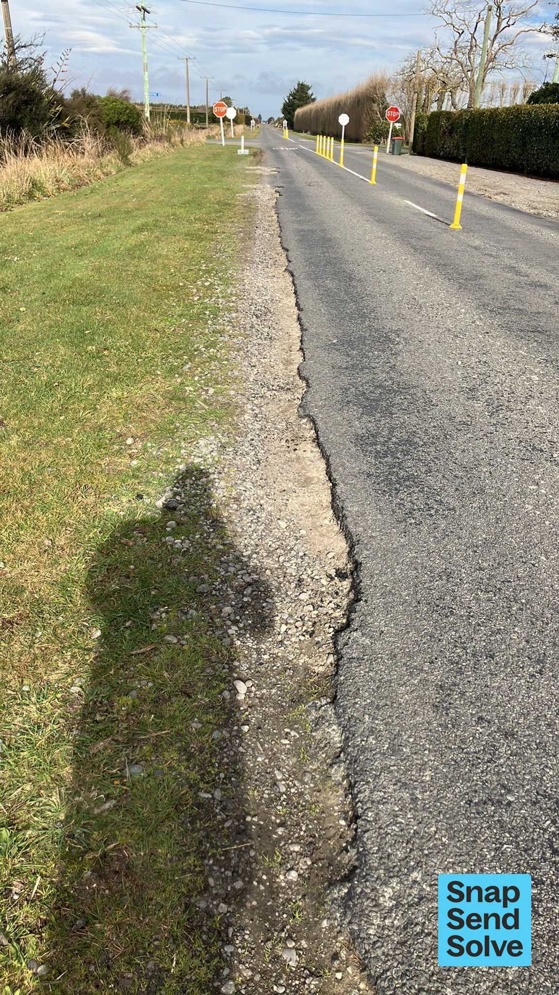
The reporter’s words
Since the addition of yellow markers being installed to separate traffic, heavy vehicles in particular are running wheels along and often beyond the edge of the seal which is creating a dangerous channel. I believe this has created a hazard for light vehicles with the potential to loose control of vehicle if left wheels get caught in the channel and the driver was to overcorrect their steering.
The filing
- Filed
- Wednesday, 12 August 2026 at 2:39 pm
- Report number
- #8,732,113
- Filed under
- roads
- Coordinates
- the pin on the map →
The council’s work orders, near this pin
- Road/Hard Surface0 m away · open, filed 12 Aug 2026 · probably the same job, filed through both doors
- Spillage - e.g. Fuel Chemicals (Road)66 m away · resolved 15 Jan 2020, took 11 months
- Vehicle73 m away · resolved 15 Dec 2021, took 4 days
- Road/Hard Surface84 m away · open, filed 22 Sept 2022
- Potholes84 m away · resolved 23 Sept 2023, took 21 hours
- Road/Hard Surface85 m away · resolved 31 Aug 2023, took 40 hours
- Potholes86 m away · resolved 19 Jul 2023, took 4 days
- Road/Hard Surface87 m away · open, filed 1 Sept 2022
MyCouncilTicket is the council’s own work-order stream, a different door from the public report above, and the same job can stand in both. The whole ticket roll →
Where this sits
The streetDawsons Roadthe street’s record, every report on itThe suburbthe suburb, in depthThe problemDamaged Roadevery filing of its kind on the city’s booksThe date12 Augustthis date in the archive, across the yearsThe year2026the year’s shelf and ledgerThe mapOn the mapthe pin, among its neighboursBeforeWhat stood herewhat the archive knows of this ground
The feed listed this report when a sweep caught it 6 Sept 2026, it has not been listed since. The record here does not move.