13 Rimu Street
9 council reports since September 2016, 9 carrying a photograph. The street’s heaviest record is 1 Rimu Street, 35 reports on file.
On the register here
- 35 Rata Street, 35 Rata Street (134m)
- Riccarton Grounds (176m)
- Former dwelling and setting, Riccarton, 16 Kahu Road (220m)
From the air, then
Sourced from Canterbury Maps and partners. LINZ, CC BY 3.0 NZ. Each frame is cut from Environment Canterbury’s historic imagery MapServer for that decade, only where the Footprints layer names a CC BY survey (NZAM-covered spots stay out). RetroLens holds more Crown aerials →
The green nearby
- Riccarton Bush, 58 m to the edge · 12 ha
- Clarence Reserve, 416 m to the edge
- Avon River Esplanade Reserve, 462 m to the edge
Parks within half a kilometre, measured to the boundary, the council’s open data. The whole roll is at /parks.
The civic shelf nearby
- Riccarton Service Centre, 364 m away · Service centre
Libraries, halls and the rest within half a kilometre, the council’s open data.
On the doorstep
- Parry Field Lawyers, 143 m away · Lawyers
- Cosmei, 161 m away · Beauty
- Fresh Cuts Barbershop, 161 m away · Hairdressers
- Park Ranger, 161 m away · Cafés
Businesses within four hundred metres, measured at the pin, OpenStreetMap and the council directories.
The bus nearby
- Westfield Riccarton, 168 m away · route 3, route 5, route 80, route 86, route 100, route 120, route 130, route 140, the Orbiter (anticlockwise)
- Kahu Rd near Titoki St, 200 m away · route 130
The closest Metro stops, within four hundred and fifty metres.
The tracks through here
- Walk and bike track through Riccarton, 174 m to the line · walk · bike
- Walk and bike track through Riccarton, 175 m to the line · walk · bike
- Walk and bike track through Riccarton, 181 m to the line · walk · bike
- Walk and bike track through Riccarton, 210 m to the line · walk · bike
- Walk and bike track through Riccarton, 224 m to the line · walk · bike
Tracks whose line passes within half a kilometre, the council’s open data.
The named ground
Named water within 500 m of this address, measured to the line or the edge; Named places within 1.5 km of this address; the council’s own structure register, bridges, boardwalks and steps standing nearby, the open map’s record.
Renting nearby
new bonds in Riccarton ran about $544 a week, about the city median, the suburb page keeps the rent record →.
What gets reported here
- Water Fountain, 2
- Water Supply, 1
- Road Signage, 1
- Poles and Signage - General, 1
- Pavement - Damaged, 1
- Graffiti, 1
Photographed here 9 on record


What’s on record
 Pavement - Damaged, 12 Jun 2026
 footpath asphalt repair has sunk. Tripping hazard.
 Water Fountain, 27 Nov 2025
 a scooter has been dumped in a city council fountain/water feature. Its inside a the locked cage
 Poles and Signage - General, 14 Oct 2025
 Pole snapped at the bottom. Comes out of the soil
 Road Signage, 5 May 2025
 Two photos here taken at the Rata St Rimu St intersection in Riccarton where almost nobody stops. The STOP sign on Rimu St heading south is
 Water Fountain, 19 Mar 2025
 This water feature is not running and is being used as a rubbish receptacle It needs to be turned back on please.
 Dumped Rubbish, 13 Mar 2025
 Facility - General Request, 3 Mar 2025
 This artesian-fed water feature is dry. Needs to be turned back on please or it becomes a rubbish dump.
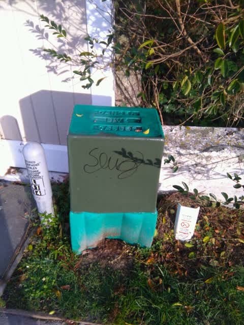
Graffiti, 28 Jun 2019
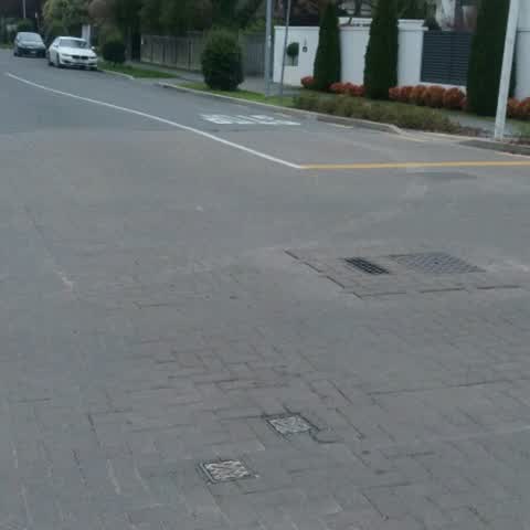
Water Supply, 24 Sept 2016
Rocking water valve cover. When traffic passes over the valve covers at the intersection of Rimu and Rata streets the covers rock causing lo
Elsewhere on Rimu Street
- 1 Rimu Street, 35 reports
- 6 Rimu Street, 7 reports
- 23 Rimu Street, 5 reports
- 7A Rimu Street, 3 reports
- 6B Rimu Street, 3 reports
- 6A Rimu Street, 3 reports
- 4 Rimu Street, 3 reports
- 19-23 Rimu Street, 3 reports
The street’s crash record
NZTA’s record names Rimu Street in 7 crashes that hurt somebody since 2006, 2 seriously hurt, nobody killed.
The civic layer
This ground votes in Riccarton ward, the Halswell-Hornby-Riccarton community board is its local layer. Ward lines don’t always follow suburb lines; this one is measured at the pin, not the suburb’s centre. The whole roll is at /wards.
Rimu Street, the whole record → · Everything about Riccarton → · What stood on this ground → · On the map → · From the air, RetroLens holds the Crown’s aerials back to 1936; search the address there →
Questions, answered briefly
9 council reports on record since September 2016, most often water fountain (2), water supply (1), road signage (1).
Riccarton, Christchurch, on Rimu Street.
The heritage register names 3 places at or beside it, 35 Rata Street, Riccarton Grounds.
Riccarton Bush, 58 m to its edge, 12 ha.