15A 15A
4 council reports since January 2017, 4 carrying a photograph.
On the register here
- 35 Rata Street, 35 Rata Street (32m)
- Riccarton Bush (168m)
- Riccarton Grounds (201m)
- Former dwelling and setting, Riccarton, 16 Kahu Road (221m)
- Former dwelling and setting, Deans Cottage (222m)
From the air, then
Sourced from Canterbury Maps and partners. LINZ, CC BY 3.0 NZ. Each frame is cut from Environment Canterbury’s historic imagery MapServer for that decade, only where the Footprints layer names a CC BY survey (NZAM-covered spots stay out). RetroLens holds more Crown aerials →
The green nearby
- Riccarton Bush, 27 m to the edge · 12 ha
- Clarence Reserve, 496 m to the edge
Parks within half a kilometre, measured to the boundary, the council’s open data. The whole roll is at /parks.
The civic shelf nearby
- Riccarton Service Centre, 445 m away · Service centre
Libraries, halls and the rest within half a kilometre, the council’s open data.
On the doorstep
- Riccarton Bush, 101 m away · Attractions
- Motion Recruitment, 132 m away · Recruitment
- House of Travel, 140 m away · Travel agents
- Mike Pero Real Estate, 141 m away · Real estate
Businesses within four hundred metres, measured at the pin, OpenStreetMap and the council directories.
The bus nearby
- Westfield Riccarton, 162 m away · route 3, route 5, route 80, route 86, route 100, route 120, route 130, route 140, the Orbiter (clockwise)
- Westfield Riccarton, 215 m away · route 3, route 5, route 80, route 86, route 100, route 120, route 130, route 140, the Orbiter (anticlockwise)
The closest Metro stops, within four hundred and fifty metres.
The tracks through here
- Walk and bike track through Riccarton, 156 m to the line · walk · bike
- Walk and bike track through Riccarton, 201 m to the line · walk · bike
- Walk and bike track through Riccarton, 229 m to the line · walk · bike
- Walk and bike track through Riccarton, 273 m to the line · walk · bike
- Walk and bike track through Riccarton, 314 m to the line · walk · bike
Tracks whose line passes within half a kilometre, the council’s open data.
The named ground
Named water within 500 m of this address, measured to the line or the edge; Named places within 1.5 km of this address, the open map’s record.
Renting nearby
new bonds in Riccarton ran about $544 a week, about the city median, the suburb page keeps the rent record →.
What gets reported here
- Parks, 2
- Water Supply, 1
- Rubbish/Recycling, 1
Photographed here 4 on record
What’s on record
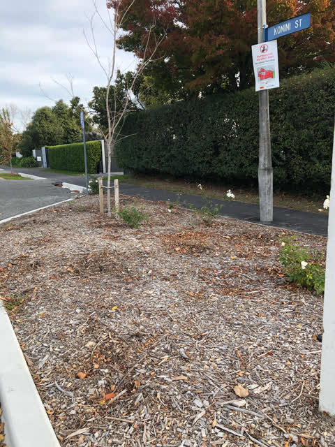
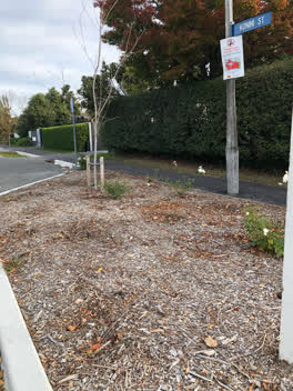 Parks, 18 Aug 2020
 The mature roses in this garden bed were removed for road works - it is now only partially replanted - can the gaps please be filled in. I
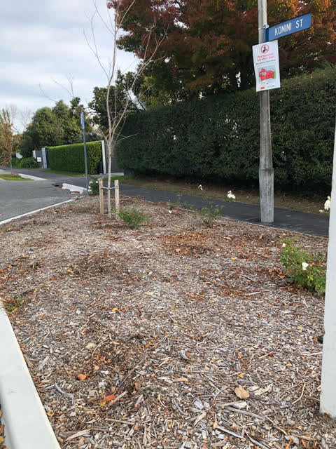
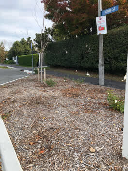 Parks, 1 May 2020
 Can you please ask the contractor (Citycare Water?) who did the works at Totara/Konini intersection to replace all the white roses which hav
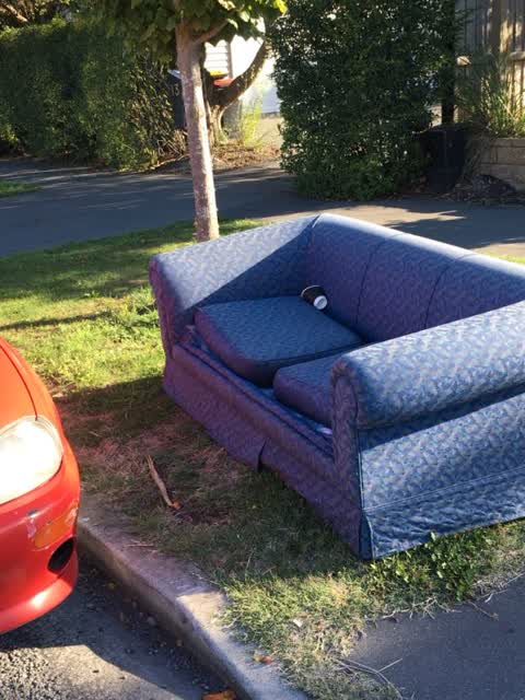
Rubbish/Recycling, 15 Mar 2017
This sofa has been left on the grass berm outside15 Harakeke St for the last 10 days. What can be done about this littering on a grand scale
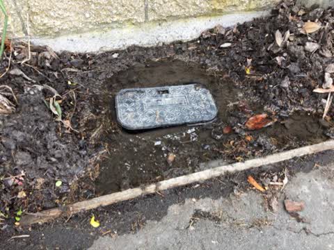
Water Supply, 2 Jan 2017
Hi, this water meter box outside 15 Harakeke street is leaking and flooding the garden etc outside the fence. Please can you arrange for the
The civic layer
This ground votes in Riccarton ward, the Halswell-Hornby-Riccarton community board is its local layer. Ward lines don’t always follow suburb lines; this one is measured at the pin, not the suburb’s centre. The whole roll is at /wards.
Everything about Riccarton → · What stood on this ground → · On the map → · From the air, RetroLens holds the Crown’s aerials back to 1936; search the address there →
Questions, answered briefly
4 council reports on record since January 2017, most often parks (2), water supply (1), rubbish/recycling (1).
Riccarton, Christchurch, on A.
The heritage register names 5 places at or beside it, 35 Rata Street, Riccarton Bush.
Riccarton Bush, 27 m to its edge, 12 ha.