27 Kilmarnock Street, Riccarton
16 reports on record since August 2021 · 12 with photographs. The most-reported address on Kilmarnock Street. Indicative rating valuation and school zones, hazards, bin day and what stood here before.
What gets reported here
Photographed here 12 on record




Reported here
 Pavement - General —
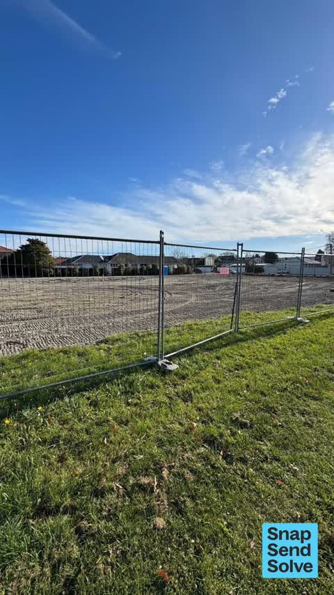
 Temporary fencing for development on south side Kilmarnock St. Metal bases stick out onto pavement. Nearly walked into one with sun in eyes.
 Damaged Road —
 Road surface very damaged adjacent to level crossing.
 Pavement - Damaged —
 Hard to capture issue well in a picture but the pedestrian path as it interfaces with the tracks is not very level.
 Sediment - Construction —
 Dust and airborne particle pollution being blown by Southerly and Westerly wind from this large area of loose material onto neibouring prope
 Graffiti on a fence, building or structure —
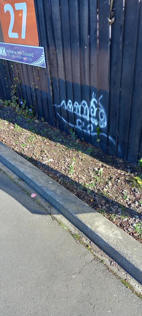
 graffiti on black wall over from railway line
 Graffiti on a fence, building or structure —
 graffiti over from railway line area
 Park - General Request —
 Cars park alongside the grassed area in Mona Vale Ave and chew up mud and ruin the edge leaving an unsightly mess which floods after rain. I
- Dumped Rubbish —
A car front bumper (from an accident?) has been thrown onto the grass verge next to the rail crossing. The vehicle's license plate is still
 Water Leak —
 Beside entrance
 Damaged Street Sign —
 Sitting outside 31 Kilmarnock. Not sure where it came from. Please remove
 Water Leak —
 The water main outside our preschool has burst and is spouting water like a huge fountain
 Water Leak —
 Water leak by railway line Kilmarnock Street
- Water Leak —
- General Request —
- Dumped Rubbish —
 Graffiti —
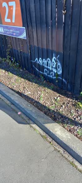
 27 Kilmarnock St- Best Start childcare centre - Graffiti on fence on southern side of driveway
Also reported on Kilmarnock Street
- 52 Kilmarnock Street — 9 reports
- 25 Kilmarnock Street — 9 reports
- 50 Kilmarnock Street — 8 reports
- 5 Kilmarnock Street — 6 reports
- 29 Kilmarnock Street — 6 reports
- 16 Kilmarnock Street — 5 reports
- 7C Kilmarnock Street — 4 reports
- 65B Kilmarnock Street — 3 reports
The street’s crash record
NZTA’s record names Kilmarnock Street in 46 crashes that hurt somebody since 2006 — 5 seriously hurt, nobody killed.
The green nearby
- Mona Vale — 186 m to the edge · Botanic · 5 ha
- Mandeville Reserve — 278 m to the edge
- Avon River Esplanade Reserve — 456 m to the edge
Parks within half a kilometre, measured to the boundary — the council’s open data.
On the doorstep
- Greatstay Bed and Breakfast — 70 m away · B&Bs
- Dux Dine Riccarton — 173 m away · Restaurants
- Ashleigh Court Motel — 179 m away · Motels
- Lorenzo Motel — 187 m away · Motels
Businesses within four hundred metres, measured at the pin — OpenStreetMap and the council directories.
The bus nearby
- Mona Vale Ave near Kilmarnock St — 85 m away · route 130
- Mona Vale Ave near Kilmarnock St — 102 m away · route 130
The closest Metro stops, within four hundred and fifty metres.
The tracks through here
- Walk and bike track through Riccarton — 25 m to the line · walk · bike
- Walk and bike track through Riccarton — 26 m to the line · walk · bike
- Walk and bike track through Riccarton — 44 m to the line · walk · bike
- Walk and bike track through Riccarton — 189 m to the line · walk · bike
- Walk and bike track through Riccarton — 189 m to the line · walk · bike
Tracks whose line passes within half a kilometre, measured to the line itself — the council’s open data.
The named ground
Named water within 500 m of this address, measured to the line or the edge; Named places within 1.5 km of this address; the council’s own structure register — bridges, boardwalks and steps standing nearby — the open map’s record.
Renting nearby
new bonds in Riccarton ran about $544 a week — about the city median — the suburb page keeps the rent record →.
What was here — Dwellling and Setting
67 m away · 20 Mona Vale Avenue · located to ±12 m · the place’s own record →
On the register. Nothing researched here yet.
The civic layer
This ground votes in Riccarton ward — the Halswell-Hornby-Riccarton community board. Ward lines don’t always follow suburb lines; this one is measured at the pin, not the suburb’s centre.
What stood on this ground → · On the map → · From the air — the Crown’s aerials back to 1936; search the address on RetroLens →
Questions, answered briefly
16 council reports on record since August 2021 — most often water leak (4), graffiti on a fence, building or structure (2), dumped rubbish (2).
Riccarton, Christchurch — on Kilmarnock Street.
The heritage register names a place at or beside it — Dwellling and Setting.
Mona Vale — 186 m to its edge, 5 ha.