33 Riccarton Road, Riccarton
32 reports on record since March 2017 · 29 with photographs. The street’s heaviest record is 35 Riccarton Road — 45 reports on file. Indicative rating valuation and school zones, hazards, bin day and what stood here before.
What gets reported here
Photographed here 29 on record


Reported here
 Road Signage —
 Bus lane signage missing. Not enforceable.
 Dumped Rubbish —
 nice to see the rubbish pile getting higher after3 or 4 months now really needs sorting out before we get rats
 Graffiti on a fence, building or structure —
 tag on the back of the Mobil service station building
 Graffiti on a fence, building or structure —
  Graffiti on a sign, mural or public art —
  Dumped Rubbish —
 this pile been here for months now and is starting to grow as more people dump on it. 3rd time reporting
 Dumped Rubbish —
 garden rubbish from other side of earth just left
 Graffiti on a fence, building or structure —
 Graffiti on wall of mobil railway line side
 Graffiti on a traffic light pole or cabinet, or wa —
  Graffiti somewhere else —
 Wall that faces towards riccarton rd mobil
 Graffiti somewhere else —
  Graffiti somewhere else —
 Barrier kiwi rail
 Graffiti somewhere else —
 Back wall of Mobil.
 Graffiti on a road, footpath or bridge —
 In Brockworth walkway
- Graffiti —
- Graffiti —
- Graffiti —
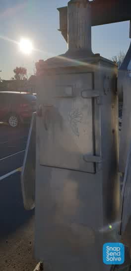 Graffiti —
 Railway barrier arm at South side riccarton Rd level crossing
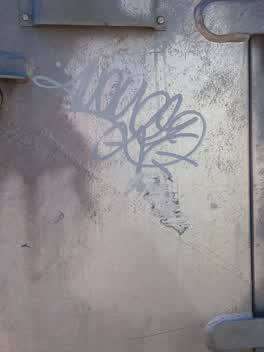 Graffiti —
 Riccarton Rd railway line - Graffiti on side of railway barrier arm control box, eastern side of Riccarton Rd
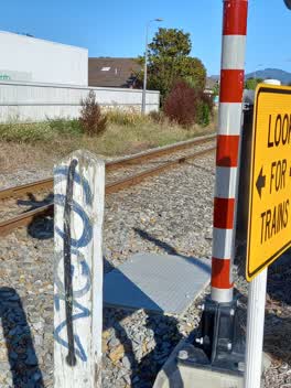 Graffiti —
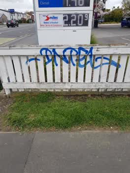
 Riccarton Rd railway crossing - white post on south side of railway line, eastern side of Riccarton Rd
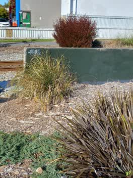 Graffiti —
 Riccarton Rd railway crossing - Graffiti on back of 'Keep Riccarton Beautiful' sign by the rail line, eastern side of Riccarton Rd
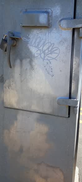 Graffiti —
 Riccarton Rd railway crossing - Graffiti on crossing arm control box, east side of road
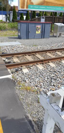 Graffiti —
 Train signals box at north side riccarton Rd level crossing
 Graffiti —
  Graffiti —
 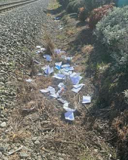 Dumped Rubbish —
 a heap of Mail along Brockworth Walkway.
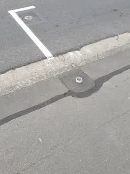 Roading/Streets —
 front bus line sign missing os mobil on ricc rd
Graffiti —
KiwiRail light, along the Brockworth walkway
Graffiti —
On Brookworth way off Riccarton road by the Rail way line
Graffiti —
Brockworth walk way
Graffiti —
Graffiti —
Lamp post on Brockworth walkway
Also reported on Riccarton Road
- 35 Riccarton Road — 45 reports
- 71 Riccarton Road — 43 reports
- 102 Riccarton Road — 36 reports
- 116 Riccarton Road — 33 reports
- 57 Riccarton Road — 32 reports
- 112 Riccarton Road — 30 reports
- 123 Riccarton Road — 27 reports
- 1 Riccarton Road — 27 reports
The street’s crash record
NZTA’s record names Riccarton Road in 275 crashes that hurt somebody since 2006 — 1 person killed, 44 seriously hurt.
The green nearby
- Mandeville Reserve — 180 m to the edge
- Hagley Park South — 287 m to the edge · Sports ground · 71 ha
- Picton Reserve — 423 m to the edge
- Mona Vale — 438 m to the edge · Botanic · 5 ha
Parks within half a kilometre, measured to the boundary — the council’s open data.
On the doorstep
- Mobil — 21 m away · Petrol stations
- Nando's — 28 m away · Restaurants
- Simo's Charcoal & Grill — 28 m away · Fast food
- Café Sismo — 30 m away · Cafés
Businesses within four hundred metres, measured at the pin — OpenStreetMap and the council directories.
The bus nearby
- Riccarton Rd near Bartlett St — 100 m away · route 3, route 5, route 80, route 86, route 130
- Riccarton Rd near Bartlett St — 108 m away · route 3, route 5, route 80, route 86, route 130
The closest Metro stops, within four hundred and fifty metres.
The tracks through here
- Walk and bike track through Riccarton — 9 m to the line · walk · bike
- Walk and bike track through Riccarton — 31 m to the line · walk · bike
- Walk and bike track through Riccarton — 70 m to the line · walk · bike
- Walk and bike track through Riccarton — 270 m to the line · walk · bike
- Walk and bike track through Riccarton — 282 m to the line · walk · bike
Tracks whose line passes within half a kilometre, measured to the line itself — the council’s open data.
The named ground
Named water within 500 m of this address, measured to the line or the edge; Named places within 1.5 km of this address; the council’s own structure register — bridges, boardwalks and steps standing nearby — the open map’s record.
The remembered names nearby
- This Feature Was Donated to the City of Christchurch — 203 m away ·
THIS FEATURE WAS DONATED TO THE CITY OF CHRISTCHURCH IN 1969 BY JOHN HEATON RHODES
· 2008
Inscribed plaques within two hundred and fifty metres — the register’s pins, not surveyed spots. The whole roll is at /plaques.
Renting nearby
new bonds in Riccarton ran about $544 a week — about the city median — the suburb page keeps the rent record →.
What was here — Dwellling and Setting
225 m away · 20 Mona Vale Avenue · located to ±12 m · the place’s own record →
On the register. Nothing researched here yet.
The civic layer
This ground votes in Riccarton ward — the Halswell-Hornby-Riccarton community board. Ward lines don’t always follow suburb lines; this one is measured at the pin, not the suburb’s centre.
What stood on this ground → · On the map → · From the air — the Crown’s aerials back to 1936; search the address on RetroLens →
Questions, answered briefly
32 council reports on record since March 2017 — most often graffiti (16), graffiti somewhere else (4), dumped rubbish (4).
Riccarton, Christchurch — on Riccarton Road.
The heritage register names a place at or beside it — Dwellling and Setting.
Mandeville Reserve — 180 m to its edge.