35A Matai Street West, Riccarton
13 reports on record since May 2022 · 6 with photographs. The most-reported address on Matai Street West. Indicative rating valuation and school zones, hazards, bin day and what stood here before.
What gets reported here
- Graffiti — 8
- General Request — 2
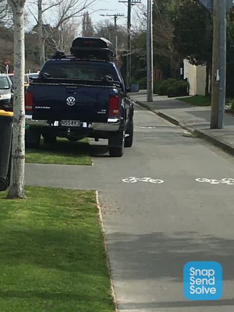
- Hazard — vehicle — 1
- Graffiti somewhere else — 1
- Damaged Street Sign — 1
Photographed here 6 on record


Reported here
 Damaged Street Sign —
Bus top sign removed and dumped
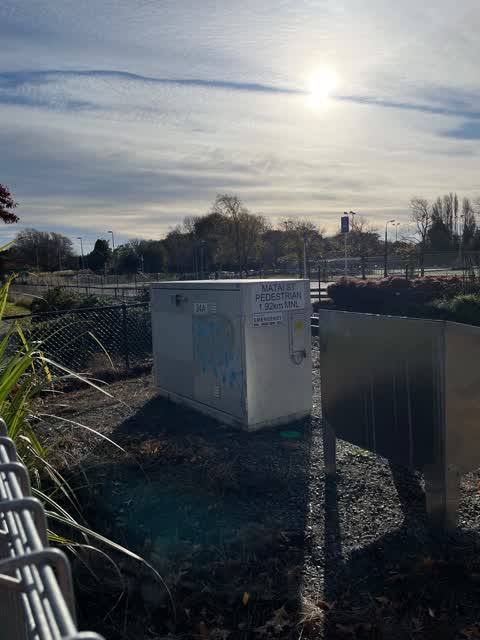
 Graffiti somewhere else —
Near walking entrance across railway line
 General Request —
Uneven Footpath outside 37 matai street A real trip hazzard
 Graffiti —
- Graffiti —
- Graffiti —
- Graffiti —
- Graffiti —
- Graffiti —
- General Request —
- Graffiti —
 Hazard — vehicle —
Arrogant parking decision.
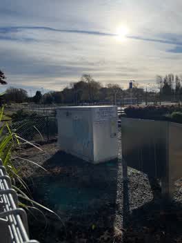 Graffiti —
KiwiRail
Also reported on Matai Street West
- 23 Matai Street West — 10 reports
- 70 Matai Street West — 7 reports
- 25A Matai Street West — 7 reports
- 48 Matai Street West — 6 reports
- 92A Matai Street West — 5 reports
- 60 Matai Street West — 5 reports
- 86 Matai Street West — 4 reports
- 55 Matai Street West — 4 reports
The street’s crash record
NZTA’s record names Matai Street West in 2 crashes that hurt somebody since 2006 — 1 seriously hurt, nobody killed.
The green nearby
- Mona Vale — 21 m to the edge · Botanic · 5 ha
- Avon River Esplanade Reserve — 355 m to the edge
- Mandeville Reserve — 444 m to the edge
- Little Hagley Park — 480 m to the edge · Botanic · 7 ha
Parks within half a kilometre, measured to the boundary — the council’s open data.
On the doorstep
- Britten Stables — 34 m away · B&Bs
- Ashleigh Court Motel — 134 m away · Motels
- Mona Vale Homestead — 184 m away · Restaurants
- Greatstay Bed and Breakfast — 195 m away · B&Bs
Businesses within four hundred metres, measured at the pin — OpenStreetMap and the council directories.
The bus nearby
- Mona Vale Ave near Kilmarnock St — 191 m away · route 130
- Mona Vale Ave near Kilmarnock St — 196 m away · route 130
The closest Metro stops, within four hundred and fifty metres.
The tracks through here
- Walk and bike track through Riccarton — 2 m to the line · walk · bike
- Walk and bike track through Riccarton — 5 m to the line · walk · bike
- Walk and bike track through Riccarton — 6 m to the line · walk · bike
- Walk and bike track through Riccarton — 46 m to the line · walk · bike
- Walk and bike track through Riccarton — 156 m to the line · walk · bike
Tracks whose line passes within half a kilometre, measured to the line itself — the council’s open data.
The named ground
Named water within 500 m of this address, measured to the line or the edge; Named places within 1.5 km of this address; the council’s own structure register — bridges, boardwalks and steps standing nearby — the open map’s record.
The remembered names nearby
- To the People of Canterbury / 'The Mighty Kauri' — 128 m away ·
To the people of Canterbury / 'The mighty Kauri' / Donated by / Harry & Beth (illegible) /
· 2009 - Mona Vale Rose Garden - Opened 1994 — 144 m away ·
Mona Vale Rose Garden - opened 1994 / Contributions for the purchase of roses in this gard
· 2009 - In Memory of / Sean J. Courtney & / Bernard T. Courtney — 160 m away ·
In Memory of / Sean J. Courtney & / Bernard T. Courtney / Mates enjoying the view
· 2009
Inscribed plaques within two hundred and fifty metres — the register’s pins, not surveyed spots. The whole roll is at /plaques.
Renting nearby
new bonds in Riccarton ran about $544 a week — about the city median — the suburb page keeps the rent record →.
What was here — Mona Vale Lodge and Setting
182 m away · 40 Mona Vale Avenue · located to ±13 m · the place’s own record →
On the register. Nothing researched here yet.
What was here — Dwellling and Setting
223 m away · 20 Mona Vale Avenue · located to ±12 m · the place’s own record →
On the register. Nothing researched here yet.
What was here — Former Dwelling and Setting, Mona Vale
246 m away · 63 Fendalton Road · located to ±26 m · the place’s own record →
On the register. Nothing researched here yet.
The civic layer
This ground votes in Riccarton ward — the Halswell-Hornby-Riccarton community board. Ward lines don’t always follow suburb lines; this one is measured at the pin, not the suburb’s centre.
What stood on this ground → · On the map → · From the air — the Crown’s aerials back to 1936; search the address on RetroLens →
Questions, answered briefly
13 council reports on record since May 2022 — most often graffiti (8), general request (2), hazard — vehicle (1).
Riccarton, Christchurch — on Matai Street West.
The heritage register names 3 places at or beside it — Mona Vale Lodge and Setting, Dwellling and Setting.
Mona Vale — 21 m to its edge, 5 ha.