59 Mandeville Street, Riccarton
11 reports on record since October 2018 · 9 with photographs. The street’s heaviest record is 54 Mandeville Street — 36 reports on file. Indicative rating valuation and school zones, hazards, bin day and what stood here before.
What gets reported here
Photographed here 9 on record


Reported here
 Water Leak —
 Graffiti on a fence, building or structure —
Graffiti on building visible from Burdale Street
 Hazard — vehicle —
Parking over driveway and fire hydrant
 Pavement - Damaged —
Footpath is very uneven
 Street Gutters / Storm Water —
Drain grate removed
 Graffiti somewhere else —
 Dumped Rubbish —
Rubbish dumped on footpath
- Graffiti —
- Dumped Rubbish —
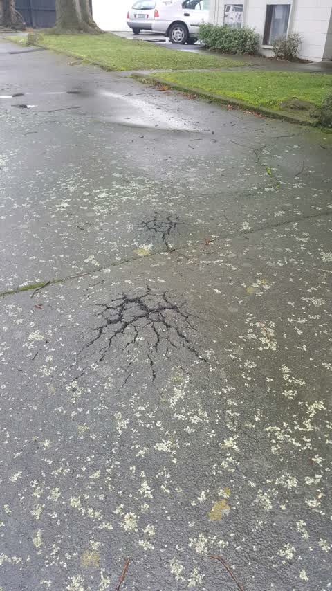
Roading/Streets —
looks more than tree roots
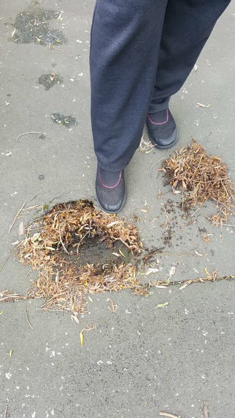
Roading/Streets —
Hole in footpath
Also reported on Mandeville Street
- 54 Mandeville Street — 36 reports
- 84 Mandeville Street — 26 reports
- 103 Mandeville Street — 15 reports
- 53 Mandeville Street — 14 reports
- 52 Mandeville Street — 14 reports
- 7 Mandeville Street — 12 reports
- 92 Mandeville Street — 11 reports
- 67 Mandeville Street — 11 reports
The street’s crash record
NZTA’s record names Mandeville Street in 30 crashes that hurt somebody since 2006 — 4 seriously hurt, nobody killed.
The green nearby
- Picton Reserve — 166 m to the edge
- Clarence Reserve — 335 m to the edge
- Mandeville Reserve — 394 m to the edge
Parks within half a kilometre, measured to the boundary — the council’s open data.
The civic shelf nearby
- Riccarton Service Centre — 450 m away · Service centre
Libraries, halls and the rest within half a kilometre — the council’s open data.
On the doorstep
- Intech Instruments Ltd — 7 m away · Electronics
- Decant Vintners and Epicures — 25 m away · Cafés
- Sculpt Reformer Pilates — 27 m away · Gyms & fitness
- KNK Architectural Hardware — 44 m away · Hardware
Businesses within four hundred metres, measured at the pin — OpenStreetMap and the council directories.
The bus nearby
- Mandeville St near Kyle St — 99 m away · route 140
- Mandeville St near Kyle St — 100 m away · route 140
The closest Metro stops, within four hundred and fifty metres.
The tracks through here
- Walk and bike track through Riccarton — 233 m to the line · walk · bike
- Walk and bike track through Riccarton — 266 m to the line · walk · bike
- Walk and bike track through Riccarton — 318 m to the line · walk · bike
- Walk and bike track through Riccarton — 381 m to the line · walk · bike
- Walk and bike track through Riccarton — 447 m to the line · walk · bike
Tracks whose line passes within half a kilometre, measured to the line itself — the council’s open data.
The named ground
Named water within 500 m of this address, measured to the line or the edge; Named places within 1.5 km of this address; the council’s own structure register — bridges, boardwalks and steps standing nearby — the open map’s record.
Renting nearby
new bonds in Riccarton ran about $544 a week — about the city median — the suburb page keeps the rent record →.
The civic layer
This ground votes in Riccarton ward — the Halswell-Hornby-Riccarton community board. Ward lines don’t always follow suburb lines; this one is measured at the pin, not the suburb’s centre.
What stood on this ground → · On the map → · From the air — the Crown’s aerials back to 1936; search the address on RetroLens →
Questions, answered briefly
11 council reports on record since October 2018 — most often roading/streets (2), dumped rubbish (2), water leak (1).
Riccarton, Christchurch — on Mandeville Street.
Nothing on the heritage register at this exact spot — the record around this ground →
Picton Reserve — 166 m to its edge.