213 River Road, Richmond
61 reports on record since October 2018 · 52 with photographs. The most-reported address on River Road. Indicative rating valuation and school zones, hazards, bin day and what stood here before.
What gets reported here
Photographed here 52 on record




Reported here
 Graffiti on a playground or in a park —
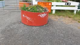
 Rude message on outdoor table in the Richmond parklet.
 Graffiti on a fence, building or structure —
 graffiti on fence
 Graffiti on a road, footpath or bridge —
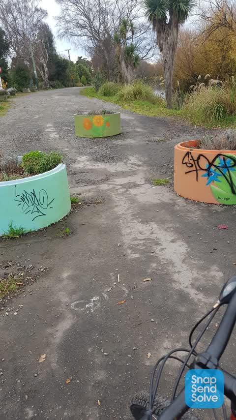
 Tagging along the city to sea pathway. Near the Swanns rd bridge.
 General Request —
 abandoned trolley yogijis Food Mart by parklet Swanns Rd Bridge
 Graffiti on a fence, building or structure —
 On fence by community gardens from River Rd walkway
 Graffiti on a fence, building or structure —
  Vandalism - General —
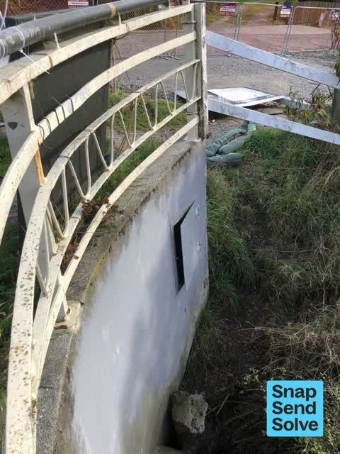
 Under the Swanns Road bridge is a box that was locked, but has now been opened. The lock was cut (and is probably in the Avon river).
 Damaged Street Light —
 Tilted power pole
 Graffiti —
  Graffiti —
 - Graffiti —
- Graffiti —
- Roads - General —
- Roads - General —
- Dumped Rubbish —
- Graffiti —
- Graffiti —
- Road Blockage —
- Pavement - Damaged —
 Graffiti —
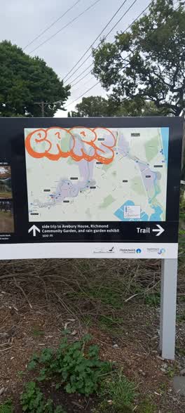
 Graffiti on the board. Entry of the red zone on swans zone.
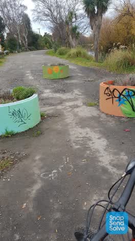 Graffiti —
 The community garden place might know the painter.
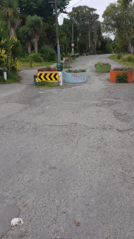 Graffiti —
  Graffiti —
  Graffiti —
  Roading/Streets —
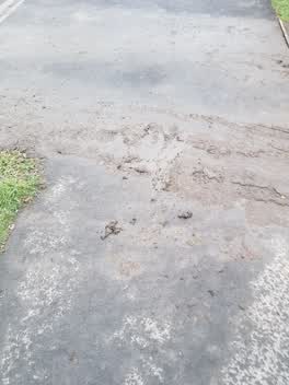
 Mud over footpath from cars entering. Caused me to slip over and bruise leg.
 Parks —
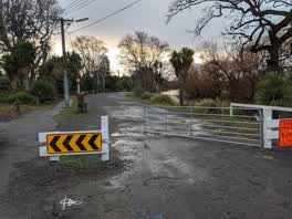
 Forced entry into the red zone near Avebury House. The chain has been cut. There is also a broken sign in the park / garden of Avebury House
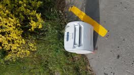 Rubbish/Recycling —
 Parks —
The chain and locks missing from the gate here have been replaced but we're not linked together properly. I have secured the gate so all 3 l
Pavement - Damaged —
Pavement sticking up pedestrian tripped hi vis painted to alert
General - Abandoned Trolley —
A trolley has been dumped just in the river near this address.
Parks —
The barrier here is still broken. There is no lock on the gate. The gate is left open. I have shut the gate. It is not secure.
Vandalism - General —
The gate here is open. One of the bollards has been fixed but the other bollard is still broken. I have closed the gate and latched it only
Parks —
The gate/road barrier and bollards here remain damaged and needing repair.
Roading/Streets —
Someone has smashed this gate again.
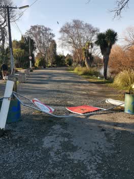 Roading/Streets —
 Gate got smaseg two days ago Last night some planter boxes down the river and the Riverlution planters got vandalis9
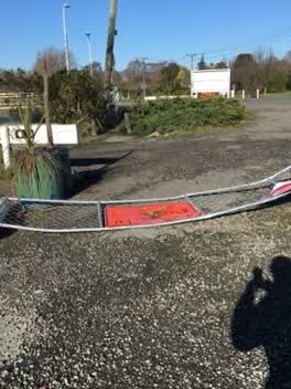 Roading/Streets —
 Gate trashed
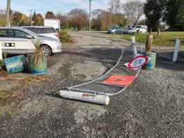 Roading/Streets —
 Access gate to Rd zone smashed. Cnr Swanns and River roads.
 Roading/Streets —
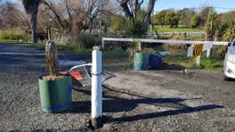
 The Red Zone barrier has been forced open with one of the wooden bollards been completely broken off from its base. The other bollard is sat
Roading/Streets —
Barrier rammed at this address no vehicles in area needs fixed asap
Roading/Streets —
Gate has been rammed and damaged lock has popped open allowing vehicle access
Rubbish/Recycling —
A seat/cushion has been dumped here.
 Roading/Streets —
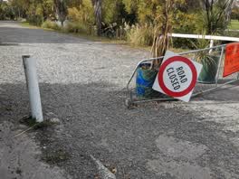
 Damaged gate at entrance to red zone. River Road at Swanns Road North Side
Graffiti —
Graffitti at base of river trail sign cnr Swanns Rd bridge
Roading/Streets —
Gate has been broken
Roading/Streets —
Roading/Streets —
Gate smashed yet again.
Roading/Streets —
Graffiti —
Roading/Streets —
Bollard & gate broken
Parks —
Someone has smashed the post and gate at River road ans Swanns Road
Roading/Streets —
Someone broke the gate entrance
Roading/Streets —
Post and Fence have been smashed by some prick
Parks —
Damaged gate River Rd / Swanns Rd
Roading/Streets —
Yet again the wooden pylon for the gate has been smashed. Needs concrete and/or steel to be honest...
Roading/Streets —
Red Zone access gate hit by car.
Roading/Streets —
Someone has tried to drive through the gate again. It's held but has buckled. The bollard next to it has been pulled right out of the ground
Rubbish/Recycling —
Rubbish/Recycling —
Rubbish/Recycling —
Rubbish dumped in plantings
Rubbish/Recycling —
Dumping on River road
Roading/Streets —
Somebody has broken the bollard right at the base. With the damage to the barrier on the other end of the road this is now once again a thro
Also reported on River Road
- 27 River Road — 47 reports
- 321 River Road — 46 reports
- 357 River Road — 43 reports
- 251 River Road — 33 reports
- 154 River Road — 33 reports
- 367 River Road — 30 reports
- 201 River Road — 29 reports
- 1 River Road — 25 reports
The street’s crash record
NZTA’s record names River Road in 7 crashes that hurt somebody since 2006 — 1 person killed, 3 seriously hurt.
The green nearby
- Avon Riverbank True Right — 34 m to the edge · 11 ha
- Avebury Park — 148 m to the edge · Botanic
- Richmond Playground — 307 m to the edge
- Alexandra Park — 379 m to the edge
- Beverley Park — 461 m to the edge · 3 ha
Parks within half a kilometre, measured to the boundary — the council’s open data.
On the doorstep
- Riverlution Cafe — 80 m away · Cafés
- npd — 255 m away · Petrol stations
- Christchurch Community Corrections — 272 m away · Government
- Edgardo's Grill — 273 m away · Restaurants
Businesses within four hundred metres, measured at the pin — OpenStreetMap and the council directories.
The bus nearby
- Stanmore Rd near Warwick St — 285 m away · route 60, the Orbiter (clockwise)
- Stanmore Rd near Alexandra St — 292 m away · route 60, the Orbiter (anticlockwise)
The closest Metro stops, within four hundred and fifty metres.
The tracks through here
- Walk and bike track through Richmond — 2 m to the line · walk · bike
- Walk and bike track through Richmond — 17 m to the line · walk · bike
- Walk and bike track through Richmond — 45 m to the line · walk · bike
- Walk and bike track through Richmond — 157 m to the line · walk · bike
- Walk and bike track through Richmond — 280 m to the line · walk · bike
Tracks whose line passes within half a kilometre, measured to the line itself — the council’s open data.
The named ground
Named water within 500 m of this address, measured to the line or the edge; the council’s own structure register — bridges, boardwalks and steps standing nearby — the open map’s record.
The remembered names nearby
- Donated by N.Z. Founders Society Inc. Canterbury Branch — 248 m away ·
Donated by N.Z. Founders Society Inc. Canterbury Branch September 2007
· 2009
Inscribed plaques within two hundred and fifty metres — the register’s pins, not surveyed spots. The whole roll is at /plaques.
Renting nearby
new bonds in Richmond ran about $499 a week — $51 below the city median of $550 — the suburb page keeps the rent record →.
What was here — MED Substation and Setting
134 m away · 11 Retreat Road · located to ±5 m · the place’s own record →
On the register. Nothing researched here yet.
What was here — Dwelling and Setting, Avebury
226 m away · 9 Eveleyn Couzins Avenue · located to ±14 m · the place’s own record →
On the register. Nothing researched here yet.
The civic layer
This ground votes in Central ward — the Papanui-Innes-Central community board. Ward lines don’t always follow suburb lines; this one is measured at the pin, not the suburb’s centre.
What stood on this ground → · On the map → · From the air — the Crown’s aerials back to 1936; search the address on RetroLens →
Questions, answered briefly
61 council reports on record since October 2018 — most often roading/streets (20), graffiti (13), rubbish/recycling (6).
Richmond, Christchurch — on River Road.
The heritage register names 2 places at or beside it — MED Substation and Setting, Dwelling and Setting, Avebury.
Avon Riverbank True Right — 34 m to its edge, 11 ha.