236 Fitzgerald Avenue, Richmond
32 reports on record since August 2015 · 26 with photographs. The street’s heaviest record is 250 Fitzgerald Avenue — 38 reports on file. Indicative rating valuation and school zones, hazards, bin day and what stood here before.
What gets reported here
Photographed here 26 on record


Reported here
 Water General —
 hose leading out from watermelon just before Kilomore St Fitzgerald Ave intersection
 General Request —
 The cycle lane leading up to the corner of river road and Fitzgerald Ave is constantly blocked by cars illegally stopping or traveling throu
 Graffiti on a sign, mural or public art —
 Graffiti signage center island
 Pest / Vermin —
 Pest plant - yellow flag iris. Along waterways- send to waterways maintenance team
 Graffiti on a sign, mural or public art —
 On road sign Fitzgerald Ave by River Rd
 Graffiti on a sign, mural or public art —
  Graffiti on a fence, building or structure —
  Graffiti on a fence, building or structure —
  Graffiti somewhere else —
 Graffiti under this bridge
 Graffiti somewhere else —
 On / underneath Fitzgerald Ave bridge
 Graffiti on a sign, mural or public art —
  Graffiti on a fence, building or structure —
  Accessibility —
 Dangerous hole, someone could break ankle. Thank you!
 Graffiti on a cabinet, pole or railway asset —
 - Graffiti —
- Graffiti —
- Overgrown Vegetation —
- Overgrown Vegetation —
- Overgrown Vegetation —
- Overgrown Vegetation —
 Roading/Streets —
 Further to my previous message. Have now driven off withoit doing anything. No markers or cones placed. This is a rather large health and s
 Roading/Streets —
 Just had an accident on the unmarked previous flooded footpath, slipping over and injurying myself. Workers.showed up as I was getting up
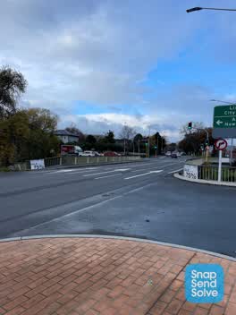 Roading/Streets —
 These advertisement signs have been up for months. Is it legal to place signs on public railing?
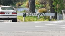 Graffiti —
 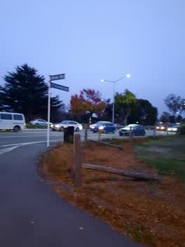 Rubbish/Recycling —
 rubbish dumped at corner of Fitzgerald and River rd. seen 7:15 10/05
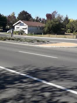 Graffiti —
 this has two lots of graffiti on the photo it's on the traffic island and the grey box the one on the traffic island is in green paint on th
Graffiti —
Graffiti —
Graffiti —
Graffiti —
Graffiti —
Roading/Streets —
Dangerous gap. 3 m fall.
Also reported on Fitzgerald Avenue
- 250 Fitzgerald Avenue — 38 reports
- 237 Fitzgerald Avenue — 34 reports
- 256 Fitzgerald Avenue — 24 reports
- 258 Fitzgerald Avenue — 21 reports
- 260 Fitzgerald Avenue — 14 reports
- 246 Fitzgerald Avenue — 13 reports
- 256E Fitzgerald Avenue — 11 reports
- 254 Fitzgerald Avenue — 8 reports
The street’s crash record
NZTA’s record names Fitzgerald Avenue in 5 crashes that hurt somebody since 2006 — 2 seriously hurt, nobody killed.
The green nearby
- Avon Riverbank Central City — 45 m to the edge · 6 ha
- William Brittan — 76 m to the edge
- Walnut Tree Park — 164 m to the edge
- Beverley Park — 269 m to the edge · 3 ha
- Chester Street East Reserve — 310 m to the edge
Parks within half a kilometre, measured to the boundary — the council’s open data.
On the doorstep
- Scott Base Motors — 33 m away · Car dealers
- Gourmet Grub Food Truck — 35 m away · Fast food
- Little Poms — 93 m away · Cafés
- Pomeroys Old Brewery Inn — 95 m away · Restaurants
Businesses within four hundred metres, measured at the pin — OpenStreetMap and the council directories.
The bus nearby
- Fitzgerald Ave near River Rd — 56 m away · route 7
- Fitzgerald Ave near Harvey Tce — 113 m away · route 7
The closest Metro stops, within four hundred and fifty metres.
The tracks through here
- Walk and bike track through Richmond — 63 m to the line · walk · bike
- Walk and bike track through Richmond — 63 m to the line · walk · bike
- Walk and bike track through Richmond — 63 m to the line · walk · bike
- Walk and bike track through Richmond — 63 m to the line · walk · bike
- Walk and bike track through Richmond — 265 m to the line · walk · bike
Tracks whose line passes within half a kilometre, measured to the line itself — the council’s open data.
The named ground
Named water within 500 m of this address, measured to the line or the edge; the council’s own structure register — bridges, boardwalks and steps standing nearby — the open map’s record.
The remembered names nearby
- He Tohu Whakamaumahara o Matou Tipuna — 84 m away ·
He tohu whakamaumahara o matou tipuna
· 2009 - William Guise Brittan Historical Garden on 26 November 1994 — 85 m away ·
WILLIAM GUISE BRITTAN HISTORICAL GARDEN On 26 November 1994 the first shrubs were planted
· 2009
Inscribed plaques within two hundred and fifty metres — the register’s pins, not surveyed spots. The whole roll is at /plaques.
Renting nearby
new bonds in Richmond ran about $499 a week — $51 below the city median of $550 — the suburb page keeps the rent record →.
What was here — Former Maturing Cellars and Administration Offices and Setting
107 m away · 294 Kilmore Street · located to ±24 m · the place’s own record →
On the register. Nothing researched here yet.
What was here — Dwelling and Setting, Englefield
118 m away · 230 Fitzgerald Avenue · located to ±14 m · the place’s own record →
On the register. Nothing researched here yet.
What was here — Former Boiler House and Setting
159 m away · 175 Chester Street East · located to ±10 m · the place’s own record →
On the register. Nothing researched here yet.
What was here — Heritage Garden and House
217 m away · 20 Templar Street · located to ±20 m · the place’s own record →
On the register. Nothing researched here yet.
The civic layer
This ground votes in Central ward — the Papanui-Innes-Central community board. Ward lines don’t always follow suburb lines; this one is measured at the pin, not the suburb’s centre.
What stood on this ground → · On the map → · From the air — the Crown’s aerials back to 1936; search the address on RetroLens →
Questions, answered briefly
32 council reports on record since August 2015 — most often graffiti (9), roading/streets (4), overgrown vegetation (4).
Richmond, Christchurch — on Fitzgerald Avenue.
The heritage register names 4 places at or beside it — Former Maturing Cellars and Administration Offices and Setting, Dwelling and Setting, Englefield.
Avon Riverbank Central City — 45 m to its edge, 6 ha.