47 Swanns Road, Richmond
12 reports on record since December 2017 · 9 with photographs. The street’s heaviest record is 51 Swanns Road — 17 reports on file. Indicative rating valuation and school zones, hazards, bin day and what stood here before.
What gets reported here
- Wastewater/Stormwater — 2
- Roading/Streets — 2
- General Request — 2
- Water Supply — 1
- Rubbish/Recycling — 1
- Rubbish and Bins - General — 1
Photographed here 9 on record


Reported here
 General Request —
 Can we please get some new address stickers to put on our red and yellow bins?
 Graffiti on a cabinet, pole or railway asset —
 Graffiti on the pole outside 45/47 Swanns Road
 General Request —
 Your new flyer regarding ‘tips to bin good’ has some spelling errors/typos on it. I’ve circled them. Hopefully you can see it in the photo’
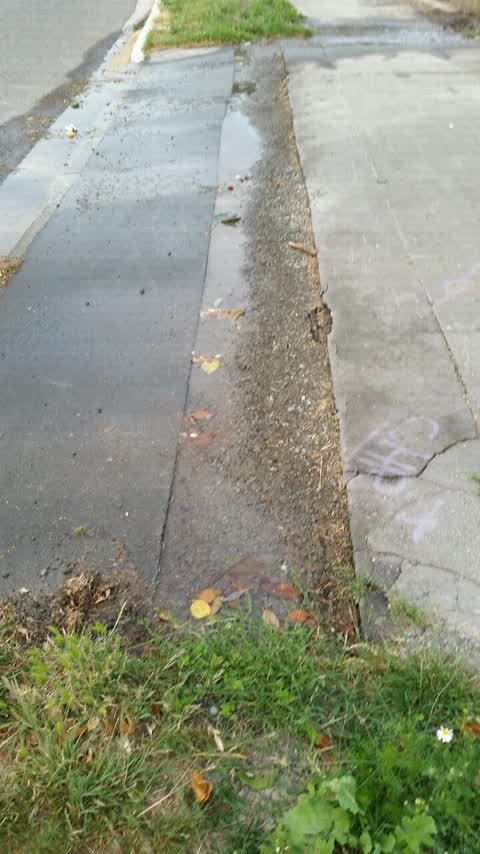
- Rubbish and Bins - General —
- Pavement - Damaged —
- Graffiti —
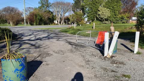
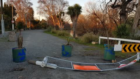
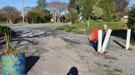 Roading/Streets —
 broken vehicle barrier
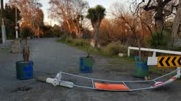 Roading/Streets —
 the gate nearest to Richmond community garden was damaged weeks ago and cards are accessing the pedestrian only roads making it unsafe. the
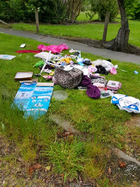
Rubbish/Recycling —
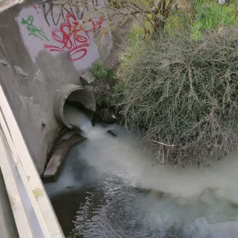
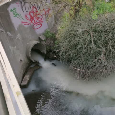
Wastewater/Stormwater —
Absolute filth running out of the storm water drain into the Avon . this is at the Swann St bridge. not the first time. This is a duplicate
Wastewater/Stormwater —
Absolute filth running out of the storm water drain into the Avon . this is at the Swann St bridge. not the first time.
Water Supply —
Leaking water main
Also reported on Swanns Road
- 51 Swanns Road — 17 reports
- 4 Swanns Road — 16 reports
- 18 Swanns Road — 9 reports
- 19 Swanns Road — 6 reports
- 23 Swanns Road — 5 reports
- 9 Swanns Road — 4 reports
- 42 Swanns Road — 4 reports
- 20 Swanns Road — 4 reports
The street’s crash record
NZTA’s record names Swanns Road in 3 crashes that hurt somebody since 2006 — 0 seriously hurt, nobody killed.
The green nearby
- Avon Riverbank True Right — 81 m to the edge · 11 ha
- Avebury Park — 170 m to the edge · Botanic
- Richmond Playground — 264 m to the edge
- Alexandra Park — 330 m to the edge
- Beverley Park — 433 m to the edge · 3 ha
Parks within half a kilometre, measured to the boundary — the council’s open data.
On the doorstep
- Riverlution Cafe — 101 m away · Cafés
- npd — 207 m away · Petrol stations
- Edgardo's Grill — 226 m away · Restaurants
- Indian Paradise — 227 m away · Restaurants
Businesses within four hundred metres, measured at the pin — OpenStreetMap and the council directories.
The bus nearby
- Stanmore Rd near Warwick St — 240 m away · route 60, the Orbiter (clockwise)
- Stanmore Rd near Alexandra St — 245 m away · route 60, the Orbiter (anticlockwise)
The closest Metro stops, within four hundred and fifty metres.
The tracks through here
- Walk and bike track through Richmond — 23 m to the line · walk · bike
- Walk and bike track through Richmond — 45 m to the line · walk · bike
- Walk and bike track through Richmond — 92 m to the line · walk · bike
- Walk and bike track through Richmond — 192 m to the line · walk · bike
- Walk and bike track through Richmond — 231 m to the line · walk · bike
Tracks whose line passes within half a kilometre, measured to the line itself — the council’s open data.
The named ground
Named water within 500 m of this address, measured to the line or the edge; the council’s own structure register — bridges, boardwalks and steps standing nearby — the open map’s record.
Renting nearby
new bonds in Richmond ran about $499 a week — $51 below the city median of $550 — the suburb page keeps the rent record →.
What was here — MED Substation and Setting
182 m away · 11 Retreat Road · located to ±5 m · the place’s own record →
On the register. Nothing researched here yet.
What was here — Dwelling and Setting, Avebury
243 m away · 9 Eveleyn Couzins Avenue · located to ±14 m · the place’s own record →
On the register. Nothing researched here yet.
The civic layer
This ground votes in Central ward — the Papanui-Innes-Central community board. Ward lines don’t always follow suburb lines; this one is measured at the pin, not the suburb’s centre.
What stood on this ground → · On the map → · From the air — the Crown’s aerials back to 1936; search the address on RetroLens →
Questions, answered briefly
12 council reports on record since December 2017 — most often wastewater/stormwater (2), roading/streets (2), general request (2).
Richmond, Christchurch — on Swanns Road.
The heritage register names 2 places at or beside it — MED Substation and Setting, Dwelling and Setting, Avebury.
Avon Riverbank True Right — 81 m to its edge, 11 ha.