16 Lingard Street
6 council reports since December 2024, 6 carrying a photograph. The most-reported address on Lingard Street.
From the air, then
Sourced from Canterbury Maps and partners. LINZ, CC BY 3.0 NZ. Each frame is cut from Environment Canterbury’s historic imagery MapServer for that decade, only where the Footprints layer names a CC BY survey (NZAM-covered spots stay out). RetroLens holds more Crown aerials →
The green nearby
- Rutland Reserve, 347 m to the edge · 2 ha · playground, 56 pieces
Parks within half a kilometre, measured to the boundary, the council’s open data. The whole roll is at /parks.
On the doorstep
- Winematters, 177 m away · Bottle stores
- Thatwineguy.nz, 265 m away · Bottle stores
- St Albans Community Market, 296 m away · Markets
Businesses within four hundred metres, measured at the pin, OpenStreetMap and the council directories.
The tracks through here
- Walk and bike track through Saint Albans, 42 m to the line · walk · bike
- Walk and bike track through Saint Albans, 242 m to the line · walk · bike
- Walk and bike track through Saint Albans, 283 m to the line · walk · bike
- Walk and bike track through Saint Albans, 366 m to the line · walk · bike
- Walk and bike track through Saint Albans, 396 m to the line · walk · bike
Tracks whose line passes within half a kilometre, the council’s open data.
The named ground
Named water within 500 m of this address, measured to the line or the edge, the open map’s record.
Renting nearby
new bonds in Saint Albans ran about $514 a week, $36 below the city median of $550, the suburb page keeps the rent record →.
What gets reported here
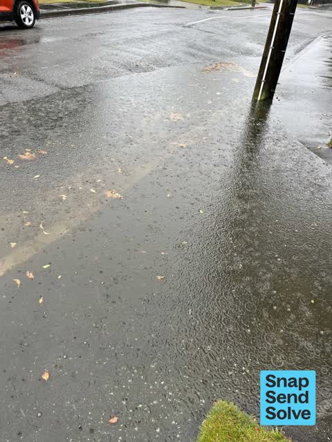
Photographed here 6 on record



What’s on record
 Accessibility, 14 Dec 2025
 The road work crews have resealed the footpath but did not reinstate the textured tiles - this is confusing and hazardous for those who rel
 Street Gutters / Storm Water, 1 May 2025
 As per the screenshot this remains an unsolved issue. Same issue as 6131908. Recommend a camera be sent down this short pipe to determine un
 Street Gutters / Storm Water, 3 Apr 2025
 This further supports continued flooding during rain events. Previous incidents (ID6011596 12 March and ID5967019 3 March) have not been res
 Street Gutters / Storm Water, 12 Mar 2025
 This is a follow up request to a snap from 3 March rain. This was not resolved and flooding has occurred again. It makes it difficult to get
 Street Gutters / Storm Water, 3 Mar 2025
 This drain was unblocked during the last big rain. It doesn’t appear to be fully resolved. It is built up worse than last time. Please note
 Street Gutters / Storm Water, 31 Dec 2024
 Drain outside 16 Lingard is blocked. The drainage pipe into Dudley stream is blocked. Could this please be unblocked.
Elsewhere on Lingard Street
- 17 Lingard Street, 1 report
The civic layer
This ground votes in Papanui ward, the Papanui-Innes-Central community board is its local layer. Ward lines don’t always follow suburb lines; this one is measured at the pin, not the suburb’s centre. The whole roll is at /wards.
Lingard Street, the whole record → · Everything about Saint Albans → · What stood on this ground → · On the map → · From the air, RetroLens holds the Crown’s aerials back to 1936; search the address there →
Questions, answered briefly
6 council reports on record since December 2024, most often street gutters / storm water (5), accessibility (1).
Saint Albans, Christchurch, on Lingard Street.
Nothing on the heritage register at this exact spot, the record around this ground →
Rutland Reserve, 347 m to its edge, 2 ha.