42 Cashmere View Street, Somerfield
14 reports on record since October 2017 · 12 with photographs. The most-reported address on Cashmere View Street. Indicative rating valuation and school zones, hazards, bin day and what stood here before.
What gets reported here
Photographed here 12 on record


Reported here
 Overgrown Vegetation —
 Entrance to Cashmere View Reserve is partially blocked by overgrown plants
 Playground Equipment —
 Playground swings have been vandalised
 Hazard — vehicle —
 Campervan has been parked here for a week
 Road Signage —
 Bush growing over sign. Sign barely visible.
 Overgrown Vegetation —
 Blocking footpath
 Dumped Rubbish —
 In front of park.
 Overgrown Vegetation —
 This is in at park
 Park - General Request —
 Footpath is very uneven and broken. This is a severe trip hazard. Also a loose brick.
 Overgrown Vegetation —
 This is a trip hazard
- Pavement - Damaged —
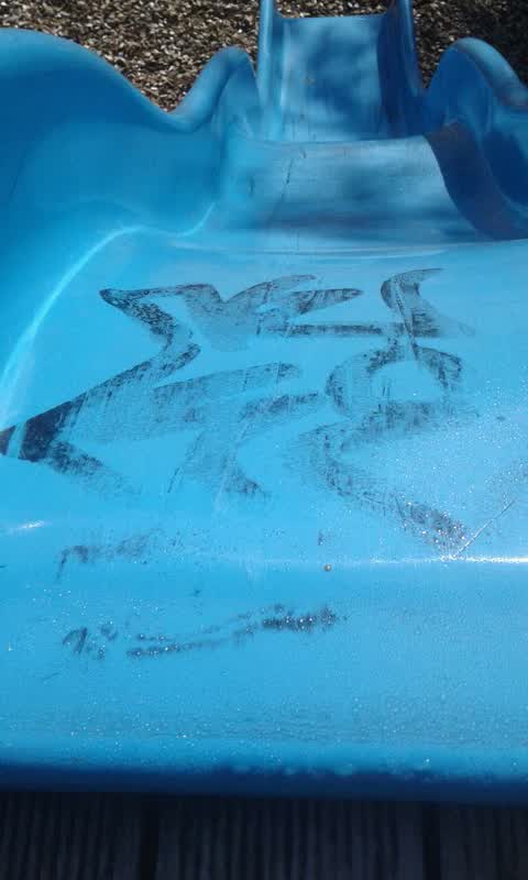
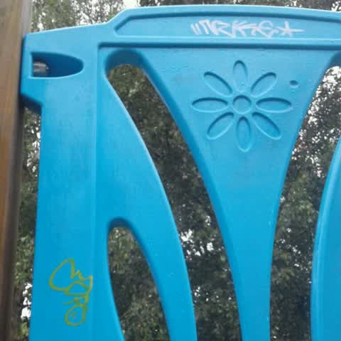
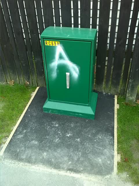
- Graffiti —
Graffiti —
Cashmereview playground Tagging This is a duplicate report. The original report was sent on 22/01/2019.
Graffiti —
Cashmereview playground Tagging
Graffiti —
Also reported on Cashmere View Street
- 38 Cashmere View Street — 12 reports
- 36 Cashmere View Street — 7 reports
- 9 Cashmere View Street — 5 reports
- 14 Cashmere View Street — 5 reports
- 49 Cashmere View Street — 4 reports
- 24 Cashmere View Street — 4 reports
- 47E Cashmere View Street — 3 reports
- 45 Cashmere View Street — 3 reports
The green nearby
- Cashmere View Playground — you are in it
- Cashmere Riverbank Reserve — 341 m to the edge · 1 ha
- Centennial Park — 345 m to the edge · Sports ground · 10 ha
- Cashmere Valley Reserve — 486 m to the edge · 2 ha
Parks within half a kilometre, measured to the boundary — the council’s open data.
The civic shelf nearby
- Pioneer — 433 m away · Recreation centre · 61 Lyttelton Street
Libraries, halls and the rest within half a kilometre — the council’s open data.
On the doorstep
- Spicyboys — 361 m away · Bottle stores
Businesses within four hundred metres, measured at the pin — OpenStreetMap and the council directories.
The bus nearby
- Rose St near Cashmere View St — 75 m away · route 44
- Rose St near Marley View St — 174 m away · route 44
The closest Metro stops, within four hundred and fifty metres.
The tracks through here
- Walk and bike track through Somerfield — 241 m to the line · walk · bike
- Walk and bike track through Somerfield — 275 m to the line · walk · bike
- Walk and bike track through Somerfield — 282 m to the line · walk · bike
- Walk and bike track through Somerfield — 350 m to the line · walk · bike
- Walk and bike track through Somerfield — 374 m to the line · walk · bike
Tracks whose line passes within half a kilometre, measured to the line itself — the council’s open data.
The named ground
Named water within 500 m of this address, measured to the line or the edge — the open map’s record.
Renting nearby
new bonds in Somerfield ran about $567 a week — $17 above the city median of $550 — the suburb page keeps the rent record →.
The civic layer
This ground votes in Cashmere ward — the Spreydon-Cashmere-Heathcote community board. Ward lines don’t always follow suburb lines; this one is measured at the pin, not the suburb’s centre.
What stood on this ground → · On the map → · From the air — the Crown’s aerials back to 1936; search the address on RetroLens →
Questions, answered briefly
14 council reports on record since October 2017 — most often overgrown vegetation (4), graffiti (4), road signage (1).
Somerfield, Christchurch — on Cashmere View Street.
Nothing on the heritage register at this exact spot — the record around this ground →
Cashmere View Playground — the address is inside it.