96 Somerfield Street, Somerfield
17 reports on record since January 2019 · 15 with photographs. The most-reported address on Somerfield Street. Indicative rating valuation and school zones, hazards, bin day and what stood here before.
What gets reported here
- Dumped Rubbish — 4
- Hazard — vehicle — 3
- Roading/Streets — 2
- Road Signage — 2
- Damaged Street Sign — 2
- Water Supply — 1
Photographed here 15 on record


Reported here
 Damaged Street Sign —
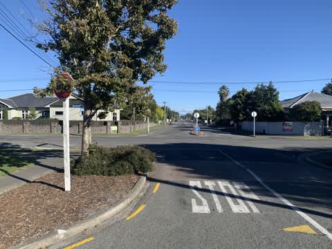
 Somerfield Street / Selwyn Street signage has been cut down!
 Hazard — vehicle —
 Car blocking footpath
 Abandoned Vehicle —
 JNJ122 car seemingly dumped outside courtyard Montessori in the prime drop off zone for weeks now. Seems inappropriate to leave a car here.
 Road Signage —
 The road signs here are a disgrace. is the maintenance contractor doing their job properly? Clean them first and if no good (like I suspect
 Flooding —
 multiple locations of flooding on this end of Selwyn Street. something is not working as planned
 Dumped Rubbish —
  Dumped Rubbish —
  Dumped Rubbish —
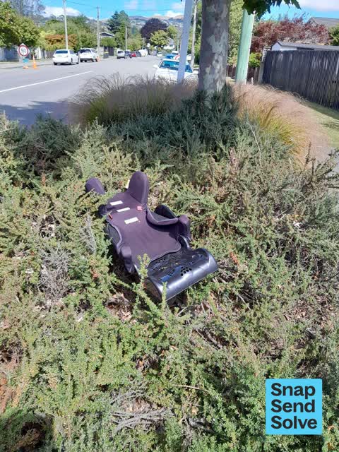
 Plastic stuff dumped by 96 Somerfield Street corner of Selwyn Street needs removal.
 Hazard — vehicle —
  Hazard — vehicle —
 The resident frequently parks his vehicle over the pavement, forcing pedestrians to walk on the road. Many school children have to pass by w
 Dumped Rubbish —
 Cnr selwyn and somerfield in planted area
- Damaged Street Sign —
- Road Signage —
Roading/Streets —
Stop sign covered by tree branch on Selwyn street, south side facing north. Reported by police officer.
Roading/Streets —
Stop sign covered by tree branch on Selwyn street, south side facing north. Reported by police officer.
Graffiti —
Water Supply —
Lot of water being wasted in to the street here at 90 Somerfield Street.
Also reported on Somerfield Street
- 5 Somerfield Street — 15 reports
- 15 Somerfield Street — 14 reports
- 38 Somerfield Street — 10 reports
- 114 Somerfield Street — 10 reports
- 71 Somerfield Street — 8 reports
- 107 Somerfield Street — 8 reports
- 98 Somerfield Street — 7 reports
- 21 Somerfield Street — 7 reports
The street’s crash record
NZTA’s record names Somerfield Street in 21 crashes that hurt somebody since 2006 — 3 seriously hurt, nobody killed.
The green nearby
- Somerfield Park — 317 m to the edge · Sports ground · 3 ha
- Colombo Reserve — 343 m to the edge
- Ernle Clark Reserve — 370 m to the edge · Botanic · 2 ha
Parks within half a kilometre, measured to the boundary — the council’s open data.
The civic shelf nearby
- South Christchurch Library — 439 m away · Library · 66 Colombo St, Cashmere, Christchurch 8022
- Beckenham Service Centre — 455 m away · Service centre
Libraries, halls and the rest within half a kilometre — the council’s open data.
On the doorstep
- Flowers on Cashmere — 345 m away · Florists
- Canterbury Childrens Theatre — 346 m away · Cinemas & theatres
- Runacres — 346 m away · Insurance
- GoodFor — 350 m away · Health Food
Businesses within four hundred metres, measured at the pin — OpenStreetMap and the council directories.
The bus nearby
The closest Metro stops, within four hundred and fifty metres.
The tracks through here
- Walk and bike track through Somerfield — 11 m to the line · walk · bike
- Walk and bike track through Somerfield — 310 m to the line · walk · bike
- Walk and bike track through Somerfield — 325 m to the line · walk · bike
- Walk and bike track through Somerfield — 325 m to the line · walk · bike
- Walk and bike track through Somerfield — 339 m to the line · walk · bike
Tracks whose line passes within half a kilometre, measured to the line itself — the council’s open data.
The named ground
Named water within 500 m of this address, measured to the line or the edge — the open map’s record.
Renting nearby
new bonds in Somerfield ran about $567 a week — $17 above the city median of $550 — the suburb page keeps the rent record →.
What was here — MED Substation
199 m away · 2E Woodard Terrace · located to ±6 m · the place’s own record →
On the register. Nothing researched here yet.
The civic layer
This ground votes in Cashmere ward — the Spreydon-Cashmere-Heathcote community board. Ward lines don’t always follow suburb lines; this one is measured at the pin, not the suburb’s centre.
What stood on this ground → · On the map → · From the air — the Crown’s aerials back to 1936; search the address on RetroLens →
Questions, answered briefly
17 council reports on record since January 2019 — most often dumped rubbish (4), hazard — vehicle (3), roading/streets (2).
Somerfield, Christchurch — on Somerfield Street.
The heritage register names a place at or beside it — MED Substation.
Somerfield Park — 317 m to its edge, 3 ha.