29 Sugden Street, Spreydon
19 reports on record since August 2018 · 16 with photographs. The street’s heaviest record is 31A Sugden Street — 21 reports on file. Indicative rating valuation and school zones, hazards, bin day and what stood here before.
What gets reported here
- Graffiti — 4
- Vandalism - General — 2
- Parks — 2
- Graffiti on a fence, building or structure — 2
- General Request — 2
- Rubbish and Bins - General — 1
Photographed here 16 on record






Reported here
 Facility - General Request —
 door smashed in, frame broken.
 Overgrown Vegetation —
 Hedge needs cutting Council came last year but never finished. Looks quite bad
 Dumped Rubbish —
 toilet block filled with rubbish, door unlocked
 General Request —
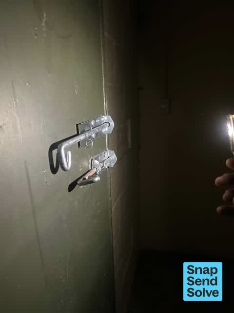
 The sheds at Barrington park appear to have been broken into last night. All the padlocks are gone and all the doors are open - we walk thro
 General Request —
 On sports building Simeon T end of park
 Graffiti somewhere else —
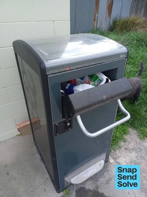
 Graffiti on the aa bin with solar panels on it in front of the mint buildings along the path at Barrington Park
 Public Toilet —
 Toilet blocked, and in a mess
 Rubbish and Bins - General —
 Full rubbish bin
 Graffiti on a fence, building or structure —
 Graffiti on front and left side of a set of beige sheds at Barrington Park along the gravel path.
 Graffiti on a fence, building or structure —
 Graffiti on the side of a beige shed unit along the gravel path at Barrington Park.
 Graffiti on a cabinet, pole or railway asset —
 White graffiti on green pole closest to the white building in Barrington Park. The pole is facing the gravel path.
 Vandalism - General —
 Broken locks on storage building in Barrington Park
 Graffiti —
 - Graffiti —
- Graffiti —
 Vandalism - General —
 Barrington park cricket room broken into
 Graffiti —
 Barrington park cricket room
 Parks —
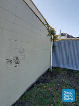
 Graffiti, vandalism and down pipe for gutters broken. Complaints about some hedges not having been trimmed from members of public
- Parks —
Hi, There is a dark chain with no reflector across the entrance to Barrington Park off Sugden Street. This is just silly and dangerous. Lot
Also reported on Sugden Street
- 31A Sugden Street — 21 reports
- 11C Sugden Street — 21 reports
- 25 Sugden Street — 8 reports
- 15B Sugden Street — 8 reports
- 11A Sugden Street — 8 reports
- 31 Sugden Street — 7 reports
- 11B Sugden Street — 7 reports
- 25A Sugden Street — 6 reports
The street’s crash record
NZTA’s record names Sugden Street in 1 crash that hurt somebody since 2006 — 0 seriously hurt, nobody killed.
The green nearby
- Barrington Park — you are in it · Sports ground · 6 ha
- Cheviot Reserve — 341 m to the edge
Parks within half a kilometre, measured to the boundary — the council’s open data.
The civic shelf nearby
- Spreydon Library — 230 m away · Library · 266 Barrington St, Spreydon, Christchurch 8024
Libraries, halls and the rest within half a kilometre — the council’s open data.
On the doorstep
- Barrington United Bowling Club — 113 m away · Clubs
- Noodle Choice - Barrington — 166 m away · Fast food
- Cafe Mosaic — 214 m away · Cafés
- Subway — 234 m away · Fast food
Businesses within four hundred metres, measured at the pin — OpenStreetMap and the council directories.
The bus nearby
- Barrington St near Wychbury St — 159 m away · the Orbiter (anticlockwise)
- Barrington St near Wychbury St — 202 m away · the Orbiter (clockwise)
The closest Metro stops, within four hundred and fifty metres.
The tracks through here
- Walk and bike track through Spreydon — 13 m to the line · walk · bike
- Walk and bike track through Spreydon — 98 m to the line · walk · bike
- Walk and bike track through Spreydon — 165 m to the line · walk · bike
- Walk and bike track through Spreydon — 173 m to the line · walk · bike
- Walk and bike track through Spreydon — 178 m to the line · walk · bike
Tracks whose line passes within half a kilometre, measured to the line itself — the council’s open data.
The named ground
the council’s own structure register — bridges, boardwalks and steps standing nearby — the open map’s record.
The remembered names nearby
- Kelvin & Gaye Shamy — 114 m away ·
Kelvin & Gaye Shamy / 28-9-1932 - 18-9-2008 31-3-1934 - 19-7-2009 / True models of love an
· 2013 - Remembering our Dear Wife & Mother Shirley Patricia Bell — 171 m away ·
Remembering Our Dear Wife & Mother SHIRLEY PATRICIA BELL (née DIGGS) 15-2-1931 — 15-8-2001
· 2008 - These Gates Were Presented and Erected in 1926 — 181 m away ·
THESE GATES WERE PRESENTED AND ERECTED IN 1926 BY W. H. WINSOR ESQ. MAYOR OF SPREYDON 1915
· 2008
Inscribed plaques within two hundred and fifty metres — the register’s pins, not surveyed spots. The whole roll is at /plaques.
Renting nearby
new bonds in Spreydon ran about $555 a week — about the city median — the suburb page keeps the rent record →.
What was here — Barrington Park Gates
on this spot · located to ±234 m · the place’s own record →
On the register. Nothing researched here yet.
The civic layer
This ground votes in Spreydon ward — the Spreydon-Cashmere-Heathcote community board. Ward lines don’t always follow suburb lines; this one is measured at the pin, not the suburb’s centre.
What stood on this ground → · On the map → · From the air — the Crown’s aerials back to 1936; search the address on RetroLens →
Questions, answered briefly
19 council reports on record since August 2018 — most often graffiti (4), vandalism - general (2), parks (2).
Spreydon, Christchurch — on Sugden Street.
The heritage register names a place at or beside it — Barrington Park Gates.
Barrington Park — the address is inside it, 6 ha.