Bassett Street
3 council reports at 1 address on Bassett Street, Avondale, on record since July 2022.
Where it runs
Each report dot is the average of the spots reports were filed from, where reporters stood on Bassett Street, not the street’s surveyed line. The strong outline is Avondale.
From the air, then
Sourced from Canterbury Maps and partners. LINZ, CC BY 3.0 NZ. Each frame is cut from Environment Canterbury’s historic imagery MapServer for that decade, only where the Footprints layer names a CC BY survey (NZAM-covered spots stay out). RetroLens holds more Crown aerials →
The numbered spots
- 4 Bassett Street, 3 reports
What got reported
- Roads & footpaths, 1 report
- Trees & parks, 1 report
- Graffiti & vandalism, 1 report
Year by year
- 2022, 1 report
- 2024, 2 reports
Documents that name it
Records on the shelf that name Bassett Street.
- BIRTHS. (Star, 18 March 1879) · Papers Past ·
…th tho wife of geo arthur smith of a eon bassett march 17 nt christchurch tho wifo of 8 k bassett storinouut cottage woodstock of a daughter farlakd march 17 1879 at durham street mrs john farland of…
- N.Z.E.F. CASUALTIES (Evening Post, 30 January 1942) · Papers Past ·
…d arthur gnr mr t r jackson richmond house picton f johnson harold gnr mr j w johnson 148 bassett street remuera f kearns theodore francis pte mr a b kearns 44 hardy street waterloo lower hutt brother…
- N.Z.E.F. ROLL OF HONOUR (Evening Post, 31 July 1942) · Papers Past ·
…scott kelvin h pte mr e h scott morton waikouaiti rd f shand maurice l sgt mrs l shand 19 bassett street burwood mj shea cyril j sgt mrs l c shea old bank hotel timaru m sim robert j pte mr r simotema…
- N.Z.E.F. PERSONNEL REPORTED SAFE (Evening Post, 27 April 1945) · Papers Past ·
…in c pte mr j d scott high cliff rd portobello brother shand maurice l sgt mrs l shand 19 bassett st burwood m sharp joseph h pte mrs e f sharp 40 mary st invercargill m l shepherd wallace d fte mrs q…
- SAFE IN BRITAIN (Evening Post, 14 May 1945) · Papers Past ·
…csm mrs m james 66 orangl-kaupapa road northland w johnson harold gnr mr j w johnson 148 bassett street remuera f johnson percival d tcpl mrs j m e a johnson moana 18 oriental terrace wellington w jo…
- In Bankruptcy · New Zealand Gazette ·
…Road, R.D. 2, Helensville, Auckland 0843, at 11.50 a.m.Dempsey, Ian David, retired, of 10 Bassett Street, Burwood, Christchurch, at 10.20 a.m.Doudney, Benjamin Henry, taxi driver, of Stonehurst, Hunte…
- In Bankruptcy · New Zealand Gazette ·
…Racecourse Road, Invercargill, at 3.05pm.Chapman-Colcord, Gregory Frederick, mechanic, 75 Bassett Street, Burwood, Christchurch, at 1.35pm.Johnson, Otis, contractor, 60 Reinga Road, Kerikeri, Northlan…
- Bankruptcies · New Zealand Gazette ·
…Dahlenburg, Eric Leslie, 130 Main Road, Tairua - 13 September 2010.Davis, Tracy Anne, 23A Bassett Street, Burwood, Christchurch - 15 September 2010.Day, Lorna Heather, 314 Turakina Beach Road, RD 11,…
- Notice of Intention to Restore Companies to the Register · New Zealand Gazette ·
…Hamilton 3216. QUALITY PLUMBING SERVICES LIMITED. Applicant: Lawrence Charles Thomas, 98 Bassett Street, Burwood, Christchurch 8083.RAINBOW HOUSING SOLUTIONS LIMITED. Applicant: Fiona Celia Hayne, 1…
The rest are a search away, the whole shelf, for the name →
The named ground
Named water within 150 m of a reported pin, measured to the line or the edge, the open map’s record.
As it was reported


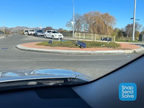
Latest on record
- Graffiti somewhere else at 4 Bassett Street, 6 Jul 2024
- Overgrown Vegetation at 4 Bassett Street, 13 Feb 2024
- Roading/Streets at 4 Bassett Street, 16 Jul 2022
Questions, answered briefly
In Avondale, Christchurch, New Zealand.
3 reports at 1 address, most often roads & footpaths (1), trees & parks (1), graffiti & vandalism (1).
2022, the record covers 3 separate days somebody filed something about it, through 2024.
Everything about Avondale → · Every street the archive knows → · the whole A–Z → · This street as a feed →