Grays Road
3 council reports at 3 addresses on Grays Road, Christchurch Airport, on record since November 2018.
Where it runs
Each report dot is the average of the spots reports were filed from, where reporters stood on Grays Road, not the street’s surveyed line. The strong outline is Christchurch Airport.
From the air, then
Sourced from Canterbury Maps and partners. LINZ, CC BY 3.0 NZ. Each frame is cut from Environment Canterbury’s historic imagery MapServer for that decade, only where the Footprints layer names a CC BY survey (NZAM-covered spots stay out). RetroLens holds more Crown aerials →
The numbered spots
- 151 Grays Road, 1 report
- 148-120 Grays Road, 1 report
- 148 Grays Road, 1 report
What got reported
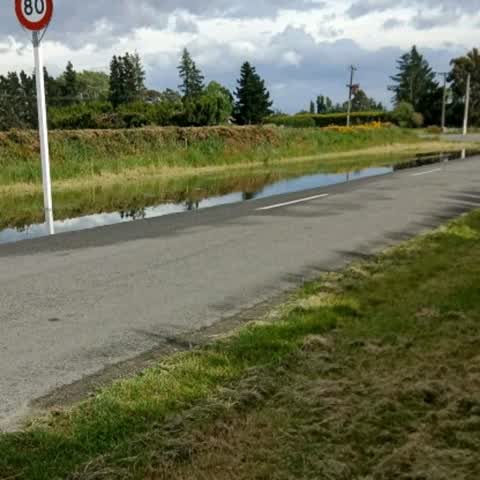
- Water & drains, 1 report
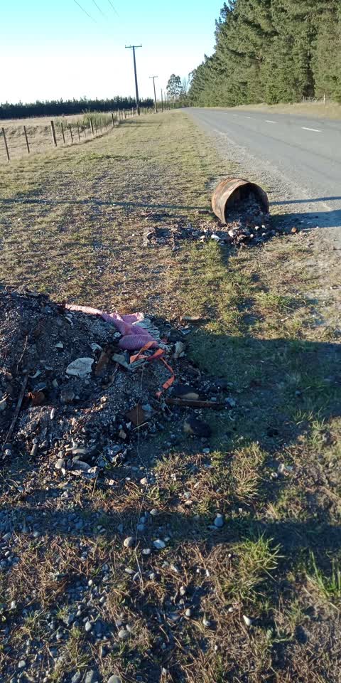
- Rubbish & dumping, 1 report
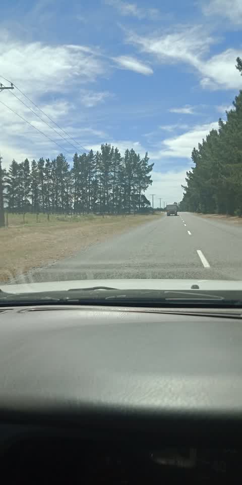
- Roads & footpaths, 1 report
Year by year
- 2018, 1 report
- 2021, 2 reports
Documents that name it
Records on the shelf that name Grays Road.
- KILLED IN ACTION. (Evening Post, 29 July 1942) · Papers Past ·
…d j pte mrs s k swanson 5 miriam street masterton m tayler collln l pte mr g l tayler 107 grays road hastings f taylor robert pte mrs a s taylor tangitere nuhaka to thomas roy p cpl mrs b thomas makak…
- Notice of Intention to Remove Companies From the Register · New Zealand Gazette ·
…T HOTELS LIMITED.HARWOOD CONTRACTING 2006 LIMITED.HAUMIHI HOLDINGS LIMITED.HAVEN VEHICLES GRAYS ROAD LIMITED.HAVERCOURT 21 LIMITED.HAWKE'S BAY DEVELOPMENTS 2006 LIMITED.HAY BENEFICIARY LIMITED.HD FOGA…
- New Zealand Transport Agency (Speed Limits on State Highways) Bylaw 2010/10 · New Zealand Gazette ·
…0, No 112, page 2967805 11 1 Amberley From 310m south of Bank Street to 60m south-east of Grays Road. 80 1/09/2010, No 112, page 2967806 11 1 Waikuku From 65m north-west of Waikuku Beach Road to 60m s…
- Notice of Intention to Remove Companies From the Register · New Zealand Gazette ·
…RCHARDS LIMITED.GRAVIDA LIMITED.GRAVITY CONTRACTORS LIMITED.GRAY BROS CONTRACTORS LIMITED.GRAYS ROAD FARM LIMITED.GRB CARPENTRY LIMITED.GREAT CAKE LIMITED.GREAT EASTBURN WALKING TRACK LIMITED.GREAT ME…
- Notice of Intention to Remove Companies From the Register · New Zealand Gazette ·
…RATA PROPERTIES LIMITED GRATEFULSOUL LIMITED GRATON HOLDINGS LIMITED GRAVE CLEANS LIMITED GRAYS ROAD STORE LIMITED GRAZE 4 FUN LIMITED GREAT MOTORS GROUP LIMITED GREAT WALL SECURITY LIMITED GREEK HOUS…
The rest are a search away, the whole shelf, for the name →
As it was reported
Latest on record
- Rubbish/Recycling at 151 Grays Road, 1 Sept 2021
- Roading/Streets at 148-120 Grays Road, 23 Feb 2021
- Flooding at 148 Grays Rd, 8 Nov 2018
Questions, answered briefly
In Christchurch Airport, Christchurch, New Zealand.
3 reports at 3 addresses, most often water & drains (1), rubbish & dumping (1), roads & footpaths (1).
2018, the record covers 3 separate days somebody filed something about it, through 2021.
Everything about Christchurch Airport → · Every street the archive knows → · the whole A–Z → · This street as a feed →