Foster Street
2 council reports at 1 address on Foster Street, Riccarton, on record since November 2024.
Where it runs
Each report dot is the average of the spots reports were filed from, where reporters stood on Foster Street, not the street’s surveyed line. The strong outline is Riccarton.
From the air, then
Sourced from Canterbury Maps and partners. LINZ, CC BY 3.0 NZ. Each frame is cut from Environment Canterbury’s historic imagery MapServer for that decade, only where the Footprints layer names a CC BY survey (NZAM-covered spots stay out). RetroLens holds more Crown aerials →
The numbered spots
- 32 Foster Street, 2 reports
What got reported
- Vehicles & parking, 1 report
- Trees & parks, 1 report
Year by year
- 2024, 1 report
- 2025, 1 report
Documents that name it
Records on the shelf that name Foster Street, 9 in total; the 3 earliest:
- CHRISTCHURCH. (Star, 24 November 1868) · Papers Past ·
…yor was desired to take legal advice upon the question and act accordingly letter from dr foster stating that having read in the local journals that the council had requested the provincial solicitor…
- CHRISTCHURCH. (Star, 11 February 1875) · Papers Past ·
…hioh stntuto ho who going under thero could not be two poiinltl s for tho sumo offence dr foster stated that ho would proceed under tho malicious injury to property act thomas brown bain called by mr…
- West Coast Times. THURSDAY, JUNE 3, 1875. (West Coast Times, 03 June 1875) · Papers Past ·
…the press of june ist says at last night meeting of the council a letter was read from dr foster stating that a leading member of the committee desired that the informations taken out should be withdr…
The rest are a search away, the whole shelf, for the name →
As it was reported

Latest on record
- Damaged Street Sign at 32 Foster St, 7 Oct 2025
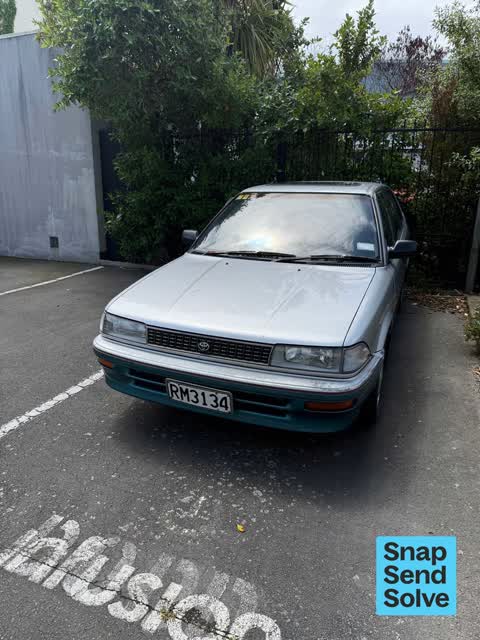
- Abandoned Vehicle at 32 Foster Street, 23 Nov 2024
Questions, answered briefly
In Riccarton, Christchurch, New Zealand.
2 reports at 1 address, most often vehicles & parking (1), trees & parks (1).
2024, the record covers 2 separate days somebody filed something about it, through 2025.
Everything about Riccarton → · Every street the archive knows → · the whole A–Z → · This street as a feed →