Mason Place
3 council reports at 3 addresses on Mason Place, Sockburn, on record since January 2024.
Where it runs
Each report dot is the average of the spots reports were filed from, where reporters stood on Mason Place, not the street’s surveyed line. The strong outline is Sockburn.
From the air, then
Sourced from Canterbury Maps and partners. LINZ, CC BY 3.0 NZ. Each frame is cut from Environment Canterbury’s historic imagery MapServer for that decade, only where the Footprints layer names a CC BY survey (NZAM-covered spots stay out). RetroLens holds more Crown aerials →
The numbered spots
- 8 Mason Place, 1 report
- 4 Mason Place, 1 report
- 1E Mason Place, 1 report
What got reported
- Water & drains, 3 reports
Year by year
- 2024, 2 reports
- 2025, 1 report
Documents that name it
Records on the shelf that name Mason Place, 4 in total; the 2 earliest:
- News of the Week. (Otago Witness, 05 December 1874) · Papers Past ·
…ery soon make the eastern point back wards the road has been metalled from the port to mr mason place ie deborah bay and as it stands is a very creditable piece of work and is open to and safe for tra…
- LOCAL AND GENERAL (Timaru Herald, 18 December 1874) · Papers Past ·
…loury d henry win smith j kadford parry lion member forol storey donald n sims h brewer g mason plnnto lion member dale meudelson hon member j blyth clinch gentlemuu salok and dr haynor hon member tnt…
The rest are a search away, the whole shelf, for the name →
As it was reported


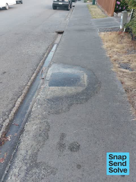
Latest on record
- Water Leak at 8 Mason Place, 28 Nov 2025
- Flooding at 1E Mason Place, 17 Sept 2024
- Water Leak at 4 Mason Place, 2 Jan 2024
Questions, answered briefly
In Sockburn, Christchurch, New Zealand.
3 reports at 3 addresses, most often water & drains (3).
2024, the record covers 3 separate days somebody filed something about it, through 2025.
Everything about Sockburn → · Every street the archive knows → · the whole A–Z → · This street as a feed →