Caton Street
3 council reports at 3 addresses on Caton Street, Sydenham, on record since June 2015.
Where it runs
Each report dot is the average of the spots reports were filed from, where reporters stood on Caton Street, not the street’s surveyed line. The strong outline is Sydenham.
From the air, then
Sourced from Canterbury Maps and partners. LINZ, CC BY 3.0 NZ. Each frame is cut from Environment Canterbury’s historic imagery MapServer for that decade, only where the Footprints layer names a CC BY survey (NZAM-covered spots stay out). RetroLens holds more Crown aerials →
The numbered spots
- 6 Caton Street, 1 report
- 4 Caton Street, 1 report
- 3 Caton Street, 1 report
What got reported
- Water & drains, 2 reports
- Rubbish & dumping, 1 report
Year by year
- 2015, 1 report
- 2016, 1 report
- 2024, 1 report
Documents that name it
Records on the shelf that name Caton Street.
- Sydenham Borough Council (Star, 26 April 1893) · Papers Past ·
…rom a number of ratepayers drawing attention to the bad state of the road and footpath in caton street and asking the counoil to asphalt the footpath before the wet season bet in eeferred to the woiks…
- Page 2 Advertisements Column 4 (Star, 16 March 1897) · Papers Past ·
…and haepee streets about half-acre fenced in one lot price 210 or will be i subdivided 1 caton street off montrea 1 street quarter acre well fenced till round 50 mont real steeet sectionhaving fronta…
- Page 4 Advertisements Column 4 (Star, 18 March 1897) · Papers Past ·
…rham and harper streets-about half-acre fenced in one lot price 210 or will be subdivided caton street off montreal street quarter aero well fenced all round 50 montreal street sectionhaving frontage…
- Page 1 Advertisements Column 4 (Star, 12 August 1897) · Papers Past ·
…nd 13 perches 90 avonside retreat eoad quarter-acre fenced on 3 sides nrte-iauwell itc 55 caton steeet sydenham quarfer-acre fenced all round 3 large walnut trees thereon 50 sub-nee berry street htvlf…
- Page 7 Advertisements Column 4 (Star, 14 August 1897) · Papers Past ·
…and 13 perches 90 a vonsidh ketreat road quarter-acrefehcea on 3 slde3 artesian well c 55 caton strket sydenham quarter-acre fenced all round 3 largo walnut trees thereon 50 sumner berry street half-a…
- Page 3 Advertisements Column 4 (Star, 22 October 1902) · Papers Past ·
…997 w toniks iw h norton tonks norton and co property auctioneers land agents and valuers caton street sydenham only a few minutes walk from railway station a very nice house of 6 rooms verandah scull…
- Page 3 Advertisements Column 2 (Star, 03 November 1902) · Papers Past ·
…s plastered and all conveneaoe3 only 30 oash required the balance can be paid as rent 167 caton strece-t sydenham only a few minutes walk from railway station a very nice house of 6 rooms verandah scu…
- Page 3 Advertisements Column 4 (Star, 05 November 1902) · Papers Past ·
…lastered and ail conveniences only 30 cash required tihe bajjance can be paid as rent 167 caton street sydenhiam only a few minutes walk from rlalway station a very nice house of 6 rooms verandah scul…
- DEATH. (Star, 31 December 1908) · Papers Past ·
…on december 30 1908 at christchurch james the beloved husband of ellen ann poterson of 63 caton street off montreal street sydenham aged fortytwo yeare until the voice of the lord is heard r…
The rest are a search away, the whole shelf, for the name →
As it was reported

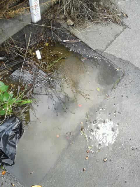
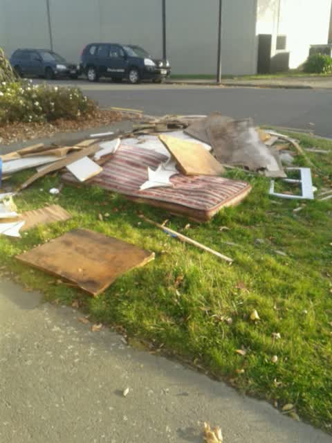
Latest on record
- Sediment - Construction at 3 Caton Street, 4 Dec 2024
- Water Supply at 6 Caton St, 29 Jan 2016
- Rubbish/Recycling at 4 Caton St, 9 Jun 2015
Questions, answered briefly
In Sydenham, Christchurch, New Zealand.
3 reports at 3 addresses, most often water & drains (2), rubbish & dumping (1).
2015, the record covers 3 separate days somebody filed something about it, through 2024.
Everything about Sydenham → · Every street the archive knows → · the whole A–Z → · This street as a feed →