47 Truro Street
9 council reports since June 2019, 8 carrying a photograph. The most-reported address on Truro Street.
From the air, then
Sourced from Canterbury Maps and partners. RNZAF, CC BY 3.0 NZ. Each frame is cut from Environment Canterbury’s historic imagery MapServer for that decade, only where the Footprints layer names a CC BY survey (NZAM-covered spots stay out). RetroLens holds more Crown aerials →
The green nearby
- St Leonards Park, 196 m to the edge · Sports ground · 2 ha · playground, 61 pieces
- Wakefield Reserve No. 1, 439 m to the edge
- Wakefield Reserve No. 2, 453 m to the edge · 1 ha
Parks within half a kilometre, measured to the boundary, the council’s open data. The whole roll is at /parks.
On the doorstep
- Sumner Sports Pavilion, 277 m away · Clubs
Businesses within four hundred metres, measured at the pin, OpenStreetMap and the council directories.
The bus nearby
The closest Metro stops, within four hundred and fifty metres.
The named ground
Named places within 1.5 km of this address, the open map’s record.
Renting nearby
new bonds in Sumner ran about $620 a week, $70 above the city median of $550, the suburb page keeps the rent record →.
What gets reported here
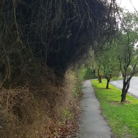
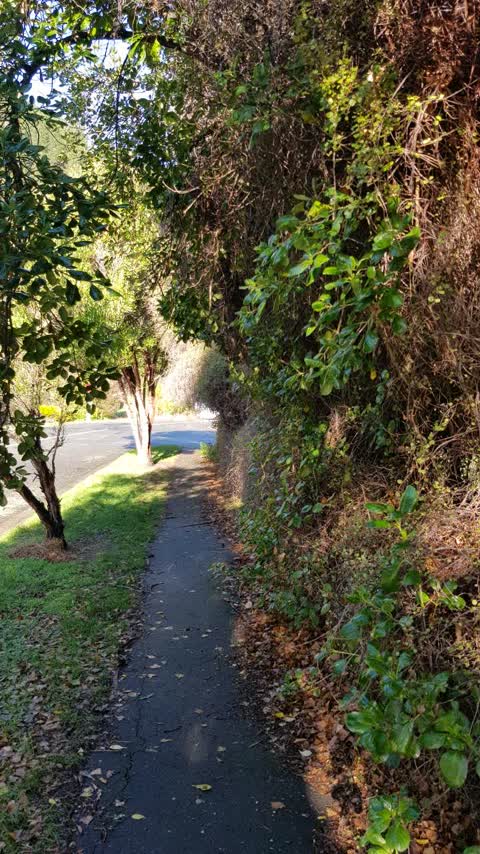
Photographed here 8 on record


What’s on record
 Abandoned Vehicle, 1 Sept 2026
 abadoned
 Roads - General, 14 Nov 2025
 left behind following road work
 Overgrown Vegetation, 2 Nov 2025
 Please can you inform the lease holder to keep this site tidy and lawns mowed. With summer approaching,this is becoming a fire hazard, espec
 Fallen Tree, 22 Oct 2025
 Uprooted tree has fallen across footoath
 Street Gutters / Storm Water, 31 Aug 2025
 Roadworks are just nearing completion in Truro St Sumner and there is a lot of debris in all the gutters. Hence we have flooding.
 Fallen Tree, 5 Dec 2023
 Heberden Ave, Antz can you please trim this damaged/ low hanging bang as it is at car height. Thanks Super Man
- Overgrown Vegetation, 2 Jul 2023
Roading/Streets, 24 Jul 2019
vegetation overflowing from red zone property. Based off recent Tsunami Workshop in Sumner this is part of an evacuation route. needs some t
Roading/Streets, 3 Jun 2019
red zone section overgrown and encroaching on path.
Elsewhere on Truro Street
- 45 Truro Street, 5 reports
- 33 Truro Street, 4 reports
- 21 Truro Street, 4 reports
- 2 Truro Street, 4 reports
- 17 Truro Street, 2 reports
- 16A Truro Street, 2 reports
- 10 Truro Street, 2 reports
- 41 Truro Street, 1 report
The civic layer
This ground votes in Heathcote ward, the Spreydon-Cashmere-Heathcote community board is its local layer. Ward lines don’t always follow suburb lines; this one is measured at the pin, not the suburb’s centre. The whole roll is at /wards.
Truro Street, the whole record → · Everything about Sumner → · What stood on this ground → · On the map → · From the air, RetroLens holds the Crown’s aerials back to 1936; search the address there →
Questions, answered briefly
9 council reports on record since June 2019, most often roading/streets (2), overgrown vegetation (2), fallen tree (2).
Sumner, Christchurch, on Truro Street.
Nothing on the heritage register at this exact spot, the record around this ground →
St Leonards Park, 196 m to its edge, 2 ha.