5 Whiterock Lane
1 council report since November 2026, 1 carrying a photograph. The most-reported address on Whiterock Lane.
The green nearby
- Greenwood Park, you are in it · Regional · 279 ha
- Sanscrit Reserve, 243 m to the edge · playground, 8 pieces
- Starwood Reserve, 268 m to the edge · playground, 2 pieces
- Brownlee Reserve, 396 m to the edge · 3 ha · playground, 24 pieces
Parks within half a kilometre, measured to the boundary, the council’s open data. The whole roll is at /parks.
The named ground
Named places within 1.5 km of this address; the council’s own structure register, bridges, boardwalks and steps standing nearby, the open map’s record.
Renting nearby
new bonds in Sumner ran about $620 a week, $70 above the city median of $550, the suburb page keeps the rent record →.
What gets reported here
Photographed here 1 on record
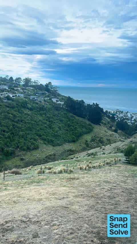
What’s on record
 Animal - General, 2 Nov 2026
Sheep getting through fence on Richmond Hill , whiterock lane area. Talk to the farmer and told me to contact ccc as the fence is the counci
Elsewhere on Whiterock Lane
- 4 Whiterock Lane, 1 report
- 3 Whiterock Lane, 1 report
The civic layer
This ground votes in Heathcote ward, the Spreydon-Cashmere-Heathcote community board is its local layer. Ward lines don’t always follow suburb lines; this one is measured at the pin, not the suburb’s centre. The whole roll is at /wards.
Whiterock Lane, the whole record → · Everything about Sumner → · What stood on this ground → · On the map → · Street View → · From the air, RetroLens holds the Crown’s aerials back to 1936; search the address there →
Questions, answered briefly
1 council report on record since November 2026, most often animal - general (1).
Sumner, Christchurch, on Whiterock Lane.
Nothing on the heritage register at this exact spot, the record around this ground →
Greenwood Park, the address is inside it, 279 ha.