14 Cass Street, Sydenham
29 reports on record since October 2017 · 24 with photographs. The most-reported address on Cass Street. Indicative rating valuation and school zones, hazards, bin day and what stood here before.
What gets reported here
Photographed here 24 on record




Reported here
 Graffiti on a road, footpath or bridge —
 under the bridge
 Hazard — vehicle —
 2 cars parked in a no parking area.
 Road Signage —
 Rohan Haulage has knocked this P30 sign and completely smashed it up, needs replacing
 Pavement - Damaged —
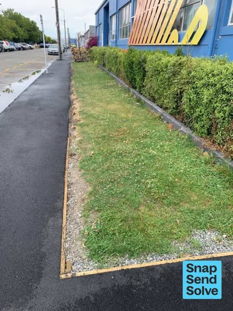
 The footpath was resealed at a different level to the grass. It has now become a trip hazard. Grass has been replaced by stones in some are
 Graffiti on a fence, building or structure —
 See pic
 Dumped Rubbish —
 Mattresses under the Cass street over bridge
 Dumped Rubbish —
 Outside enviro waste. It's been notified to you for several weeks.
 Graffiti on a road, footpath or bridge —
 Graffiti on the side of the bridge and under the bridge.
 Dumped Rubbish —
 Wood dumped on footpath under the overhead bridge.
 Graffiti on a fence, building or structure —
 White paint tag on top rail of Durham Street South overbridge on the east side.
 Graffiti somewhere else —
 Graffiti under Durham st Bridge
 Graffiti somewhere else —
  Hazard — vehicle —
 Parking on the footpath and blocking it.
 Graffiti on a fence, building or structure —
 Multiple graffiti on bridge structure where there’s private space and parking This seems to be ongoing and never addressed
 Graffiti on a road, footpath or bridge —
 Graffiti vandalism on the bridge.
 Graffiti on a sign, mural or public art —
 Graffitti on 2 Billboards located on roof of 14 Cass St, Sydenham
 Graffiti —
  Graffiti —
 Multiple paint tags on Durham Street underpass on Cass Street.
 Graffiti —
 Multiple tagging under Durham st overbridge
- Graffiti —
- Dumped Rubbish —
- General - Abandoned Trolley —
- Graffiti —
- Graffiti —
 Dumped Rubbish —
 Dumped rubbish under overbridge, left beside skips, as owner of skips it’s not ours
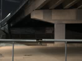 Graffiti —
 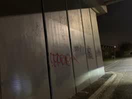 Graffiti —
 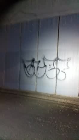 Graffiti —
 Graffiti —
Also reported on Cass Street
- 10 Cass Street — 21 reports
- 40 Cass Street — 19 reports
- 13 Cass Street — 11 reports
- 16–38 Cass Street — 10 reports
- 6 Cass Street — 7 reports
- 5 Cass Street — 5 reports
- 16 Cass Street — 5 reports
- 1-5 Cass Street — 3 reports
The street’s crash record
NZTA’s record names Cass Street in 2 crashes that hurt somebody since 2006 — 1 seriously hurt, nobody killed.
The green nearby
- Carlyle Reserve — 254 m to the edge
- Buchan Playground — 444 m to the edge
- Braddon Reserve — 492 m to the edge
Parks within half a kilometre, measured to the boundary — the council’s open data.
On the doorstep
- Golden Fleece Factory Shop — 35 m away · Clothing
- Pita Pit — 58 m away · Company
- Sydenham Underpass — 60 m away · Venues & events
- Benny's Barber Shop — 62 m away · Hairdressers
Businesses within four hundred metres, measured at the pin — OpenStreetMap and the council directories.
The bus nearby
- Moorhouse Ave near Orbell St — 226 m away · route 140
- Colombo St near Cass St — 229 m away · route 1, route 8, route 44
The closest Metro stops, within four hundred and fifty metres.
The tracks through here
- Walk and bike track through Sydenham — 225 m to the line · walk · bike
- Walk and bike track through Sydenham — 225 m to the line · walk · bike
- Walk and bike track through Sydenham — 235 m to the line · walk · bike
- Walk and bike track through Sydenham — 325 m to the line · walk · bike
- Walk and bike track through Sydenham — 470 m to the line · walk · bike
Tracks whose line passes within half a kilometre, measured to the line itself — the council’s open data.
The named ground
Named places within 1.5 km of this address — the open map’s record.
Renting nearby
new bonds in Sydenham ran about $518 a week — $32 below the city median of $550 — the suburb page keeps the rent record →.
The civic layer
This ground votes in Heathcote ward — the Spreydon-Cashmere-Heathcote community board. Ward lines don’t always follow suburb lines; this one is measured at the pin, not the suburb’s centre.
What stood on this ground → · On the map → · From the air — the Crown’s aerials back to 1936; search the address on RetroLens →
Questions, answered briefly
29 council reports on record since October 2017 — most often graffiti (10), dumped rubbish (5), graffiti on a road, footpath or bridge (3).
Sydenham, Christchurch — on Cass Street.
Nothing on the heritage register at this exact spot — the record around this ground →
Carlyle Reserve — 254 m to its edge.