208 Strickland Street, Sydenham
26 reports on record since November 2018 · 11 with photographs. The street’s heaviest record is 114 Strickland Street — 27 reports on file. Indicative rating valuation and school zones, hazards, bin day and what stood here before.
What gets reported here
Photographed here 11 on record


Reported here
 Water Leak —
 water leak
 Water Leak —
 Water leak?
 Water Leak —
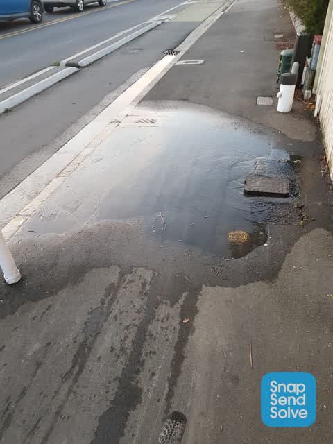
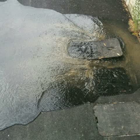
 Water leak from valve box in footpath with considerable flow
 Damaged Road —
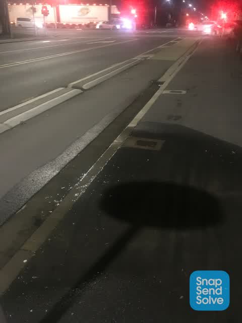
 Significant damage in Strickland Street cycle lane. Long and wide rut making it very dangerous for people on bikes.
 Graffiti on a fence, building or structure —
  Damaged Road —
 This section of the Strickland Street cycleway has a large rut through it, making it uncomfortable at best and dangerous for those riding.
 Water Leak —
 Water leak on footpath. Appears to have been a previous repair at this site as there is a patch in the footpath.
- Water Leak —
- Water Leak —
- Water Leak —
- Water Leak —
- Water Leak —
- Water Leak —
- Flooding —
- Water Leak —
- Water Leak —
- Water Leak —
- Water Leak —
- Water Leak —
- Dumped Rubbish —
- Dumped Rubbish —
- Sewer - Leak / Blockage —
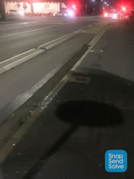 Water Leak —
 From Toby box 2 l/sec flow
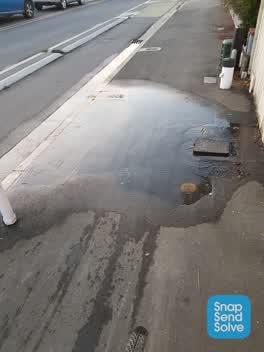 Water Leak —
 Water leaking out of water meter area and flowing over footpath onto road. I couldnt see how to turn it off sorry
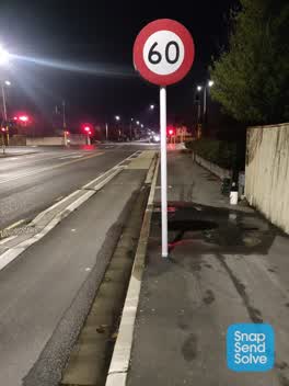 Water Leak —
 Water streaming out since yesterday
Water Supply —
Also reported on Strickland Street
- 114 Strickland Street — 27 reports
- 103 Strickland Street — 18 reports
- 120 Strickland Street — 16 reports
- 103A Strickland Street — 14 reports
- 110 Strickland Street — 11 reports
- 22 Strickland Street — 10 reports
- 183 Strickland Street — 10 reports
- 210 Strickland Street — 9 reports
The street’s crash record
NZTA’s record names Strickland Street in 42 crashes that hurt somebody since 2006 — 9 seriously hurt, nobody killed.
The green nearby
- Antigua Reserve — 74 m to the edge
- Ruskin Reserve — 347 m to the edge
- Sydenham Park — 397 m to the edge · Sports ground · 5 ha
- Baxters Drain — 401 m to the edge
- Bradford Park — 492 m to the edge · Sports ground · 3 ha
Parks within half a kilometre, measured to the boundary — the council’s open data.
On the doorstep
- Underground Coffee South — 297 m away · Cafés
- Mitre 10 Mega — 340 m away · Hardware
- Flyrite Dart Club — 385 m away · Clubs
- Christchurch Electrical — 391 m away · Electricians
Businesses within four hundred metres, measured at the pin — OpenStreetMap and the council directories.
The bus nearby
- Brougham St near James K Baxter Pl — 104 m away · route 120
- Brougham St near Barrie St — 173 m away · route 120
The closest Metro stops, within four hundred and fifty metres.
The tracks through here
- Walk and bike track through Sydenham — 6 m to the line · walk · bike
- Walk and bike track through Sydenham — 111 m to the line · walk · bike
- Walk and bike track through Sydenham — 479 m to the line · walk · bike
- Walk and bike track through Sydenham — 488 m to the line · walk · bike
Tracks whose line passes within half a kilometre, measured to the line itself — the council’s open data.
The named ground
Named water within 500 m of this address, measured to the line or the edge — the open map’s record.
Renting nearby
new bonds in Sydenham ran about $518 a week — $32 below the city median of $550 — the suburb page keeps the rent record →.
The civic layer
This ground votes in Heathcote ward — the Spreydon-Cashmere-Heathcote community board. Ward lines don’t always follow suburb lines; this one is measured at the pin, not the suburb’s centre.
What stood on this ground → · On the map → · From the air — the Crown’s aerials back to 1936; search the address on RetroLens →
Questions, answered briefly
26 council reports on record since November 2018 — most often water leak (18), dumped rubbish (2), damaged road (2).
Sydenham, Christchurch — on Strickland Street.
Nothing on the heritage register at this exact spot — the record around this ground →
Antigua Reserve — 74 m to its edge.