290 Colombo Street, Sydenham
20 reports on record since July 2022 · 14 with photographs. The street’s heaviest record is 468 Colombo Street — 71 reports on file. Indicative rating valuation and school zones, hazards, bin day and what stood here before.
What gets reported here
- Graffiti somewhere else — 5
- Graffiti — 4
- Pavement - Damaged — 2
- Hazard — vehicle — 2
- General Request — 2
- Vandalism - General — 1
Photographed here 14 on record




Reported here
 Pavement - General —
 Footpath advertising is very confusing for low vision pedestrians. Are there guidelines to prevent this?
 Traffic Signals —
 Huge line of cars backed up along Colombo Street to Milton Road (at least) due to the extremely short light phase on Sundays for streets cro
 Graffiti somewhere else —
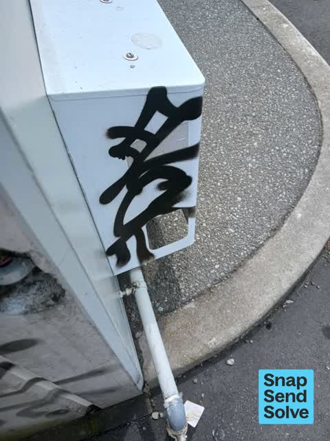
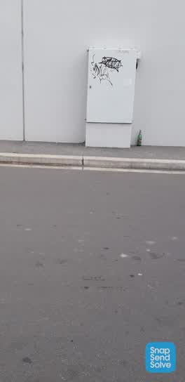
 On white box beside the other boxes
 Graffiti somewhere else —
 Behind pita pit building
 Graffiti somewhere else —
  Graffiti somewhere else —
 Whiteboard behind Colombo st shops by Mobil garage
 Graffiti somewhere else —
 Multiple tags on the of the building of Pita Pit - 290 Colombo St
 Dumped Rubbish —
  Graffiti —
  General Request —
 Broken windows to replace on local business premises
 Vandalism - General —
 Broken window/s at a local business to replace
 Accessibility —
 Broken glass at burger fuel shop
- Graffiti —
- Pavement - Damaged —
- Pavement - Damaged —
- General Request —
- Graffiti —
- Hazard — vehicle —
 Hazard — vehicle —
 Pothole in car park area outside shopping centre
 Graffiti —
Also reported on Colombo Street
- 468 Colombo Street — 71 reports
- 300 Colombo Street — 66 reports
- 303 Colombo Street — 64 reports
- 504 Colombo Street — 56 reports
- 340 Colombo Street — 52 reports
- 406 Colombo Street — 37 reports
- 500 Colombo Street — 36 reports
- 420 Colombo Street — 36 reports
The street’s crash record
NZTA’s record names Colombo Street in 200 crashes that hurt somebody since 2006 — 2 people killed, 35 seriously hurt.
The green nearby
- Sydenham Park — 85 m to the edge · Sports ground · 5 ha
- Cadogan Reserve — 230 m to the edge
- Jacksons Creek — 253 m to the edge
- Bradford Park — 344 m to the edge · Sports ground · 3 ha
- Cameron Reserve — 472 m to the edge
Parks within half a kilometre, measured to the boundary — the council’s open data.
On the doorstep
- Burger Fuel Sydenham — 4 m away · Fast food
- Kosco Sydenham — 6 m away · Delis
- Pita Pit — 12 m away · Fast food
- St Pierres Sushi Sydenham — 12 m away · Fast food
Businesses within four hundred metres, measured at the pin — OpenStreetMap and the council directories.
The bus nearby
- Colombo St near Walton St — 67 m away · route 1, route 44
- Colombo St near Hastings St W — 115 m away · route 1, route 44
The closest Metro stops, within four hundred and fifty metres.
The tracks through here
- Walk and bike track through Sydenham — 37 m to the line · walk · bike
- Walk and bike track through Sydenham — 63 m to the line · walk · bike
- Walk and bike track through Sydenham — 188 m to the line · walk · bike
Tracks whose line passes within half a kilometre, measured to the line itself — the council’s open data.
The named ground
Named water within 500 m of this address, measured to the line or the edge; the council’s own structure register — bridges, boardwalks and steps standing nearby — the open map’s record.
The remembered names nearby
- Sydenham Park plaque — 138 m away
- This Fountain Was Moved and Resited by the City Council — 248 m away ·
THIS FOUNTAIN WAS MOVED AND RESITED BY THE CITY COUNCIL ON THE HUNDREDTH ANNIVERSARY OF TH
· 2009
Inscribed plaques within two hundred and fifty metres — the register’s pins, not surveyed spots. The whole roll is at /plaques.
Renting nearby
new bonds in Sydenham ran about $518 a week — $32 below the city median of $550 — the suburb page keeps the rent record →.
What was here — Former MED Substation and Setting
156 m away · 259 Milton Street · located to ±15 m · the place’s own record →
On the register. Nothing researched here yet.
What was here — Dwelling and Setting
200 m away · 12 Drummond Street · located to ±7 m · the place’s own record →
On the register. Nothing researched here yet.
What was here — King Edward VII Coronation Memorial Lamp and Drinking Fountain and Setting
250 m away · located to ±1 m · the place’s own record →
On the register. Nothing researched here yet.
The civic layer
This ground votes in Heathcote ward — the Spreydon-Cashmere-Heathcote community board. Ward lines don’t always follow suburb lines; this one is measured at the pin, not the suburb’s centre.
What stood on this ground → · On the map → · From the air — the Crown’s aerials back to 1936; search the address on RetroLens →
Questions, answered briefly
20 council reports on record since July 2022 — most often graffiti somewhere else (5), graffiti (4), pavement - damaged (2).
Sydenham, Christchurch — on Colombo Street.
The heritage register names 3 places at or beside it — Former MED Substation and Setting, Dwelling and Setting.
Sydenham Park — 85 m to its edge, 5 ha.