5 Gasson Street, Sydenham
15 reports on record since August 2021 · 14 with photographs. The street’s heaviest record is 103 Gasson Street — 41 reports on file. Indicative rating valuation and school zones, hazards, bin day and what stood here before.
What gets reported here
Photographed here 14 on record



Reported here
 Graffiti on a fence, building or structure —
 graffiti on main sign
 Graffiti on a fence, building or structure —
 graffiti on container
 Graffiti on a fence, building or structure —
 Graffiti on cream color building nearby
 Graffiti somewhere else —
  Graffiti on a fence, building or structure —
 Unsure what the box is for sorry Corner of Brougham St and Gasson St
 Graffiti somewhere else —
 Amare safety
 Pavement - Damaged —
 Missing berm to replace
 Pavement - Damaged —
 Damaged potholed cracked driveway entrance to business
 Water General —
 Water meter lid missing & site is full of vegetation
 Graffiti —
 Centre island near lights
 Street Cleaning —
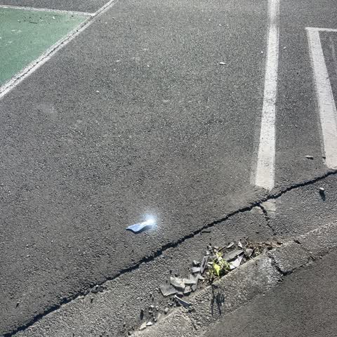
 Glass and debris through road and cycle way. Worse in person, hard to photograph in traffic.
 Poles and Signage - General —
 Travelling along Brougham Street heading south today and wanted to turn off to Spreydon. The signage to turn at Burlington Street would be
 Overgrown Vegetation —
 Overgrown bushes obstructing clear footpath. Particularly those on crutches, wheelchairs and walkers having to go on to the berm and closer
- Roads - General —
 Roading/Streets —
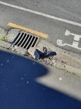
 The concrete curb is broken, often ends up on the cycle path.
Also reported on Gasson Street
- 103 Gasson Street — 41 reports
- 2 Gasson Street — 26 reports
- 113 Gasson Street — 26 reports
- 125 Gasson Street — 22 reports
- 105 Gasson Street — 16 reports
- 84 Gasson Street — 13 reports
- 77 Gasson Street — 13 reports
- 35 Gasson Street — 13 reports
The street’s crash record
NZTA’s record names Gasson Street in 105 crashes that hurt somebody since 2006 — 4 people killed, 25 seriously hurt.
The green nearby
- Hastings Reserve — 95 m to the edge
- Cadogan Reserve — 298 m to the edge
- Cameron Reserve — 326 m to the edge
- Jacksons Creek — 330 m to the edge
- Tommy Taylor Reserve — 379 m to the edge
Parks within half a kilometre, measured to the boundary — the council’s open data.
On the doorstep
- The Science Shop — 117 m away · Toy shops
- FAB Lab CHCH — 122 m away · Makerspaces
- X-Ten Collective — 195 m away · Cafés
- Prima Roastery — 197 m away · Coffee roasters
Businesses within four hundred metres, measured at the pin — OpenStreetMap and the council directories.
The bus nearby
- Brougham St near Albemarle St — 102 m away · route 8
- Brougham St near Albemarle St — 113 m away · route 8
The closest Metro stops, within four hundred and fifty metres.
The tracks through here
- Walk and bike track through Sydenham — 86 m to the line · walk · bike
- Walk and bike track through Sydenham — 351 m to the line · walk · bike
- Walk and bike track through Sydenham — 359 m to the line · walk · bike
- Walk and bike track through Sydenham — 469 m to the line · walk · bike
Tracks whose line passes within half a kilometre, measured to the line itself — the council’s open data.
The named ground
Named water within 500 m of this address, measured to the line or the edge — the open map’s record.
Renting nearby
new bonds in Sydenham ran about $518 a week — $32 below the city median of $550 — the suburb page keeps the rent record →.
The civic layer
This ground votes in Heathcote ward — the Spreydon-Cashmere-Heathcote community board. Ward lines don’t always follow suburb lines; this one is measured at the pin, not the suburb’s centre.
What stood on this ground → · On the map → · From the air — the Crown’s aerials back to 1936; search the address on RetroLens →
Questions, answered briefly
15 council reports on record since August 2021 — most often graffiti on a fence, building or structure (4), pavement - damaged (2), graffiti somewhere else (2).
Sydenham, Christchurch — on Gasson Street.
Nothing on the heritage register at this exact spot — the record around this ground →
Hastings Reserve — 95 m to its edge.