58 Wordsworth Street, Sydenham
15 reports on record since March 2021 · 9 with photographs. The street’s heaviest record is 93 Wordsworth Street — 48 reports on file. Indicative rating valuation and school zones, hazards, bin day and what stood here before.
What gets reported here
Photographed here 9 on record


Reported here
 Graffiti on a fence, building or structure —
  Graffiti somewhere else —
  Graffiti on a cabinet, pole or railway asset —
  Graffiti somewhere else —
 Back of public toilets
 Graffiti somewhere else —
  Graffiti somewhere else —
  Graffiti somewhere else —
 - Rubbish and Bins - General —
- Graffiti —
- Graffiti —
- Graffiti —
- Graffiti —
 Graffiti —
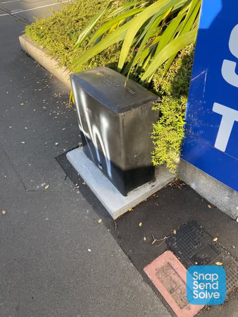
 White paint tag on black Backflow Prevention Assembly utility cabinet by 58 Wordsworth Street near Colombo Street.
 Graffiti —
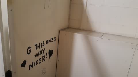
 Wordsworth St Womans toilet inside cubicle.
- Graffiti —
Wordsworth St Mens toilet usual tagging
Also reported on Wordsworth Street
- 93 Wordsworth Street — 48 reports
- 161 Wordsworth Street — 47 reports
- 60 Wordsworth Street — 34 reports
- 74 Wordsworth Street — 27 reports
- 100 Wordsworth Street — 23 reports
- 97 Wordsworth Street — 21 reports
- 55 Wordsworth Street — 21 reports
- 95 Wordsworth Street — 19 reports
The street’s crash record
NZTA’s record names Wordsworth Street in 70 crashes that hurt somebody since 2006 — 5 seriously hurt, nobody killed.
The green nearby
- Buchan Playground — 109 m to the edge
- Sydenham Park — 309 m to the edge · Sports ground · 5 ha
- Carlyle Reserve — 390 m to the edge
Parks within half a kilometre, measured to the boundary — the council’s open data.
On the doorstep
- Maihan Supermarket & Halal Meat Ltd — 35 m away · Butchers
- Novelty Sweets — 38 m away · Restaurants
- Southside Social — 39 m away · Cafés
- Catnap Cafe — 42 m away · Cafés
Businesses within four hundred metres, measured at the pin — OpenStreetMap and the council directories.
The bus nearby
- Colombo St near Wordsworth St — 65 m away · route 1, route 8, route 44
- Colombo St near Lawson St — 70 m away · route 1, route 8, route 44
The closest Metro stops, within four hundred and fifty metres.
The tracks through here
- Walk and bike track through Sydenham — 50 m to the line · walk · bike
Tracks whose line passes within half a kilometre, measured to the line itself — the council’s open data.
The named ground
Named water within 500 m of this address, measured to the line or the edge; Named places within 1.5 km of this address — the open map’s record.
The remembered names nearby
- Presented by Jubilee Committee 75th Anniversary — 138 m away ·
PRESENTED BY JUBILEE COMMITTEE 75TH ANNIVERSARY CELEBRATIONS NOVEMBER 1948 PRESIDENT: T. C
· 2008 - Presented by Jubilee Committee 75th Anniversary — 139 m away ·
PRESENTED BY JUBILEE COMMITTEE 75TH ANNIVERSARY CELEBRATIONS NOVEMBER 1948 PRESIDENT: T. C
· 2008 - Presented by Jubilee Committee 75th Anniversary — 140 m away ·
PRESENTED BY JUBILEE COMMITTEE 75TH ANNIVERSARY CELEBRATIONS NOVEMBER 1948 PRESIDENT: T. C
· 2008
Inscribed plaques within two hundred and fifty metres — the register’s pins, not surveyed spots. The whole roll is at /plaques.
Renting nearby
new bonds in Sydenham ran about $518 a week — $32 below the city median of $550 — the suburb page keeps the rent record →.
What was here — Former Dwellings and Setting, Blackheath Place
223 m away · 71 Durham Street South · located to ±30 m · the place’s own record →
On the register. Nothing researched here yet.
The civic layer
This ground votes in Heathcote ward — the Spreydon-Cashmere-Heathcote community board. Ward lines don’t always follow suburb lines; this one is measured at the pin, not the suburb’s centre.
What stood on this ground → · On the map → · From the air — the Crown’s aerials back to 1936; search the address on RetroLens →
Questions, answered briefly
15 council reports on record since March 2021 — most often graffiti (7), graffiti somewhere else (5), rubbish and bins - general (1).
Sydenham, Christchurch — on Wordsworth Street.
The heritage register names a place at or beside it — Former Dwellings and Setting, Blackheath Place.
Buchan Playground — 109 m to its edge.