63A Huxley Street, Sydenham
24 reports on record since August 2016 · 17 with photographs. The street’s heaviest record is 83A Huxley Street — 27 reports on file. Indicative rating valuation and school zones, hazards, bin day and what stood here before.
What gets reported here
Photographed here 17 on record


Reported here
 Dumped Rubbish —
 Dumped tyre in gutter
 Graffiti on a bus stop or public toilet —
  Dumped Rubbish —
 Dumped rubbish - pallet and chair on side of road
 Dumped Rubbish —
  Dumped Rubbish —
 Wooden pallets
 Abandoned Vehicle —
 Car left on side of road unmoved since last week. Wipers and radio left running. Rego 18 months expired.
 Dumped Rubbish —
 70 Huxley
- Dumped Rubbish —
- Dumped Rubbish —
- Dumped Rubbish —
- Rubbish and Bins - General —
- Rubbish and Bins - General —
- Overgrown Vegetation —
- Street Gutters / Storm Water —
 Dumped Rubbish —
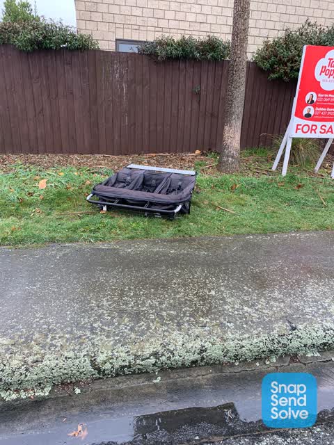
 Dumped children toys
 Roads - General —
 Smashed glass on road & gutter
 Dumped Rubbish —
 Dumped sofa on Huxley St
 Pavement - Damaged —
 Exposed water pipes due to erosion
 Rubbish/Recycling —
  Rubbish/Recycling —
  Rubbish/Recycling —
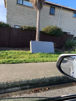
 Mattress base under cabbage tree
Rubbish/Recycling —
Christchurch south community watch
Roading/Streets —
No parking cones were set up on Huxley st a week ago to block of parking to a 100m stretch of huxley st south of our place. No road works we
Roading/Streets —
Abandoned vehicle. Suspension collapsed. Liquids leaked on to street. Vandals have removed the radiator
Also reported on Huxley Street
- 83A Huxley Street — 27 reports
- 51 Huxley Street — 26 reports
- 38 Huxley Street — 24 reports
- 98 Huxley Street — 20 reports
- 79A Huxley Street — 20 reports
- 143 Huxley Street — 18 reports
- 135 Huxley Street — 17 reports
- 89 Huxley Street — 15 reports
The street’s crash record
NZTA’s record names Huxley Street in 27 crashes that hurt somebody since 2006 — 1 person killed, 6 seriously hurt.
The green nearby
- Jacksons Creek — 53 m to the edge
- Cadogan Reserve — 118 m to the edge
- Cameron Reserve — 171 m to the edge
- Hastings Reserve — 326 m to the edge
- Sydenham Park — 398 m to the edge · Sports ground · 5 ha
Parks within half a kilometre, measured to the boundary — the council’s open data.
On the doorstep
- Sandridge Motel — 186 m away · Motels
- Sandridge Hotel — 228 m away · Hotels
- Designer Cottage — 275 m away · B&Bs
- The Funky Pumpkin — 295 m away · Fruit & veg
Businesses within four hundred metres, measured at the pin — OpenStreetMap and the council directories.
The bus nearby
The closest Metro stops, within four hundred and fifty metres.
The tracks through here
- Walk and bike track through Sydenham — 102 m to the line · walk · bike
- Walk and bike track through Sydenham — 334 m to the line · walk · bike
- Walk and bike track through Sydenham — 338 m to the line · walk · bike
- Walk and bike track through Sydenham — 473 m to the line · walk · bike
Tracks whose line passes within half a kilometre, measured to the line itself — the council’s open data.
The named ground
Named water within 500 m of this address, measured to the line or the edge; the council’s own structure register — bridges, boardwalks and steps standing nearby — the open map’s record.
Renting nearby
new bonds in Sydenham ran about $518 a week — $32 below the city median of $550 — the suburb page keeps the rent record →.
The civic layer
This ground votes in Heathcote ward — the Spreydon-Cashmere-Heathcote community board. Ward lines don’t always follow suburb lines; this one is measured at the pin, not the suburb’s centre.
What stood on this ground → · On the map → · From the air — the Crown’s aerials back to 1936; search the address on RetroLens →
Questions, answered briefly
24 council reports on record since August 2016 — most often dumped rubbish (10), rubbish/recycling (4), rubbish and bins - general (2).
Sydenham, Christchurch — on Huxley Street.
Nothing on the heritage register at this exact spot — the record around this ground →
Jacksons Creek — 53 m to its edge.