740 Main S Road
1 council report since August 2017, 1 carrying a photograph.
From the air, then
Sourced from Canterbury Maps and partners. LINZ, CC BY 3.0 NZ. Each frame is cut from Environment Canterbury’s historic imagery MapServer for that decade, only where the Footprints layer names a CC BY survey (NZAM-covered spots stay out). RetroLens holds more Crown aerials →
On the doorstep
- The Bottle-O Templeton, 138 m away · Bottle stores
- Z Templeton, 210 m away · Petrol stations
Businesses within four hundred metres, measured at the pin, OpenStreetMap and the council directories.
The tracks through here
- Walk and bike track through Templeton, 86 m to the line · walk · bike
Tracks whose line passes within half a kilometre, the council’s open data.
Renting nearby
new bonds in Templeton ran about $620 a week, $70 above the city median of $550, the suburb page keeps the rent record →.
What gets reported here
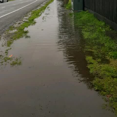
Photographed here 1 on record
What’s on record
Wastewater/Stormwater, 15 Aug 2017
Every time it rains the run off from Main South Rd floods our front yard and runs through the ventilation grates under our house. The run of
The civic layer
This ground votes in Hornby ward, the Halswell-Hornby-Riccarton community board is its local layer. Ward lines don’t always follow suburb lines; this one is measured at the pin, not the suburb’s centre. The whole roll is at /wards.
Main S Road, the whole record → · Everything about Templeton → · What stood on this ground → · On the map → · From the air, RetroLens holds the Crown’s aerials back to 1936; search the address there →
Questions, answered briefly
1 council report on record since August 2017, most often wastewater/stormwater (1).
Templeton, Christchurch, on Main S Road.
Nothing on the heritage register at this exact spot, the record around this ground →