13 Leslie Street, Upper Riccarton
35 reports on record since May 2023 · 34 with photographs. The most-reported address on Leslie Street. Indicative rating valuation and school zones, hazards, bin day and what stood here before.
What gets reported here
Photographed here 34 on record




Reported here
 Pavement - General —
 Those were disappeared for awhile but now they have come back
 Pavement - General —
 Street traders Occupying footpath again
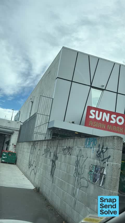
 Graffiti on a fence, building or structure —
 graffiti all on the building
 Hazard — vehicle —
 Another weekend hogging car park for trading purpose … there are just so limited car spaces especially on a weekend . Can somebody sort thes
 Hazard — vehicle —
 Empty parking but occupied by traders . I can’t park Please get parking infringement team to issue a ticket or some sort
 Graffiti on a fence, building or structure —
 Graffiti on wall
 Graffiti on a fence, building or structure —
 Graffiti on a wall
 Graffiti on a fence, building or structure —
 Graffiti on garage shutter of China Town market
 Dumped Rubbish —
 rubbish
 Dumped Rubbish —
 Ongoing turf war by illegal market stallholders causing illegal dumped rubbish to accumulate over time Causing inconvenience to pedestrians
 Litter —
 Vege merchant with no permit setting up stall on carpark. Leaving boxes and vege scraps all over carpark and foot path
 Accessibility —
 Vege merchant selling on foot path . Blocking disable ramp and access .
 Hazard — vehicle —
 Red station wagon Parked all morning over the time restriction. Selling vege on Carpark
 Hazard — vehicle —
 Blocking foot traffic
 Hazard — vehicle —
 Owner of shop parks here every day all day. Blocking foot traffic
 Graffiti on a fence, building or structure —
  Accessibility —
 There are a lot of pallets and packages piled on the footpath near the shops at Church Corner. This has severely impact the accessibility of
 Pavement - General —
 Ongoing turf war by illegal market stallholders causing illegal dumped rubbish to accumulate over time Causing inconvenience to pedestrians
 Rubbish and Bins - General —
 Appears to be V mart rubbish.
 Graffiti on a fence, building or structure —
 Car Park Church Corner. Off Leslie Street Fresco building
 Graffiti on a fence, building or structure —
 My Hair andBeauty wall. In church Corner Carpark. .
 Graffiti somewhere else —
  General Request —
 Crates and rubbish blocking walk area, people selling produce on pavement and taking several car parks
 Pavement - General —
 Hi at the back of china town on Peerswick lane chinese people sell illegal vegetables outside the shop . Now the build these pallets to sell
 Graffiti somewhere else —
  Accessibility —
 There street stall are blocking access footpath ramp every weekend on the public/council footpath . I think they have already been told by c
 Fallen Tree —
 Snapped branch in carpark
 Graffiti on a cabinet, pole or railway asset —
  Graffiti on a fence, building or structure —
  Graffiti on a fence, building or structure —
  Pavement - Damaged —
 Pavement damaged by trees uprooting concrete pavement surface Pedestrian hazard.
 Pavement - Damaged —
 Concrete paths in the car park are very damaged. Lots of broken concrete, lifted dangerously high in places to be trip hazard. Is this cou
 Pavement - General —
 These footpath sellers are congesting the pedestrian foot path. Also hogging a car park as their storage . It’s accident awaiting to happen
 Pothole —
 Potholes in Leslie St and the Council owned part of the carpark behind the church corner shops
- General Request —
Also reported on Leslie Street
- 19 Leslie Street — 22 reports
- 17 Leslie Street — 21 reports
- 21 Leslie Street — 17 reports
- 11 Leslie Street — 14 reports
- 9 Leslie Street — 6 reports
- 15A Leslie Street — 6 reports
- 7 Leslie Street — 5 reports
- 15 Leslie Street — 5 reports
The street’s crash record
NZTA’s record names Leslie Street in 2 crashes that hurt somebody since 2006 — 0 seriously hurt, nobody killed.
The green nearby
- Auburn Reserve — 272 m to the edge · 1 ha
- Hansons Reserve — 279 m to the edge
Parks within half a kilometre, measured to the boundary — the council’s open data.
On the doorstep
- Small farmers market — 4 m away · Marketplace
- Chatime Tea — 11 m away · Business
- V-Mart — 11 m away · Grocery
- my hair & beauty — 19 m away · Beauty
Businesses within four hundred metres, measured at the pin — OpenStreetMap and the council directories.
The bus nearby
- Church Corner — 64 m away · route 5, route 86, route 100, route 130, route 140
- Church Corner — 93 m away · route 5, route 86, route 100, route 130, route 140
The closest Metro stops, within four hundred and fifty metres.
The tracks through here
- Walk and bike track through Upper Riccarton — 75 m to the line · walk · bike
- Walk and bike track through Upper Riccarton — 107 m to the line · walk · bike
- Walk and bike track through Upper Riccarton — 143 m to the line · walk · bike
- Walk and bike track through Upper Riccarton — 445 m to the line · walk · bike
- Walk and bike track through Upper Riccarton — 445 m to the line · walk · bike
Tracks whose line passes within half a kilometre, measured to the line itself — the council’s open data.
The remembered names nearby
- This Stone Was Laid by Lady Bowen 15th March 1919 Trustees — 85 m away ·
THIS STONE WAS LAID BY LADY BOWEN 15TH MARCH 1919 TRUSTEES J.E. HANSON, GEO. FORSYTH, T. C
· 2025 - Upper Riccarton War Memorial plaque — 95 m away · 2025
Inscribed plaques within two hundred and fifty metres — the register’s pins, not surveyed spots. The whole roll is at /plaques.
What was here — J.R. McKenzie Memorial Children's Library and Setting
103 m away · 393 Riccarton Road · located to ±10 m · the place’s own record →
On the register. Nothing researched here yet.
What was here — Commercial Building and Setting
154 m away · 355B Riccarton Road · located to ±6 m · the place’s own record →
On the register. Nothing researched here yet.
What was here — Bush Inn Hotel and Setting
165 m away · 350 Riccarton Road · located to ±16 m · the place’s own record →
On the register. Nothing researched here yet.
What was here — St Peter's Church & Setting
202 m away · 24 Main South Road · located to ±116 m · the place’s own record →
On the register. Nothing researched here yet.
What was here — St Peter's Church Graveyard and Setting
222 m away · 24 Main South Road · located to ±21 m · the place’s own record →
On the register. Nothing researched here yet.
The civic layer
This ground votes in Riccarton ward — the Halswell-Hornby-Riccarton community board. Ward lines don’t always follow suburb lines; this one is measured at the pin, not the suburb’s centre.
What stood on this ground → · On the map → · From the air — the Crown’s aerials back to 1936; search the address on RetroLens →
Questions, answered briefly
35 council reports on record since May 2023 — most often graffiti on a fence, building or structure (9), pavement - general (5), hazard — vehicle (5).
Upper Riccarton, Christchurch — on Leslie Street.
The heritage register names 5 places at or beside it — J.R. McKenzie Memorial Children's Library and Setting, Commercial Building and Setting.
Auburn Reserve — 272 m to its edge, 1 ha.