174-42 Wainui Main Road
6 council reports since October 2023, 5 carrying a photograph. The street’s heaviest record is 772 Wainui Main Road, 15 reports on file.
The named ground
Named places within 1.5 km of this address; the council’s own structure register, bridges, boardwalks and steps standing nearby, the open map’s record.
What gets reported here
Photographed here 5 on record


What’s on record
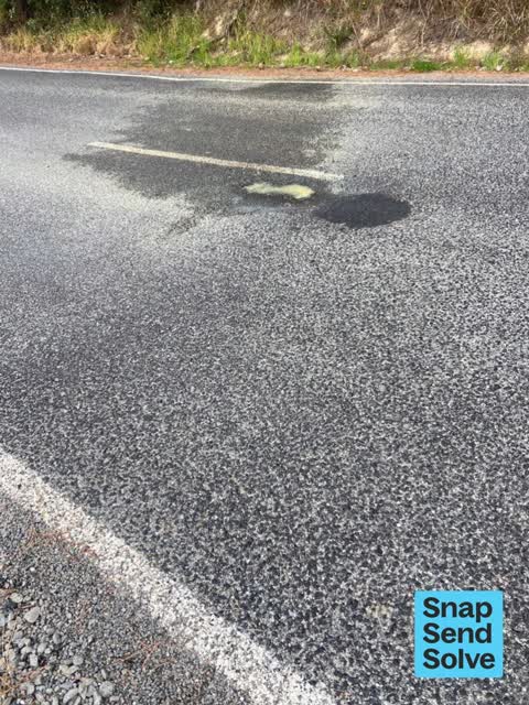
 Damaged Road, 19 Feb 2025
 Is there any plan to do further work / resealing on wainui main road between state highway75& French farm? It had work done ~Oct/nov but was
 Hazard, vehicle, 21 Dec 2024
 No allowance for cars and boats using slipway
 Hazard, vehicle, 13 Dec 2024
 Freedom campers. In between two very clear no parking signs
 Hazard, vehicle, 1 Nov 2024
 Freedom camping at Barry's Bay slipway has started. This vechile here overnight. Where are the security checks that should be happening twi
 Overgrown Vegetation, 1 Apr 2024
 These very overgrown road verges on wainui main road make it very tricky for pedestrians to safely get off the road if there is traffic comi
- Road Blockage, 24 Oct 2023
Elsewhere on Wainui Main Road
- 772 Wainui Main Road, 15 reports
- 146 Wainui Main Road, 10 reports
- 830 Wainui Main Road, 9 reports
- 816 Wainui Main Road, 9 reports
- 54–130 Wainui Main Road, 8 reports
- 840 Wainui Main Road, 7 reports
- 834 Wainui Main Road, 6 reports
- 870 Wainui Main Road, 5 reports
The street’s crash record
NZTA’s record names Wainui Main Road in 13 crashes that hurt somebody since 2006, 3 seriously hurt, nobody killed.
The civic layer
This ground votes in Banks Peninsula ward, the Banks Peninsula community board is its local layer. Ward lines don’t always follow suburb lines; this one is measured at the pin, not the suburb’s centre. The whole roll is at /wards.
Wainui Main Road, the whole record → · Everything about Wainui → · What stood on this ground → · On the map → · From the air, RetroLens holds the Crown’s aerials back to 1936; search the address there →
Questions, answered briefly
6 council reports on record since October 2023, most often hazard, vehicle (3), road blockage (1), overgrown vegetation (1).
Wainui, Christchurch, on Wainui Main Road.
Nothing on the heritage register at this exact spot, the record around this ground →