194 Jubilee Road
4 council reports since November 2024, 4 carrying a photograph. The most-reported address on Jubilee Road.
The green nearby
- Wainui Boat Ramp, 490 m to the edge
Parks within half a kilometre, measured to the boundary, the council’s open data. The whole roll is at /parks.
What gets reported here
- Road Blockage, 2
- General Request, 1
- Fallen Tree, 1
Photographed here 4 on record



What’s on record
 Road Blockage, 17 Feb 2026
 Bridge undermined by slip and road washed away
 General Request, 31 Jul 2025
 At the bottom of jubilee road there is flooding all over the road. The drain is blocked again. Making it hard to pass. Too deep for my gumbo
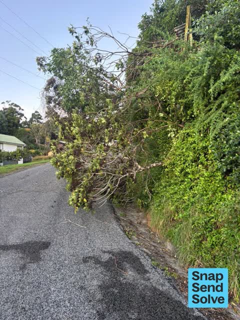
 Fallen Tree, 9 Apr 2025
 Around 9 jubilee road. Tree fallen and blocking most of the road. An old tree house looks to be on top of it too. Too dangerous for me to mo
 Road Blockage, 20 Nov 2024
 Branch down blocking entire road
Elsewhere on Jubilee Road
- 9 Jubilee Road, 3 reports
- 160 Jubilee Road, 2 reports
- 9A Jubilee Road, 1 report
- 99 Jubilee Road, 1 report
- 51 Jubilee Road, 1 report
- 37 Jubilee Road, 1 report
- 197 Jubilee Road, 1 report
- 19 Jubilee Road, 1 report
The civic layer
This ground votes in Banks Peninsula ward, the Banks Peninsula community board is its local layer. Ward lines don’t always follow suburb lines; this one is measured at the pin, not the suburb’s centre. The whole roll is at /wards.
Jubilee Road, the whole record → · Everything about Wainui → · What stood on this ground → · On the map → · From the air, RetroLens holds the Crown’s aerials back to 1936; search the address there →
Questions, answered briefly
4 council reports on record since November 2024, most often road blockage (2), general request (1), fallen tree (1).
Wainui, Christchurch, on Jubilee Road.
Nothing on the heritage register at this exact spot, the record around this ground →
Wainui Boat Ramp, 490 m to its edge.