The old north road
Papanui Road was the road north before the suburbs were suburbs, and St Albans kept the best of its houses, the register lists nineteen places here, most of them on the road or a street off it. This walk follows the road south and picks up the named dwellings on the way. Flat, about two kilometres with the detours.
The walk, as a line
Straight between pins, the streets run longer. Every numbered pin opens that place’s own record.
The stops, in order
- Commercial Building and Setting, 20 Papanui Road · 20 unread leads
A commercial building on the road’s north end, the walk starts where the shops start.
- Te Whatu Manawa Maoritanga O Rehua and Setting, 79 Springfield Road · 22 unread leads
Te Whatu Manawa Māoritanga o Rehua on Springfield Road, the register’s Rehua entry.
- Former Dwelling/ School and Setting, Former Rangi Ruru/Roseneath House, 110 Papanui Road · 20 unread leads
The former dwelling and school at 110 Papanui Road, two past lives in one listing.
- Dwelling and Setting, Te Wepu, 122 Papanui Road · Heritage NZ list 4923 · 20 unread leads
Te Wepu at 122 Papanui Road, the first of the road’s named houses.
- Dwelling and Setting, 45 Ranfurly Street · Heritage NZ list 298 · 20 unread leads
45 Ranfurly Street, half of the street’s listed pair.
- Dwelling and Setting, 41 Ranfurly Street · Heritage NZ list 1890 · 20 unread leads
41 Ranfurly Street, the other half, a few doors down.
- Dwelling and Setting, Orana, 146 Papanui Road · Heritage NZ list 1910 · 20 unread leads
Orana at 146 Papanui Road, another named house the road kept.
- Abberley Park · 20 unread leads
Abberley Park, listed ground, not just a house on it.
- Dwelling and Setting, Amwell, 166 Papanui Road · 20 unread leads
Amwell at 166 Papanui Road, the names continue south.
- Former St Albans Automatic Telephone Exchange and Setting, 29 St Albans Street · 26 unread leads
The former automatic telephone exchange on St Albans Street, infrastructure on the register.
- Former Dwelling and Setting, Fitzroy · Heritage NZ list 1908
Fitzroy, a named former dwelling off the road.
- Dwelling and Setting, Chippenham Lodge, 51 Browns Road · Heritage NZ list 1846 · 21 unread leads
Chippenham Lodge on Browns Road, the named lodge on the roll.
- Dwelling and Setting, Cobham, 35 Knowles Street · Heritage NZ list 1883 · 20 unread leads
Cobham on Knowles Street, the walk’s last entry.
What the register built on the way
Council structures within about 30 m of the stop-to-stop line, the bridges, steps and shelters the route passes. Site names are the register’s own.
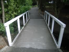 A footbridge at Abberley Park, 6 m long · built 2006
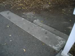 A set of steps at Abberley Park, 2 steps · built 2009
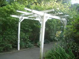 A shelter at Abberley Park, built 2009 4 m off the line
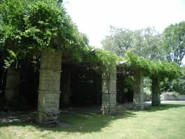 A shelter at Abberley Park, built 2009 13 m off the line
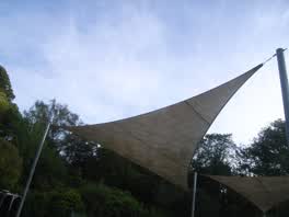 A shelter at Abberley Park - Facilities, built 2009 20 m off the line
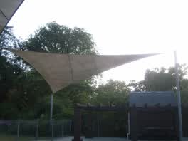 A shelter at Abberley Park - Facilities, built 2009 21 m off the line
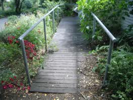 A ramp at Abberley Park, 7 m long · built 2009 22 m off the line
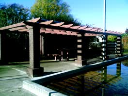 A shelter at Abberley Park - Facilities 23 m off the line
The reports along it
1,834 council reports pinned within 150 m of the line, most often Water & drains and Roads & footpaths, 1,503 with a photograph. A pin is where a reporter stood, not a claim about the place itself.
 Playground Equipment
 Poles and Signage - General
 Trees - General
 Hazard, vehicle
 Water Leak
 Street Cleaning
 Street Gutters / Storm Water
 Playground Equipment
 Hazard, vehicle
 Hazard, vehicle
 Dumped Rubbish
Questions, answered briefly
Papanui Road was the road north before the suburbs were suburbs, and St Albans kept the best of its houses, the register lists nineteen places here, most of them on the road or a street off it. 13 listed places, 4.1 km as the line runs, St Albans.
Commercial Building and Setting (20 Papanui Road) to Dwelling and Setting, Cobham (35 Knowles Street), the order is a suggestion, not the only way round.
Every one, each pin is a row in the district plan’s heritage schedule, and each opens the place’s own sourced record here.
4.1 km measured straight between the pins, the streets run longer, and the stops deserve a pause each.
The record behind this
Every stop is a row in the district plan’s heritage schedule, held here as the register’s own layer. The order and the notes are ours, the listings are the council’s and Heritage New Zealand’s. "Setting" is the register’s word for the ground a listing covers.
The rest of the register here: St Albans
The same ground today: Saint Albans
This page as markdown: /walks/st-albans-north-road.md · the route as data: /walks/st-albans-north-road.geojson · on the live map: the walks layer.