268A Ferry Road, Waltham
21 reports on record since January 2017 · 17 with photographs. The street’s heaviest record is 357 Ferry Road — 73 reports on file. Indicative rating valuation and school zones, hazards, bin day and what stood here before.
What gets reported here
Photographed here 17 on record


Reported here
 Graffiti on a fence, building or structure —
 Graffiti on femce of buns bakery on ferry road
 Graffiti on a fence, building or structure —
 Graffiti on fencing
 Graffiti on a fence, building or structure —
 Graffiti on signage
 Graffiti on a fence, building or structure —
  Graffiti somewhere else —
 Graffiti on roller doors ferry road food market
 Graffiti somewhere else —
 Tagging by Westpac ATM.
 Graffiti on a fence, building or structure —
 Graffiti on Ferry Road Medical Centre, 276 Ferry Road Waltham
 Graffiti on a fence, building or structure —
 Graffiti, 1, on a building sign. 2, on a sign by footpath. Outside Buns Bakery. Ferry Road Waltham
 Poles and Signage - General —
 P 10 sign needs rotating. Not visible from the road it covers.
 Graffiti on a fence, building or structure —
  Street Gutters / Storm Water —
 Two blocked storm water drains outside bunns bakery. Reported last winter and were never cleared. Thought I'd have another crack this year
 Vandalism - General —
 Tagging to the left of the Westpac ATM.
 Graffiti on a fence, building or structure —
 Multiple tags as shown, plus the side of the medical centre by their driveway tagging. Area looks awful with them all.
 Street Gutters / Storm Water —
 Drain completely blocked with rubbish and dirt. Full of water 24 hours after last rain.
- Graffiti —
- Graffiti —
- Street Gutters / Storm Water —
- Graffiti —
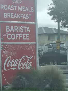 Graffiti —
 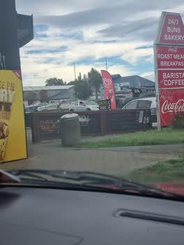 Graffiti —
 Graffiti —
Also reported on Ferry Road
- 357 Ferry Road — 73 reports
- 261T Ferry Road — 64 reports
- 360 Ferry Road — 44 reports
- 244 Ferry Road — 43 reports
- 241 Ferry Road — 34 reports
- 330 Ferry Road — 32 reports
- 372 Ferry Road — 31 reports
- 365 Ferry Road — 29 reports
The street’s crash record
NZTA’s record names Ferry Road in 141 crashes that hurt somebody since 2006 — 1 person killed, 37 seriously hurt.
The green nearby
- Cross Reserve — 312 m to the edge
- Charleston Reserve — 341 m to the edge
- Edmonds Park — 362 m to the edge · Sports ground · 2 ha
- Edmonds Factory Garden — 372 m to the edge · Botanic
Parks within half a kilometre, measured to the boundary — the council’s open data.
On the doorstep
- Cake Boutique — 5 m away · Delis
- Buns Bakery and Cafe — 12 m away · Bakeries
- Buns 24/7 Bakery — 14 m away · Business
- M&M Minimart — 18 m away · Dairies & convenience
Businesses within four hundred metres, measured at the pin — OpenStreetMap and the council directories.
The bus nearby
- Ferry Rd near Phillipstown Cts — 87 m away · route 3, route 140
- Ferry Rd near Bordesley St — 109 m away · route 3, route 140
The closest Metro stops, within four hundred and fifty metres.
The tracks through here
- Walk and bike track through Waltham — 11 m to the line · walk · bike
- Walk and bike track through Waltham — 11 m to the line · walk · bike
- Walk and bike track through Waltham — 340 m to the line · walk · bike
- Walk and bike track through Waltham — 453 m to the line · walk · bike
- Walk and bike track through Waltham — 496 m to the line · walk · bike
Tracks whose line passes within half a kilometre, measured to the line itself — the council’s open data.
Renting nearby
new bonds in Waltham ran about $463 a week — $87 below the city median of $550 — the suburb page keeps the rent record →.
The civic layer
This ground votes in Central ward — the Papanui-Innes-Central community board. Ward lines don’t always follow suburb lines; this one is measured at the pin, not the suburb’s centre.
What stood on this ground → · On the map → · From the air — the Crown’s aerials back to 1936; search the address on RetroLens →
Questions, answered briefly
21 council reports on record since January 2017 — most often graffiti on a fence, building or structure (8), graffiti (6), street gutters / storm water (3).
Waltham, Christchurch — on Ferry Road.
Nothing on the heritage register at this exact spot — the record around this ground →
Cross Reserve — 312 m to its edge.