24 Symes Road
1 council report since November 2026, 1 carrying a photograph. The street’s heaviest record is 21A Symes Road, 5 reports on file.
The green nearby
- Vickerys Reserve, 4 m to the edge · playground, 4 pieces
Parks within half a kilometre, measured to the boundary, the council’s open data. The whole roll is at /parks.
On the doorstep
- Angus Meats - Factory Shop, 144 m away · Clothing
- Mi Woollies Sheepskin & Footwear Factory Shop, 175 m away · Clothing
- Custom Kauri, 196 m away · Furniture
- Archives New Zealand / Te Rua Mahara o te Kāwanatanga, 201 m away · Government
Businesses within four hundred metres, measured at the pin, OpenStreetMap and the council directories.
The bus nearby
- Main South Rd near Harvard Ave, 285 m away · route 5, route 80, route 100
- Harvard Ave and Main South Rd, 331 m away · route 5, route 80, route 100
The closest Metro stops, within four hundred and fifty metres.
The tracks through here
- Walk and bike track through Wigram, 337 m to the line · walk · bike
Tracks whose line passes within half a kilometre, the council’s open data.
The named ground
Named water within 500 m of this address, measured to the line or the edge, the open map’s record.
Renting nearby
new bonds in Wigram ran about $697 a week, $147 above the city median of $550, the suburb page keeps the rent record →.
What gets reported here
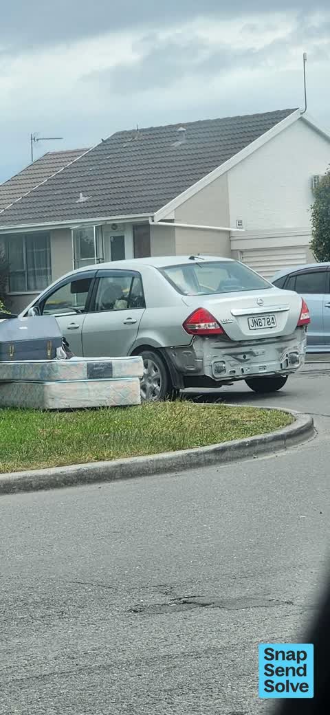
Photographed here 1 on record
What’s on record
 Dumped Rubbish, 2 Nov 2026
I arrived home to see a lady filling a suitcase of unwanted items on top of a dumped single mattress and base
Elsewhere on Symes Road
- 21A Symes Road, 5 reports
- 21 Symes Road, 5 reports
- 19 Symes Road, 3 reports
- 11 Symes Road, 3 reports
- 10 Symes Road, 3 reports
- 21–27 Symes Road, 2 reports
- 12C Symes Road, 2 reports
- 12 Symes Road, 2 reports
The civic layer
This ground votes in Hornby ward, the Halswell-Hornby-Riccarton community board is its local layer. Ward lines don’t always follow suburb lines; this one is measured at the pin, not the suburb’s centre. The whole roll is at /wards.
Symes Road, the whole record → · Everything about Wigram → · What stood on this ground → · On the map → · Street View → · From the air, RetroLens holds the Crown’s aerials back to 1936; search the address there →
Questions, answered briefly
1 council report on record since November 2026, most often dumped rubbish (1).
Wigram, Christchurch, on Symes Road.
Nothing on the heritage register at this exact spot, the record around this ground →
Vickerys Reserve, 4 m to its edge.