15 Kestrel Place, Woolston
12 reports on record since June 2016 · 9 with photographs. The most-reported address on Kestrel Place. Indicative rating valuation and school zones, hazards, bin day and what stood here before.
What gets reported here
- Trees - General — 2
- Roading/Streets — 2
- Overgrown Vegetation — 2
- Water Leak — 1
- Graffiti somewhere else — 1
- Graffiti — 1
Photographed here 9 on record


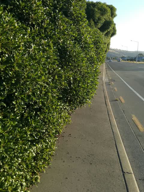
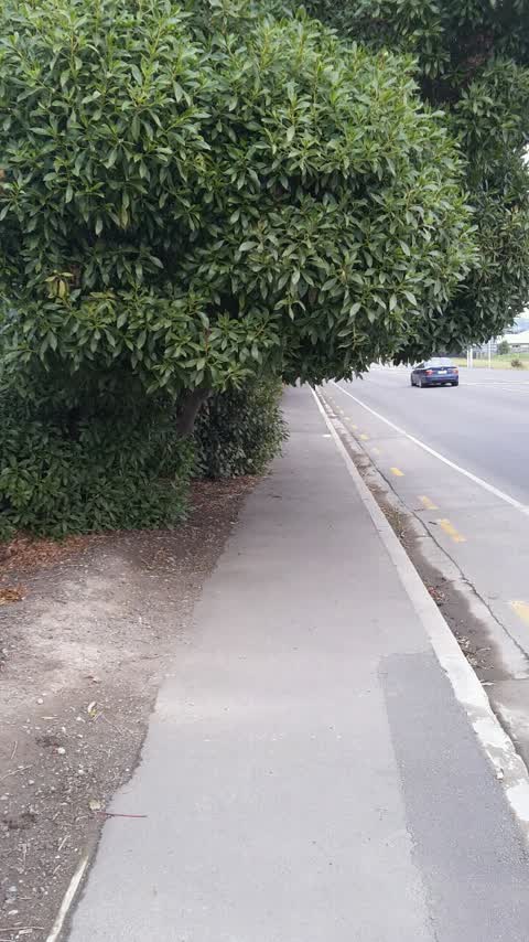
Reported here
 Dumped Rubbish —
 Dumped rubbish in the alleyway to Ti Rakau reserve and Charlesworth reserve.
 Trees - General —
 trees over grown on pathway
 Fallen Tree —
 Large tree branch has snapped at the trunk and is inverted over the footpath just about head height presently. Likely to start pulling away
 Graffiti somewhere else —
 On electric box
 Trees - General —
 Low hanging trees , hitting high sided vehicles in the left hand southbound lane
- Overgrown Vegetation —
trees overgrown and encroaching into roadway
 Water Leak —
 Burst water pipe?
 Overgrown Vegetation —
 Affects walkway as hangs into path. Worse if on bike. Needs to be a bit wider
- General Request —
- Graffiti —
Roading/Streets —
hi. could the shrubs be trimmed please, that would be much appreciated by walkers and runners in this area. they are covering the majority o
Roading/Streets —
Footpath along Dyers Road between Linwood Ave and Ti Rakau Dr needs trees trimmed as pedestrians have to duck to get past.
Also reported on Kestrel Place
- 4 Kestrel Place — 10 reports
- 3 Kestrel Place — 4 reports
- 14 Kestrel Place — 4 reports
- 2 Kestrel Place — 3 reports
- 6 Kestrel Place — 2 reports
- 21 Kestrel Place — 2 reports
- 17 Kestrel Place — 2 reports
- 16-2 Kestrel Place — 2 reports
The green nearby
- Ti Rakau Reserve — 11 m to the edge · 3 ha
- St Florian Reserve — 250 m to the edge
- Bayswater Reserve — 269 m to the edge · 2 ha
- St Lukes East Drainage Reserve — 294 m to the edge
- Charlesworth Reserve — 351 m to the edge · Regional · 24 ha
Parks within half a kilometre, measured to the boundary — the council’s open data.
On the doorstep
- Kidbrooke Convenience — 316 m away · Dairies & convenience
- Christchurch Kiwi Holiday Park and Motels — 381 m away · Campgrounds
Businesses within four hundred metres, measured at the pin — OpenStreetMap and the council directories.
The bus nearby
- Ti Rakau Dr near Kestrel Pl — 200 m away · route 140
- Ti Rakau Dr near Shearwater Dr — 239 m away · route 140
The closest Metro stops, within four hundred and fifty metres.
The tracks through here
- Walk and bike track through Woolston — 35 m to the line · walk · bike
- Walk and bike track through Woolston — 52 m to the line · walk · bike
- Walk and bike track through Woolston — 58 m to the line · walk · bike
- Walk and bike track through Woolston — 174 m to the line · walk · bike
- Walk and bike track through Woolston — 224 m to the line · walk · bike
Tracks whose line passes within half a kilometre, measured to the line itself — the council’s open data.
The named ground
Named water within 500 m of this address, measured to the line or the edge; the council’s own structure register — bridges, boardwalks and steps standing nearby — the open map’s record.
Renting nearby
new bonds in Woolston ran about $511 a week — $39 below the city median of $550 — the suburb page keeps the rent record →.
The civic layer
This ground votes in Heathcote ward — the Spreydon-Cashmere-Heathcote community board. Ward lines don’t always follow suburb lines; this one is measured at the pin, not the suburb’s centre.
What stood on this ground → · On the map → · From the air — the Crown’s aerials back to 1936; search the address on RetroLens →
Questions, answered briefly
12 council reports on record since June 2016 — most often trees - general (2), roading/streets (2), overgrown vegetation (2).
Woolston, Christchurch — on Kestrel Place.
Nothing on the heritage register at this exact spot — the record around this ground →
Ti Rakau Reserve — 11 m to its edge, 3 ha.