32 Gould Crescent, Woolston
23 reports on record since October 2017 · 21 with photographs. The most-reported address on Gould Crescent. Indicative rating valuation and school zones, hazards, bin day and what stood here before.
What gets reported here
Photographed here 21 on record


Reported here
 Graffiti on a fence, building or structure —
 Tagged again
 Graffiti on a road, footpath or bridge —
 Graffiti on bridge at Heathcote estuary loop track
 Graffiti on a fence, building or structure —
 Graffiti at Heathcote estuary loop track
 Graffiti on a playground or in a park —
 Once again it’s been tagged
 Dumped Rubbish —
 Dumped rubbish.
 Graffiti on a playground or in a park —
 Graffiti on seat
 Dumped Rubbish —
 Dumped mattress on Opawaho river bank
 Water Pollution - Sediment —
 Waratah in water way. Boating hazard
 Water Leak —
 Water leak repair didn’t work
 Graffiti on a fence, building or structure —
  Graffiti on a fence, building or structure —
 Near river
 Street Gutters / Storm Water —
 Something isn’t working right with the drainage system from Gould Crescent - there isn’t much of a flow of water making its way from the sum
 Dumped Rubbish —
 Dumped cans and bottles
 Graffiti on a fence, building or structure —
 Facing the river.
 Overgrown Vegetation —
 Too low for mowers
- Park - General Request —
- Park - General Request —
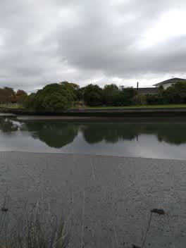 Rubbish/Recycling —
 Bike and camping gear dumped by woolston cut
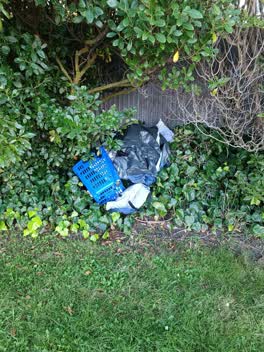 Rubbish/Recycling —
 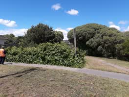 Parks —
 Over growen ive
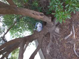 Rubbish/Recycling —
 rubbish stacked behind tree
Roading/Streets —
Hi there, just wondering if this ivy can either be cut back or got rid of (and replanted with natives etc.) It is a bit out of control and c
Graffiti —
Also reported on Gould Crescent
- 54 Gould Crescent — 19 reports
- 28 Gould Crescent — 12 reports
- 62 Gould Crescent — 11 reports
- 31 Gould Crescent — 10 reports
- 52 Gould Crescent — 9 reports
- 12 Gould Crescent — 9 reports
- 36 Gould Crescent — 5 reports
- 34 Gould Crescent — 5 reports
The street’s crash record
NZTA’s record names Gould Crescent in 5 crashes that hurt somebody since 2006 — 2 people killed, 2 seriously hurt.
The green nearby
- Heathcote Riverbank True Right — 33 m to the edge · 8 ha
- Gould Reserve — 42 m to the edge
- Staunton Esplanade Reserve — 47 m to the edge · 3 ha
- Roundabout Reserve — 202 m to the edge
- Tunnel Road Reserve — 228 m to the edge · 3 ha
Parks within half a kilometre, measured to the boundary — the council’s open data.
The bus nearby
- Ferry Rd near Alport Pl — 256 m away · route 3, route 155
- Ferry Rd near Tunnel Rd — 273 m away · route 3, route 155
The closest Metro stops, within four hundred and fifty metres.
The tracks through here
- Walk and bike track through Woolston — 21 m to the line · walk · bike
- Walk and bike track through Woolston — 28 m to the line · walk · bike
- Walk and bike track through Woolston — 36 m to the line · walk · bike
- Walk and bike track through Woolston — 85 m to the line · walk · bike
- Walk and bike track through Woolston — 128 m to the line · walk · bike
Tracks whose line passes within half a kilometre, measured to the line itself — the council’s open data.
The named ground
Named water within 500 m of this address, measured to the line or the edge; the council’s own structure register — bridges, boardwalks and steps standing nearby — the open map’s record.
Renting nearby
new bonds in Woolston ran about $511 a week — $39 below the city median of $550 — the suburb page keeps the rent record →.
The civic layer
This ground votes in Heathcote ward — the Spreydon-Cashmere-Heathcote community board. Ward lines don’t always follow suburb lines; this one is measured at the pin, not the suburb’s centre.
What stood on this ground → · On the map → · From the air — the Crown’s aerials back to 1936; search the address on RetroLens →
Questions, answered briefly
23 council reports on record since October 2017 — most often graffiti on a fence, building or structure (5), rubbish/recycling (3), dumped rubbish (3).
Woolston, Christchurch — on Gould Crescent.
Nothing on the heritage register at this exact spot — the record around this ground →
Heathcote Riverbank True Right — 33 m to its edge, 8 ha.