80 Rutherford Street, Woolston
33 reports on record since December 2018 · 30 with photographs. The street’s heaviest record is 25 Rutherford Street — 44 reports on file. Indicative rating valuation and school zones, hazards, bin day and what stood here before.
What gets reported here
Photographed here 30 on record






Reported here
 Graffiti on a road, footpath or bridge —
 graffiti on end of bridge
 Graffiti on a fence, building or structure —
 graffiti on grey wall
 Graffiti on a road, footpath or bridge —
 Graffiti on bridge. please check whole bridge as there is graffiti on both sides.
 Graffiti on a fence, building or structure —
 graffiti
 Graffiti on a fence, building or structure —
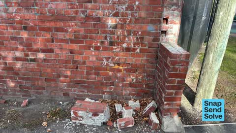
 The section of the council wall attached to the neighbouring building at relevant cemetery has broken off in the upper section and is lying
 Graffiti on a fence, building or structure —
 x3 tagging on business building (woodworkers Plank)
 Dumped Rubbish —
 Dumped rubbish on Connal St and Rutherford corner. also 3 road cones.
 Road Signage —
 King Edward Terrace street name blade fallen down at Rutherford
 Graffiti on a fence, building or structure —
  Graffiti on a fence, building or structure —
  Graffiti on a fence, building or structure —
  Graffiti on a fence, building or structure —
 Entrance to Rutherford Cemetery
 Graffiti on a fence, building or structure —
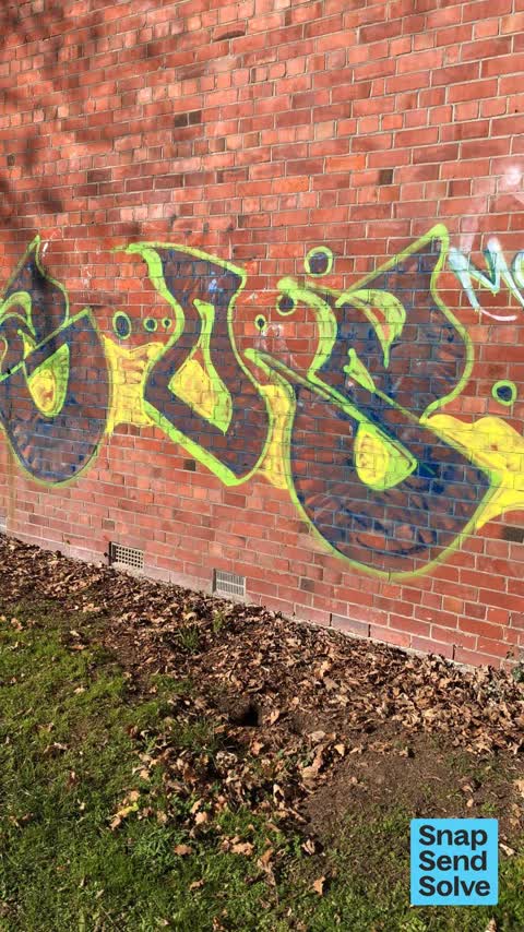
 graffiti on brickwork
 Graffiti on a fence, building or structure —
 Graffiti on reed fence on Connel street
 Graffiti on a fence, building or structure —
 Racist tagging at Rutherford cemetery
 Graffiti somewhere else —
 Opposite the Tannery on the cycle path next to Cycleways
 Graffiti somewhere else —
 Garlands road bridge has graffiti on it
 Graffiti somewhere else —
 Grey block wall shown in pic opposite jubilee st
 Road Blockage —
 The road along connal street has been reduced to a single lane of traffic as the trees along it are so over grown. Scraping my boot through
 Graffiti somewhere else —
  Graffiti —
  Graffiti —
 - Dumped Rubbish —
- Overgrown Vegetation —
- Graffiti —
 Graffiti —
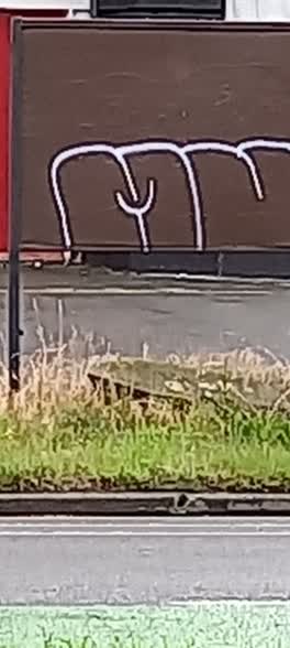
 80 Rutherford St - Graffiti on sign board in grass berm
 Graffiti —
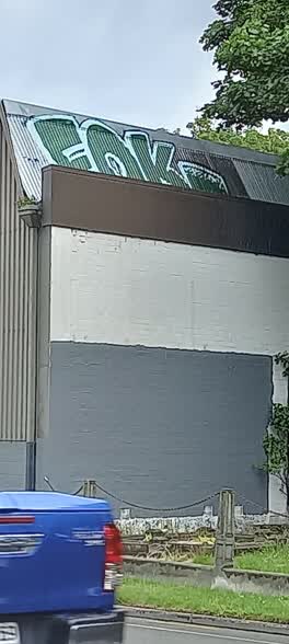
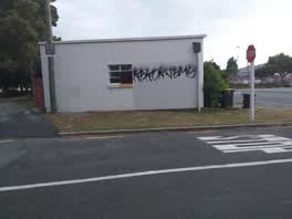
 80 Rutherford St - multiple graffiti on street-frontage wall. Also high up on North side of building
 Graffiti —
 entry to Woolston Cemetery off Connal st
Graffiti —
Graffiti —
Graffiti —
Graffiti —
Graffiti —
Also reported on Rutherford Street
- 25 Rutherford Street — 44 reports
- 24B Rutherford Street — 26 reports
- 35 Rutherford Street — 20 reports
- 56 Rutherford Street — 15 reports
- 23 Rutherford Street — 13 reports
- 58 Rutherford Street — 12 reports
- 81A Rutherford Street — 10 reports
- 37 Rutherford Street — 10 reports
The street’s crash record
NZTA’s record names Rutherford Street in 13 crashes that hurt somebody since 2006 — 1 seriously hurt, nobody killed.
The green nearby
- Rutherford Cemetery — 14 m to the edge · Botanic
- Heathcote Riverbank True Right — 56 m to the edge · 8 ha
- Heathcote Riverbank — 357 m to the edge
- Staunton Esplanade Reserve — 357 m to the edge · 3 ha
- Radley Park — 402 m to the edge · 3 ha
Parks within half a kilometre, measured to the boundary — the council’s open data.
On the doorstep
- Nikau Bakehouse — 44 m away · Business
- The Brewery — 97 m away · Bars & pubs
- La La Land Chocolate Garden Cafe — 98 m away · Cafés
- Blue Smoke — 99 m away · Bars & pubs
Businesses within four hundred metres, measured at the pin — OpenStreetMap and the council directories.
The bus nearby
- Garlands Rd near Cumnor Tce — 97 m away · route 155
- Garlands Rd near Tanner St — 315 m away · route 155
The closest Metro stops, within four hundred and fifty metres.
The tracks through here
- Walk and bike track through Woolston — 17 m to the line · walk · bike
- Walk and bike track through Woolston — 360 m to the line · walk · bike
- Walk and bike track through Woolston — 413 m to the line · walk · bike
- Walk and bike track through Woolston — 437 m to the line · walk · bike
- Walk and bike track through Woolston — 457 m to the line · walk · bike
Tracks whose line passes within half a kilometre, measured to the line itself — the council’s open data.
The named ground
Named water within 500 m of this address, measured to the line or the edge — the open map’s record.
Renting nearby
new bonds in Woolston ran about $511 a week — $39 below the city median of $550 — the suburb page keeps the rent record →.
What was here — Woolston Cemetery
on this spot · 76 Rutherford Street · located to ±92 m · the place’s own record →
On the register. Nothing researched here yet.
The civic layer
This ground votes in Linwood ward — the Coastal-Burwood-Linwood community board. Ward lines don’t always follow suburb lines; this one is measured at the pin, not the suburb’s centre.
What stood on this ground → · On the map → · From the air — the Crown’s aerials back to 1936; search the address on RetroLens →
Questions, answered briefly
33 council reports on record since December 2018 — most often graffiti on a fence, building or structure (11), graffiti (11), graffiti somewhere else (4).
Woolston, Christchurch — on Rutherford Street.
The heritage register names a place at or beside it — Woolston Cemetery.
Rutherford Cemetery — 14 m to its edge.