Gurudwara Singh Sabha
a gurdwara, Woolston
a gurdwara
The record
- The map calls it
- a gurdwara
- Religion
- sikh
- Address
- 537 Ferry Road
- Street
- Ferry Road
- Suburb
- Woolston
In the archive
- Documents naming it on the shelf →
- The record’s own search for it →
- The suburb it stands in →
- The whole roll →
A document a search names is a lead worth reading, not a claim the site makes.
Other places of worship near it 4
The nearest other places of worship by distance, proximity on the map, not a claim of kinship.
The green nearby 4
Parks whose drawn outline sits within 400 m, measured to the outline itself, so a place on a big reserve’s edge still counts.
The register nearby 1
Heritage-register places within 300 m of the place’s point, proximity, not a claim of place.
Remembered on the ground 3
Plaques standing within 300 m of the point, the ground’s own footnotes, not the congregation’s.
The reports nearby
911 council reports pinned within 250 m of the place, most often Graffiti & vandalism and Rubbish & dumping, 759 with a photograph. A pin is where a reporter stood, not a claim about the place itself.
 Graffiti on a bus stop or public toilet
 Graffiti on a traffic light pole or cabinet, or wa
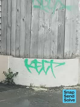 Graffiti on a fence, building or structure
 Overgrown Vegetation
 Pavement - General
 Graffiti on a fence, building or structure
 Dumped Rubbish
 Water General
 Dumped Rubbish
 Graffiti on a playground or in a park
 Graffiti on a fence, building or structure
 Dumped Rubbish
Getting there
The nearest stop the Metro map carries, measured to the pin, not the door.
Questions, answered briefly
537 Ferry Road, Woolston, Christchurch, on the map →.
The map calls it a gurdwara. That is the mapper’s tag, not this site’s own survey.
Source: OpenStreetMap way/443963632 (ODbL). A directory, not a census of faith: name, religion, denomination and address are the tags OpenStreetMap’s mappers give each place, and a tag the map does not carry stays unstated here rather than guessed from a name. A listing is a lead, not a claim, it says a place of worship is mapped on this ground, not that a congregation meets there this week. Coordinates pin the building as the map draws it.