62 School Road, Yaldhurst
47 reports on record since October 2016 · 38 with photographs. The most-reported address on School Road. Indicative rating valuation and school zones, hazards, bin day and what stood here before.
What gets reported here
- Dumped Rubbish — 11
- Parks — 7
- Park - General Request — 7
- Facility - General Request — 5
- Public Toilet — 4
- Graffiti — 3
Photographed here 38 on record




Reported here
 Facility - General Request —
 no padlock on access
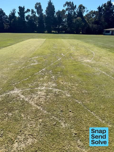
 Park - General Request —
 Someone has vandalised the cricket block at Yaldhurst Domain. I walk my dog here frequently, and have seen how much work went into it since
 Dumped Rubbish —
 rubbish
 Dumped Rubbish —
 rubbish
 Public Toilet —
 Toilets are disgusting
 Overgrown Vegetation —
 Park boundary has become overgrown again making a visual boundary between the carpark, playground and the road. We have noticed an increase
 Public Toilet —
 Yaldhurst Doman toilets in dire need of cleaning
 Dumped Rubbish —
 rubbish dumped
 Dumped Rubbish —
 sofa just inside entrance to right, hidden behind sheubs
 Public Toilet —
 the clearlight roof section in flapping in the wind and the male toilets are in a shocking state
 Park - General Request —
 well done council getting the car park done thank you
 Park - General Request —
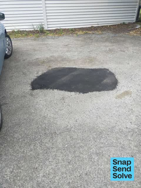
 Yaldhurst domain carpark has pot holes . They are getting bigger . Could these be fixed please .
 Facility - General Request —
 Someone has pulled this bollard out and driven all over the sports field. Will need urgent attention.
 Hazard — vehicle —
 Trees are hanging over the entrance and making it hard for vehicles to enter the car park
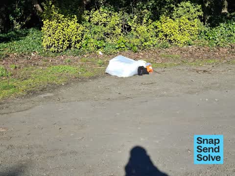
 Dumped Rubbish —
 Tyre left outside carpark to yaldhurst domain
 Public Toilet —
 These publick toilets are used by the park and tennis club members . Often the toilets are vandalised to the extent they cannot be used. I
 Facility - General Request —
 No Lock or chain on the bollard at Yaldhurst domain
 Park - General Request —
 Road access way needs filling with gravel as not currently usable
 Park - General Request —
 Bollard needs repairing. You can pull it out of the ground
 Graffiti on a fence, building or structure —
 All over the main building at yaldhurst
 Rubbish and Bins - General —
 This rubbish bin has been damaged and needs repaired or replaced
 Dumped Rubbish —
 The first two photos are on the right when entering the park The other photos are at the back of the park behind the tennis courts
 Facility - General Request —
 There is a large pothole in the entrance to Yardhurst domain
 Facility - General Request —
 Gate doesn't close, need longer chain
- Park - General Request —
- Litter —
- Dumped Rubbish —
- Park - General Request —
- Graffiti —
- Graffiti —
- Overgrown Vegetation —
 Dumped Rubbish —
 Yaldhurst Domain carpark
 Dumped Rubbish —
 Dumped Rubbish at yaldhurst domain.
 Dumped Rubbish —
 Rubbish dumped in Yaldhurst Domain carpark
- Dumped Rubbish —
In carpark not far from tennis club.
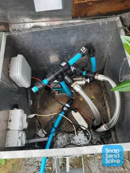 Water Supply —
 Cage and paddlock lid has been ripped off with crowbar and water pipes have been dismantled.
Parks —
no water
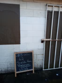 Graffiti —
 Painted out by PEEEP Trust 27-5-2021 62 School road Templeton Domain 411135
Parks —
bollard taken out so park is open
Water Supply —
- Roading/Streets —
quarry truck going through school zone. going to sols quarry.
Parks —
type in the brush on left side of car Park
Parks —
rubbish dumped in the brush in the car park on the left
Flooding —
leakage from toilet block to tennis courts
Parks —
Once again the domain is not locked up. According to your sign it is to be locked at 5.30pm, it is now almost 8.30pm!! And the ongoing iss
Parks —
Once again the domain is not locked up. According to your sign it is to be locked at 5.30pm, it is now almost 8.30pm!! And the ongoing iss
Parks —
Grass all over path slippery when wet mowed rubbish and skid marks
Also reported on School Road
- 1–11 School Road — 8 reports
- 69 School Road — 7 reports
- 56 School Road — 6 reports
- 48 School Road — 4 reports
- 63 School Road — 3 reports
- 33 School Road — 3 reports
- 231 School Road — 3 reports
- 150 School Road — 3 reports
The street’s crash record
NZTA’s record names School Road in 5 crashes that hurt somebody since 2006 — 0 seriously hurt, nobody killed.
The green nearby
- Yaldhurst Domain — you are in it · Sports ground · 2 ha
Parks within half a kilometre, measured to the boundary — the council’s open data.
On the doorstep
- CLAAS Harvest Centre Christchurch — 159 m away · Agrarian
- Atomic Travel — 367 m away · Company
- Antler Cafe — 367 m away · Cafés
- Yaldhurst Museum of Transport & Science — 372 m away · Attractions
Businesses within four hundred metres, measured at the pin — OpenStreetMap and the council directories.
Renting nearby
new bonds in Yaldhurst ran about $650 a week — $100 above the city median of $550 — the suburb page keeps the rent record →.
The civic layer
This ground votes in Harewood ward — the Fendalton-Waimairi-Harewood community board. Ward lines don’t always follow suburb lines; this one is measured at the pin, not the suburb’s centre.
What stood on this ground → · On the map → · From the air — the Crown’s aerials back to 1936; search the address on RetroLens →
Questions, answered briefly
47 council reports on record since October 2016 — most often dumped rubbish (11), parks (7), park - general request (7).
Yaldhurst, Christchurch — on School Road.
Nothing on the heritage register at this exact spot — the record around this ground →
Yaldhurst Domain — the address is inside it, 2 ha.