11 Church Square, Addington
11 reports on record since June 2019 · 5 with photographs. The street’s heaviest record is 14 Church Square — 48 reports on file. Indicative rating valuation and school zones, hazards, bin day and what stood here before.
What gets reported here
- Roading/Streets — 2
- Pavement - General — 2
- Overgrown Vegetation — 2
- Dumped Rubbish — 2
- Parks — 1
- Graffiti — 1
Photographed here 5 on record

Reported here
- Pavement - General —
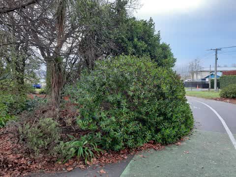
- Overgrown Vegetation —
- Flooding —
- Dumped Rubbish —
- Dumped Rubbish —
- Overgrown Vegetation —
 Pavement - General —
 Poor drainage results in cycle path always flooding. Requires sump with connection to SW
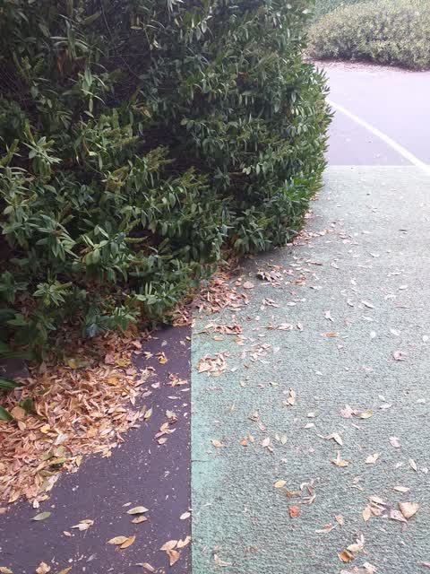
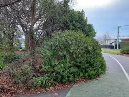 Parks —
 this hebe is growing well into the cycle lane and its a sight line issue for people leaving the park across the cycle way. cheers
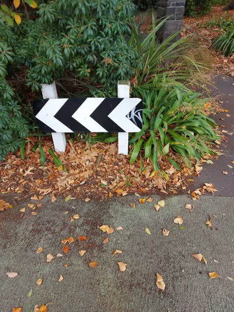
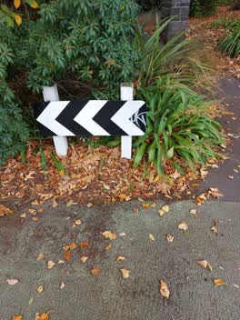 Graffiti —
 graffiti on street sign
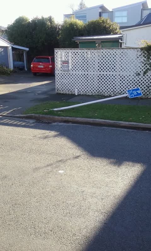
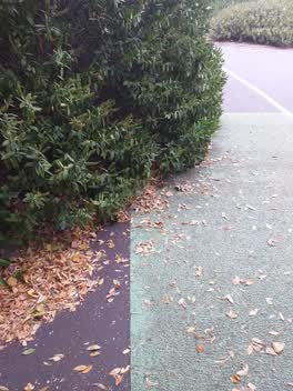 Roading/Streets —
 growth over cycleway.Needs trimming back as blocks vision for pedestrians.Church Square West side with Poulson St
Roading/Streets —
Also reported on Church Square
- 14 Church Square — 48 reports
- 29 Church Square — 17 reports
- 30 Church Square — 16 reports
- 19 Church Square — 13 reports
- 6 Church Square — 11 reports
- 16 Church Square — 10 reports
- 35 Church Square — 8 reports
- 7 Church Square — 7 reports
The street’s crash record
NZTA’s record names Church Square in 4 crashes that hurt somebody since 2006 — 0 seriously hurt, nobody killed.
The green nearby
- Cornelius O'connor Reserve — 176 m to the edge
- Mountfort Park — 205 m to the edge · Botanic
- Addington Cemetery — 369 m to the edge · Botanic · 2 ha
- Jerrold Reserve — 392 m to the edge
- Disraeli Reserve — 414 m to the edge
Parks within half a kilometre, measured to the boundary — the council’s open data.
On the doorstep
- Jailhouse Accommodation — 265 m away · Hostels
- Harcourts Christchurch — 295 m away · Real estate
- Cheeky Sparrow - Addington — 307 m away · Cafés
- Burger King — 319 m away · Fast food
Businesses within four hundred metres, measured at the pin — OpenStreetMap and the council directories.
The bus nearby
The closest Metro stops, within four hundred and fifty metres.
The tracks through here
- Walk and bike track through Addington — 3 m to the line · walk · bike
- Walk and bike track through Addington — 56 m to the line · walk · bike
- Walk and bike track through Addington — 57 m to the line · walk · bike
- Walk and bike track through Addington — 278 m to the line · walk · bike
- Walk and bike track through Addington — 349 m to the line · walk · bike
Tracks whose line passes within half a kilometre, measured to the line itself — the council’s open data.
The named ground
Named water within 500 m of this address, measured to the line or the edge; Named places within 1.5 km of this address — the open map’s record.
The remembered names nearby
- Charles Dickens (1812 - 1870) Was One of the Most Popular — 216 m away ·
Charles Dickens (1812 - 1870) was one of the most popular English novelists of the Victori
· 2013
Inscribed plaques within two hundred and fifty metres — the register’s pins, not surveyed spots. The whole roll is at /plaques.
Renting nearby
new bonds in Addington ran about $502 a week — $48 below the city median of $550 — the suburb page keeps the rent record →.
What was here — Church Square and Setting
47 m away · 21A Church Square · located to ±45 m · the place’s own record →
On the register. Nothing researched here yet.
What was here — Church of St Mary the Virgin Belltower and Setting
47 m away · located to ±3 m · the place’s own record →
On the register. Nothing researched here yet.
What was here — Church of St Mary the Virgin Lychgate and Setting
48 m away · located to ±3 m · the place’s own record →
On the register. Nothing researched here yet.
What was here — Church of St Mary the Virgin and Setting
65 m away · 21A Church Square · located to ±16 m · the place’s own record →
On the register. Nothing researched here yet.
The civic layer
This ground votes in Spreydon ward — the Spreydon-Cashmere-Heathcote community board. Ward lines don’t always follow suburb lines; this one is measured at the pin, not the suburb’s centre.
What stood on this ground → · On the map → · From the air — the Crown’s aerials back to 1936; search the address on RetroLens →
Questions, answered briefly
11 council reports on record since June 2019 — most often roading/streets (2), pavement - general (2), overgrown vegetation (2).
Addington, Christchurch — on Church Square.
The heritage register names 4 places at or beside it — Church Square and Setting, Church of St Mary the Virgin Belltower and Setting.
Cornelius O'connor Reserve — 176 m to its edge.