465 Barrington Street, Addington
39 reports on record since August 2021 · 30 with photographs. The street’s heaviest record is 468 Barrington Street — 67 reports on file. Indicative rating valuation and school zones, hazards, bin day and what stood here before.
What gets reported here
Photographed here 30 on record




Reported here
 Graffiti on a road, footpath or bridge —
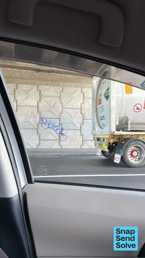
 graffiti under Barrington bridge
 Graffiti somewhere else —
  Graffiti somewhere else —
 Waka kotahi
 Graffiti somewhere else —
 Waka kotahi
 Graffiti on a road, footpath or bridge —
  Graffiti somewhere else —
 Graffiti on the outside of the tunnel on Barrington Street and Jerrold Street North.
 Graffiti somewhere else —
 Graffiti on light pole between the tunnel and Jerrold Street North
 Graffiti somewhere else —
  Graffiti somewhere else —
  Graffiti somewhere else —
  Graffiti on a road, footpath or bridge —
 Graffiti under bridge
 Graffiti on a fence, building or structure —
 - Graffiti somewhere else —
Tagging on Barrington St under the motorway bridge. No photo sorry. Black spray paint on concrete walls under bridge.
 Graffiti somewhere else —
 Graffiti under bridge on west side see pics
 Graffiti on a sign, mural or public art —
 Cnr Barrington and Jerrold. Agile mortgages 08001Agile
 Graffiti on a road, footpath or bridge —
 Multiple graffiti on Barrington over bridge
 Graffiti on a road, footpath or bridge —
 Tagging on the Barrington Street underpass.
 Graffiti somewhere else —
 More graffiti on the wall of the tunnel on Barrington Street under state highway 76
 Graffiti somewhere else —
 Graffiti on the wall of the tunnel on Barrington Street under state highway 76
 Graffiti on a sign, mural or public art —
 Graffiti on highway sign pointing to wolf brook arena on Barrington Street at intersection with state highway 76
 Graffiti somewhere else —
 Tagging under the bridge. Barrington / Brougham.
 Graffiti somewhere else —
 Graffiti under the Barrington over bridge is right along both side
 Graffiti on a road, footpath or bridge —
 Under the overpass
 Graffiti on a fence, building or structure —
 Have reported this 3times over past 3weeks Please treat as urgent
 Graffiti somewhere else —
  Graffiti on a road, footpath or bridge —
 Tagging in the Barrington Street underpass.
 Graffiti —
 Tagging on the light pole in Barrington Street.
- Graffiti —
- Graffiti —
- Graffiti —
- Roads - General —
- Roads - General —
- Roading/Streets —
The lights turning left from Brougham St into Barrington Street are not picking up my motorcycle. I either have to signal a car forward o
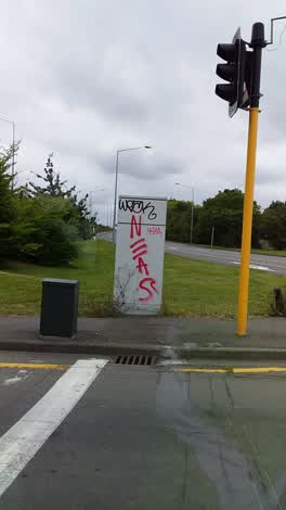 Graffiti —
 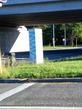 Graffiti —
 Hi. I reported this graffiti on 4 December. Just letting you know it hasn't been removed. It is on the corner of Barrington Street and th
- Roading/Streets —
Pothole at intersection as you come of the motorway to turn left onto Barrington street
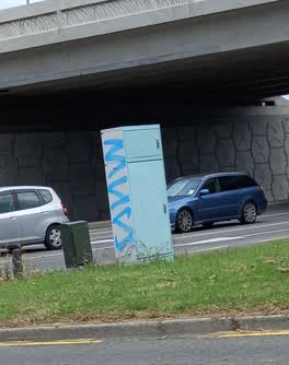 Graffiti —
 Graffiti on the box pictured in Barrington Street
- Graffiti —
Graffiti on both sides, under the overpass. Unable to take photo. Multiple tags.
 Roading/Streets —
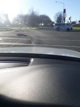
 Hi, this major and busy intersection has small rocks and lots of stones around. Someone may have dropped them from a load. They are a hazar
Also reported on Barrington Street
- 468 Barrington Street — 67 reports
- 458 Barrington Street — 57 reports
- 452 Barrington Street — 27 reports
- 467B Barrington Street — 24 reports
- 485 Barrington Street — 22 reports
- 469 Barrington Street — 15 reports
- 470 Barrington Street — 12 reports
- 479 Barrington Street — 10 reports
The street’s crash record
NZTA’s record names Barrington Street in 66 crashes that hurt somebody since 2006 — 1 person killed, 19 seriously hurt.
The green nearby
- Addington Park — 60 m to the edge · Sports ground · 3 ha
- Leith Reserve — 291 m to the edge
- Parade Court Reserve — 299 m to the edge
- Jerrold Reserve — 430 m to the edge
Parks within half a kilometre, measured to the boundary — the council’s open data.
On the doorstep
- Addington Motel Raceway — 226 m away · Motels
- Raceway Motel — 235 m away · Motels
- Z — 264 m away · Petrol stations
- Z2O — 266 m away · Car washes
Businesses within four hundred metres, measured at the pin — OpenStreetMap and the council directories.
The bus nearby
- Lincoln Rd near Parade Ct — 279 m away · route 7
- Barrington St near Hammond Pl — 293 m away · the Orbiter (clockwise)
The closest Metro stops, within four hundred and fifty metres.
The tracks through here
- Walk and bike track through Addington — 12 m to the line · walk · bike
- Walk and bike track through Addington — 165 m to the line · walk · bike
- Walk and bike track through Addington — 286 m to the line · walk · bike
- Walk and bike track through Addington — 309 m to the line · walk · bike
Tracks whose line passes within half a kilometre, measured to the line itself — the council’s open data.
The named ground
Named water within 500 m of this address, measured to the line or the edge; Named places within 1.5 km of this address; the council’s own structure register — bridges, boardwalks and steps standing nearby — the open map’s record.
Renting nearby
new bonds in Addington ran about $502 a week — $48 below the city median of $550 — the suburb page keeps the rent record →.
The civic layer
This ground votes in Spreydon ward — the Spreydon-Cashmere-Heathcote community board. Ward lines don’t always follow suburb lines; this one is measured at the pin, not the suburb’s centre.
What stood on this ground → · On the map → · From the air — the Crown’s aerials back to 1936; search the address on RetroLens →
Questions, answered briefly
39 council reports on record since August 2021 — most often graffiti somewhere else (15), graffiti (8), graffiti on a road, footpath or bridge (7).
Addington, Christchurch — on Barrington Street.
Nothing on the heritage register at this exact spot — the record around this ground →
Addington Park — 60 m to its edge, 3 ha.