76 Poulson Street, Addington
17 reports on record since March 2016 · 17 with photographs. The street’s heaviest record is 31 Poulson Street — 36 reports on file. Indicative rating valuation and school zones, hazards, bin day and what stood here before.
What gets reported here
Photographed here 17 on record




Reported here
 Rubbish and Bins - General —
 Yellow bins full of general rubbish and not for this allocated house - they have 6 yellow bins??
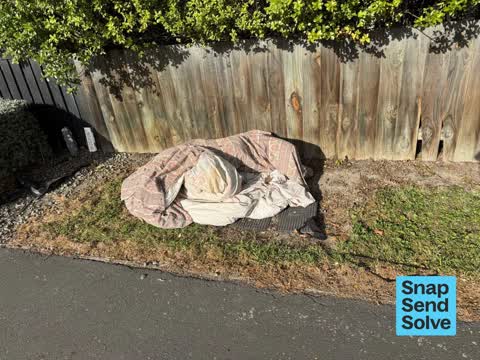
 Dumped Rubbish —
 Rubbish etc been on Berm for weeks please remove thank you....
 Rubbish and Bins - General —
 3 red recycle bins not linked to 2/76 Poulson Street please have these removed
 Dumped Rubbish —
  Dumped Rubbish —
 Trolleys full of rubbish also rubbish bins full
 Dumped Rubbish —
 Dumped clothes
 Water Leak —
 Steady leak coming from footpath to driveway transition. Requires prompt attention thank you.
 General Request —
 Leah Paul Kainga Ora tenant at Unit 2/76 Ppulson Street has a spa pool informed her front yard, the gate is looked but it sure if it’s compl
 Water Leak —
 Leaking water meter
 Sewer - Leak / Blockage —
 Water running!
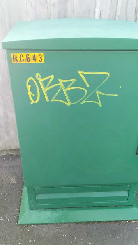
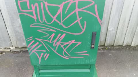
Graffiti —
Graffiti —
Rubbish and Bins - General —
Rubbish/Recycling —
Rubbish/Recycling —
Graffiti —
Roading/Streets —
Walkway only one side with yellow line. People with disabilities can't pass if vehicle park there
Also reported on Poulson Street
- 31 Poulson Street — 36 reports
- 71 Poulson Street — 24 reports
- 43 Poulson Street — 22 reports
- 78 Poulson Street — 18 reports
- 84 Poulson Street — 16 reports
- 80 Poulson Street — 14 reports
- 90 Poulson Street — 13 reports
- 89 Poulson Street — 13 reports
The street’s crash record
NZTA’s record names Poulson Street in 7 crashes that hurt somebody since 2006 — 3 seriously hurt, nobody killed.
The green nearby
- Mountfort Park — 182 m to the edge · Botanic
- Cornelius O'connor Reserve — 214 m to the edge
- Jerrold Reserve — 366 m to the edge
- Addington Cemetery — 410 m to the edge · Botanic · 2 ha
- Addington Park — 431 m to the edge · Sports ground · 3 ha
Parks within half a kilometre, measured to the boundary — the council’s open data.
On the doorstep
- Jailhouse Accommodation — 236 m away · Hostels
- Burger King — 307 m away · Fast food
- Young Sing Takeaway — 307 m away · Fast food
- Harcourts Christchurch — 311 m away · Real estate
Businesses within four hundred metres, measured at the pin — OpenStreetMap and the council directories.
The bus nearby
The closest Metro stops, within four hundred and fifty metres.
The tracks through here
- Walk and bike track through Addington — 41 m to the line · walk · bike
- Walk and bike track through Addington — 59 m to the line · walk · bike
- Walk and bike track through Addington — 98 m to the line · walk · bike
- Walk and bike track through Addington — 304 m to the line · walk · bike
- Walk and bike track through Addington — 338 m to the line · walk · bike
Tracks whose line passes within half a kilometre, measured to the line itself — the council’s open data.
The named ground
Named water within 500 m of this address, measured to the line or the edge; Named places within 1.5 km of this address — the open map’s record.
The remembered names nearby
- Charles Dickens (1812 - 1870) Was One of the Most Popular — 198 m away ·
Charles Dickens (1812 - 1870) was one of the most popular English novelists of the Victori
· 2013
Inscribed plaques within two hundred and fifty metres — the register’s pins, not surveyed spots. The whole roll is at /plaques.
Renting nearby
new bonds in Addington ran about $502 a week — $48 below the city median of $550 — the suburb page keeps the rent record →.
What was here — Church of St Mary the Virgin Belltower and Setting
75 m away · located to ±3 m · the place’s own record →
On the register. Nothing researched here yet.
What was here — Church Square and Setting
84 m away · 21A Church Square · located to ±45 m · the place’s own record →
On the register. Nothing researched here yet.
What was here — Church of St Mary the Virgin Lychgate and Setting
91 m away · located to ±3 m · the place’s own record →
On the register. Nothing researched here yet.
What was here — Church of St Mary the Virgin and Setting
99 m away · 21A Church Square · located to ±16 m · the place’s own record →
On the register. Nothing researched here yet.
The civic layer
This ground votes in Spreydon ward — the Spreydon-Cashmere-Heathcote community board. Ward lines don’t always follow suburb lines; this one is measured at the pin, not the suburb’s centre.
What stood on this ground → · On the map → · From the air — the Crown’s aerials back to 1936; search the address on RetroLens →
Questions, answered briefly
17 council reports on record since March 2016 — most often dumped rubbish (4), rubbish and bins - general (3), graffiti (3).
Addington, Christchurch — on Poulson Street.
The heritage register names 4 places at or beside it — Church of St Mary the Virgin Belltower and Setting, Church Square and Setting.
Mountfort Park — 182 m to its edge.