78 Poulson Street, Addington
19 reports on record since October 2017 · 12 with photographs. The street’s heaviest record is 31 Poulson Street, 36 reports on file. Indicative rating valuation and school zones, hazards, bin day and what stood here before.
What gets reported here
Photographed here 12 on record


Reported here
 Damaged Street Light,
 Street light in park is flashing on and off in an alarming manner
 Dumped Rubbish,
 Big bag of rubbish clothing etc. 20 plus items
 Dumped Rubbish,
 Suitcase on the side of the road
 Dumped Rubbish,
 Dumped mattress outside property fence line
 Dumped Rubbish,
  Dumped Rubbish,
 Dumped rubbish. Thanks.
 Dumped Rubbish,
 - Vandalism - General,
- Dumped Rubbish,
- Graffiti,
- Dumped Rubbish,
- Dumped Rubbish,
- Rubbish and Bins - General,
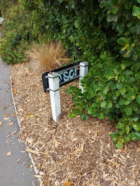
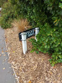 Graffiti,
 graffiti on the back of street signs
- Sewer - General,
very heavy drain cover west side church square near cycleway
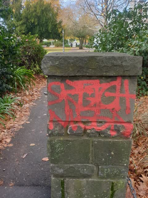
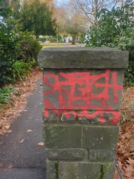 Graffiti,
 Graffiti on a historic stone marker for the west Evans to church Square in Addington
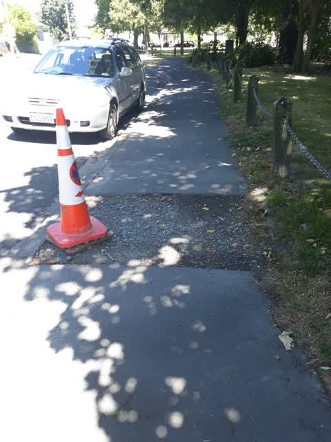
Roading/Streets,
This has been left like this since 2018! This area has a high number of people with mobilty issues and children walking and on scooters alon
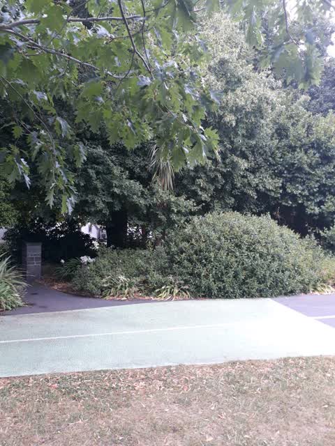
Roading/Streets,
Coming out of Church Square on the west side the bush completely obscures line of sight for and of the pedestrian on the cycleway. There hav
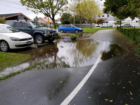
Wastewater/Stormwater,
Flooding of cycleway and gardens at church square everytime it rains
Also reported on Poulson Street
- 31 Poulson Street, 36 reports
- 71 Poulson Street, 24 reports
- 43 Poulson Street, 22 reports
- 76 Poulson Street, 17 reports
- 84 Poulson Street, 16 reports
- 80 Poulson Street, 14 reports
- 90 Poulson Street, 13 reports
- 89 Poulson Street, 13 reports
From the air, then
Sourced from Canterbury Maps and partners. LINZ, CC BY 3.0 NZ. Each frame is cut from Environment Canterbury’s historic imagery MapServer for that decade, only where the Footprints layer names a CC BY survey (NZAM-covered spots stay out). RetroLens holds more Crown aerials →
The street’s crash record
NZTA’s record names Poulson Street in 7 crashes that hurt somebody since 2006, 3 seriously hurt, nobody killed.
The green nearby
- Cornelius O'connor Reserve, 191 m to the edge
- Mountfort Park, 208 m to the edge · Botanic
- Jerrold Reserve, 376 m to the edge
- Addington Cemetery, 378 m to the edge · Botanic · 2 ha
- Disraeli Reserve, 427 m to the edge
Parks within half a kilometre, measured to the boundary, the council’s open data.
On the doorstep
- Jailhouse Accommodation, 264 m away · Hostels
- Harcourts Christchurch, 309 m away · Real estate
- Cheeky Sparrow - Addington, 319 m away · Cafés
- Burger King, 325 m away · Fast food
Businesses within four hundred metres, measured at the pin: OpenStreetMap and the council directories.
The bus nearby
The closest Metro stops, within four hundred and fifty metres.
The tracks through here
- Walk and bike track through Addington, 9 m to the line · walk · bike
- Walk and bike track through Addington, 43 m to the line · walk · bike
- Walk and bike track through Addington, 70 m to the line · walk · bike
- Walk and bike track through Addington, 294 m to the line · walk · bike
- Walk and bike track through Addington, 357 m to the line · walk · bike
Tracks whose line passes within half a kilometre, measured to the line itself, the council’s open data.
The named ground
Named water within 500 m of this address, measured to the line or the edge; Named places within 1.5 km of this address, the open map’s record.
The remembered names nearby
- Charles Dickens (1812 - 1870) Was One of the Most Popular, 220 m away ·
Charles Dickens (1812 - 1870) was one of the most popular English novelists of the Victori
· 2013
Inscribed plaques within two hundred and fifty metres, the register’s pins, not surveyed spots. The whole roll is at /plaques.
Renting nearby
new bonds in Addington ran about $502 a week, $48 below the city median of $550, the suburb page keeps the rent record →.
What was here, Church of St Mary the Virgin Belltower and Setting
45 m away · located to ±3 m · the place’s own record →
On the register. Nothing researched here yet.
What was here, Church Square and Setting
52 m away · 21A Church Square · located to ±45 m · the place’s own record →
On the register. Nothing researched here yet.
What was here, Church of St Mary the Virgin Lychgate and Setting
61 m away · located to ±3 m · the place’s own record →
On the register. Nothing researched here yet.
What was here, Church of St Mary the Virgin and Setting
67 m away · 21A Church Square · located to ±16 m · the place’s own record →
On the register. Nothing researched here yet.
The civic layer
This ground votes in Spreydon ward, the Spreydon-Cashmere-Heathcote community board. Ward lines don’t always follow suburb lines; this one is measured at the pin, not the suburb’s centre.
What stood on this ground → · On the map → · From the air, the Crown’s aerials back to 1936; search the address on RetroLens →
Questions, answered briefly
19 council reports on record since October 2017, most often dumped rubbish (9), graffiti (3), roading/streets (2).
Addington, Christchurch, on Poulson Street.
The heritage register names 4 places at or beside it, Church of St Mary the Virgin Belltower and Setting, Church Square and Setting.
Cornelius O'connor Reserve, 191 m to its edge.