25 Nash Road
8 council reports since October 2019, 7 carrying a photograph. The most-reported address on Nash Road.
On the register here
- Former Mount Magdala Chapel/ St John of God Chapel and Setting, 26A Nash Road (243m)
From the air, then
Sourced from Canterbury Maps and partners. RNZAF, CC BY 3.0 NZ. Each frame is cut from Environment Canterbury’s historic imagery MapServer for that decade, only where the Footprints layer names a CC BY survey (NZAM-covered spots stay out). RetroLens holds more Crown aerials →
The green nearby
- Mcmahon Reserve, 96 m to the edge
- Kinsella Reserve, 212 m to the edge · playground, 50 pieces
- Bibiana Reserve, 281 m to the edge
- Nga Puna Wai, 328 m to the edge · Sports ground · 83 ha · playground, 4 pieces
- Heathcote Esplanade Reserve, 333 m to the edge
Parks within half a kilometre, measured to the boundary, the council’s open data. The whole roll is at /parks.
The civic shelf nearby
- Mt Magdala Cemetery, 215 m away · Cemetery
Libraries, halls and the rest within half a kilometre, the council’s open data.
On the doorstep
- Halswell Community Market, 212 m away · Markets
- Starfish Swim School, 227 m away · Sports centres
- BestStart Aidanfield, 248 m away · Childcare
- Anthony Wilding Retirement Village, 400 m away · Business
Businesses within four hundred metres, measured at the pin, OpenStreetMap and the council directories.
The bus nearby
- Aidenfield (near McMahon Dr), 266 m away · route 60
- Aidenfield (near McMahon Dr), 292 m away · route 60
The closest Metro stops, within four hundred and fifty metres.
The named ground
Named water within 500 m of this address, measured to the line or the edge; Named places within 1.5 km of this address, the open map’s record.
Renting nearby
new bonds in Aidanfield ran about $750 a week, $200 above the city median of $550, the suburb page keeps the rent record →.
What gets reported here
- Graffiti on a fence, building or structure, 2
- Street Light Outage, 1
- Street Gutters / Storm Water, 1
- Road Signage, 1
- Graffiti, 1
- General Request, 1
Photographed here 7 on record




What’s on record
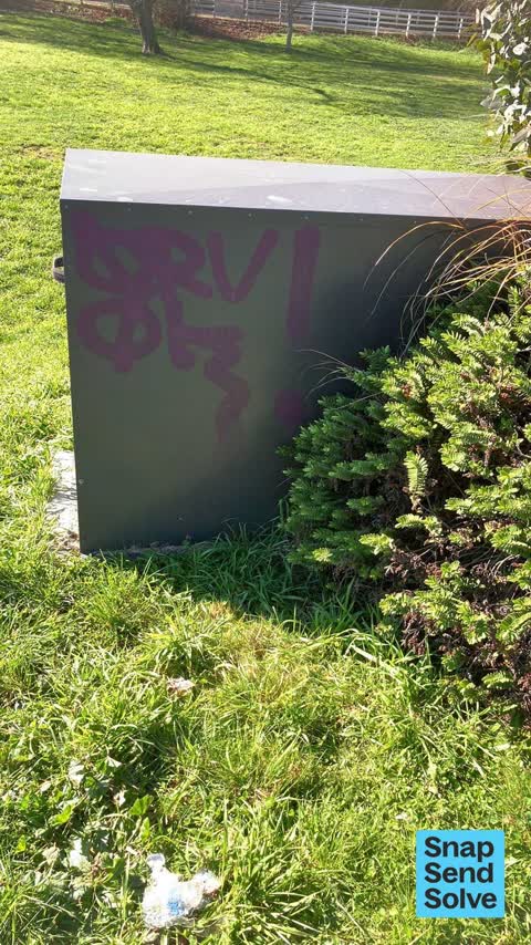
 Graffiti on a fence, building or structure, 18 Jan 2026
 Graffiti and badly dented. No ID. On this utility.
 General Request, 7 Dec 2025
 power or pump case is broken and displaced, allowing access to the machinery inside
 Street Gutters / Storm Water, 17 Aug 2025
 Metal cover in drainage swale has been lifted and dropped into the drain - jammed in place and may have damaged plastic pipes inside the dra
 Graffiti on a fence, building or structure, 14 Aug 2025
 Unknown utility box beside bridge on Nash road
 Road Signage, 8 Aug 2025
 The School Zone 40kph speed restriction sign in Aidanfield Dr (when heading east) is NOT working.
 Street Light Outage, 14 Aug 2022
 Steeet light by bridge blinking rapidly on Saturday night
- Damaged Street Light, 12 Aug 2022
Light is flashing on Leaf bridge on Aidanfield dtive
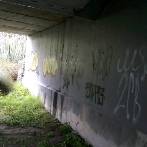
Graffiti, 15 Oct 2019
this is under the bridge on Adienfield drive. I received a notification saying it has been done. As you can see by photos just taken it hasn
Elsewhere on Nash Road
- 2 Nash Road, 8 reports
- 26 Nash Road, 3 reports
- 28 Nash Road, 1 report
The street’s crash record
NZTA’s record names Nash Road in 1 crash that hurt somebody since 2006, 0 seriously hurt, nobody killed.
The civic layer
This ground votes in Halswell ward, the Halswell-Hornby-Riccarton community board is its local layer. Ward lines don’t always follow suburb lines; this one is measured at the pin, not the suburb’s centre. The whole roll is at /wards.
Nash Road, the whole record → · Everything about Aidanfield → · What stood on this ground → · On the map → · From the air, RetroLens holds the Crown’s aerials back to 1936; search the address there →
Questions, answered briefly
8 council reports on record since October 2019, most often graffiti on a fence, building or structure (2), street light outage (1), street gutters / storm water (1).
Aidanfield, Christchurch, on Nash Road.
The heritage register names a place at or beside it, Former Mount Magdala Chapel/ St John of God Chapel and Setting.
Mcmahon Reserve, 96 m to its edge.